Paragon, Indiana

Last updated

Paragon, Indiana
Morgan County Indiana Incorporated and Unincorporated areas Paragon Highlighted 1857870.svg
Location in Morgan County, Indiana
Coordinates: 39°23′42″N86°33′46″W / 39.39500°N 86.56278°W / 39.39500; -86.56278
Country United States
State Indiana
County Morgan
Township Ray
Area
[1]
  Total0.28 sq mi (0.71 km2)
  Land0.28 sq mi (0.71 km2)
  Water0.00 sq mi (0.00 km2)
Elevation
[2]
581 ft (177 m)
Population
 (2020) [3]
  Total556
  Density2,021.82/sq mi (780.50/km2)
Time zone UTC-5 (Eastern (EST))
  Summer (DST) UTC-4 (EDT)
ZIP code
46166
Area code 765
FIPS code 18-57870 [4]
GNIS feature ID2396847 [2]

Paragon is a town in Ray Township, Morgan County, in the U.S. state of Indiana. [2] The population was 556 at the 2020 census, [3] down from 659 in 2010.

Contents

History

Paragon was founded in the early 1850s about the same time the first store was opened in the community in 1852. [5] A post office has been in operation at Paragon since 1868. [6]

Geography

Paragon is in southwestern Morgan County along Indiana State Road 67, which leads northeast 8 miles (13 km) to Martinsville, the county seat, and southwest 16 miles (26 km) to Spencer.

According to the U.S. Census Bureau, Paragon has a total area of 0.28 square miles (0.73 km2), all land. [1] The town is in the valley of the White River, which passes 1.5 miles (2.4 km) to the south.

Demographics

Historical population
CensusPop.Note
1880 306
1900 413
1910 409−1.0%
1920 4448.6%
1930 366−17.6%
1940 45424.0%
1950 4632.0%
1960 56021.0%
1970 538−3.9%
1980 5380.0%
1990 515−4.3%
2000 66328.7%
2010 659−0.6%
2020 556−15.6%
U.S. Decennial Census [7]

2010 census

As of the census [8] of 2010, there were 659 people, 233 households, and 172 families living in the town. The population density was 1,938.2 inhabitants per square mile (748.3/km2). There were 261 housing units at an average density of 767.6 per square mile (296.4/km2). The racial makeup of the town was 97.4% White, 0.2% African American, 0.5% from other races, and 2.0% from two or more races. Hispanic or Latino of any race were 0.9% of the population.

There were 233 households, of which 39.5% had children under the age of 18 living with them, 52.8% were married couples living together, 15.0% had a female householder with no husband present, 6.0% had a male householder with no wife present, and 26.2% were non-families. 18.5% of all households were made up of individuals, and 7.3% had someone living alone who was 65 years of age or older. The average household size was 2.83 and the average family size was 3.18.

The median age in the town was 33.3 years. 30.2% of residents were under the age of 18; 10.6% were between the ages of 18 and 24; 24.7% were from 25 to 44; 23.9% were from 45 to 64; and 10.6% were 65 years of age or older. The gender makeup of the town was 48.4% male and 51.6% female.

2000 census

As of the census [4] of 2000, there were 663 people, 237 households, and 176 families living in the town. The population density was 2,640.8 inhabitants per square mile (1,019.6/km2). There were 275 housing units at an average density of 1,095.4 per square mile (422.9/km2). The racial makeup of the town was 99.70% White, 0.15% from other races, and 0.15% from two or more races. Hispanic or Latino of any race were 0.60% of the population.

There were 237 households, out of which 39.7% had children under the age of 18 living with them, 62.4% were married couples living together, 6.8% had a female householder with no husband present, and 25.7% were non-families. 18.1% of all households were made up of individuals, and 11.8% had someone living alone who was 65 years of age or older. The average household size was 2.80 and the average family size was 3.18.

In the town, the population was spread out, with 32.4% under the age of 18, 7.8% from 18 to 24, 29.9% from 25 to 44, 19.0% from 45 to 64, and 10.9% who were 65 years of age or older. The median age was 31 years. For every 100 females, there were 99.7 males. For every 100 females age 18 and over, there were 99.1 males.

The median income for a household in the town was $37,333, and the median income for a family was $38,971. Males had a median income of $33,750 versus $21,354 for females. The per capita income for the town was $14,193. About 11.5% of families and 13.3% of the population were below the poverty line, including 10.8% of those under age 18 and 9.8% of those age 65 or over.

Related Research Articles

<span class="mw-page-title-main">St. Paul, Indiana</span> Town in Indiana, United States

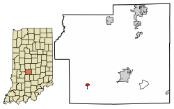
St. Paul or Saint Paul is a small town on the border of Decatur and Shelby counties in the U.S. state of Indiana. The population was 1,031 at the 2010 census.

<span class="mw-page-title-main">Ashley, Indiana</span> Town in Indiana, United States

Ashley is a town in Indiana located on the border of Smithfield Township, DeKalb County and Steuben Township, Steuben County. The population was 983 at the 2010 census.

<span class="mw-page-title-main">Albany, Indiana</span> Town in Indiana, United States

Albany is a town in Delaware and Randolph counties in the U.S. state of Indiana, along the Mississinewa River. The population was 2,295 at the 2020 census. It is part of the Muncie, IN Metropolitan Statistical Area.

<span class="mw-page-title-main">Palmyra, Indiana</span> Town in Indiana, United States

Palmyra is a town in Morgan Township, Harrison County, Indiana, United States. The population was 930 at the 2010 census.

<span class="mw-page-title-main">Andrews, Indiana</span> Town in Indiana, United States

Andrews is a town in Dallas Township, Huntington County, Indiana, United States. The population was 1,048 at the 2020 census.

<span class="mw-page-title-main">Dupont, Indiana</span> Town in Indiana, United States

Dupont is a town in Lancaster Township, Jefferson County, Indiana, United States. The population was 339 at the 2010 census.

<span class="mw-page-title-main">Vernon, Indiana</span> Town in Indiana, United States

Vernon is a town within Vernon Township and the county seat of Jennings County, Indiana, United States. With a population of 318 in the 2010 census, it is the smallest town with that designation in the state of Indiana, lying just south of the much larger North Vernon. It is nearly surrounded by the Muscatatuck River. Vernon is the only Indiana town with an elected mayor and an elected town marshal. As of 2023, Marshall Zamora is the mayor and Britt Burgmeier is the marshal.

<span class="mw-page-title-main">Bargersville, Indiana</span> Town in Indiana, United States

Bargersville is a town in White River and Union townships, Johnson County, Indiana, United States. The population was 9,560 at the 2020 census.

<span class="mw-page-title-main">Prince's Lakes, Indiana</span> Town in Indiana, United States

Prince's Lakes is a town in Nineveh Township, Johnson County, Indiana, United States. The population was 1,312 at the 2010 census.

<span class="mw-page-title-main">Trafalgar, Indiana</span> Town in Indiana, United States

Trafalgar is a town in Nineveh and Hensley townships, Johnson County, Indiana, United States. The population was 1,101 at the 2010 census.

<span class="mw-page-title-main">Silver Lake, Indiana</span> Town in Indiana, United States

Silver Lake is a town in Lake Township, Kosciusko County, in the U.S. state of Indiana. The population was 915 at the 2010 census.

<span class="mw-page-title-main">Edgewood, Indiana</span> Town in Indiana, United States

Edgewood is a town in Anderson Township, Madison County, Indiana, United States. It is part of the Indianapolis–Carmel–Anderson metropolitan statistical area. The population was 2,053 at the 2020 census.

<span class="mw-page-title-main">Bethany, Indiana</span> Town in Indiana, United States

Bethany is a town in Clay Township, Morgan County, in the U.S. state of Indiana. The population was 95 at the 2020 census.

<span class="mw-page-title-main">Brooklyn, Indiana</span> Town in Indiana, United States

Brooklyn is a town in Clay and Brown townships, Morgan County, Indiana, United States. The population was 2,511 at the 2020 census, up from 1,598 in 2010.

<span class="mw-page-title-main">Monrovia, Indiana</span> Town in Indiana, United States

Monrovia is a town in Monroe Township, Morgan County, in the U.S. state of Indiana. The population was 1,643 at the 2020 census, up from 1,063 in 2010.

<span class="mw-page-title-main">Morgantown, Indiana</span> Town in Indiana, United States

Morgantown is a town at the intersection of Indiana state routes 135 and 252 in Jackson Township, Morgan County, in the U.S. state of Indiana. The population was 1,014 at the 2020 census.

<span class="mw-page-title-main">Cloverdale, Indiana</span> Town in Indiana, United States

Cloverdale is a town in Cloverdale and Warren townships, Putnam County, in the U.S. state of Indiana. The population was 2,172 at the 2010 census.

<span class="mw-page-title-main">Clear Lake, Indiana</span> Town in Indiana, United States

Clear Lake is a town located in the northeast corner of Steuben County, Indiana, in Clear Lake Township. As such, is the northeasternmost community in the State of Indiana. The population was 339 at the 2010 census.

<span class="mw-page-title-main">Meridian Hills, Indiana</span> Town in Indiana, United States

Meridian Hills is a town in Washington Township, Marion County, Indiana, about 8 miles (13 km) north of downtown Indianapolis. It had a population of 1,774 at the 2020 census, up from 1,616 in 2010.

<span class="mw-page-title-main">Wynnedale, Indiana</span> Town in Indiana, United States

Wynnedale is a town in Washington Township, Marion County, Indiana, United States. The population was 215 at the 2020 census. It has existed as an "included town" since 1970, when it was incorporated into Indianapolis as part of Unigov. It is part of Indianapolis, but retains a functioning town government under IC 36-3-1-11.

References

  1. 1 2 "2022 U.S. Gazetteer Files: Indiana". United States Census Bureau. Retrieved April 26, 2023.
  2. 1 2 3 U.S. Geological Survey Geographic Names Information System: Paragon, Indiana
  3. 1 2 "P1. Race – Paragon town, Indiana: 2020 DEC Redistricting Data (PL 94-171)". U.S. Census Bureau. Retrieved April 26, 2023.
  4. 1 2 "U.S. Census website". United States Census Bureau . Retrieved January 31, 2008.
  5. Blanchard, Charles (1884). Counties of Morgan, Monroe and Brown, Indiana: Historical and Biographical. F.A. Battey & Company. pp.  140.
  6. "Morgan County". Jim Forte Postal History. Retrieved September 8, 2015.
  7. "Census of Population and Housing". Census.gov. Retrieved June 4, 2015.
  8. "U.S. Census website". United States Census Bureau . Retrieved December 11, 2012.