Port Washington, Ohio

Last updated

Port Washington, Ohio
Port Washington Town Hall.jpg
Village Hall
OHMap-doton-Port Washington.png
Location of Port Washington, Ohio
Map of Tuscarawas County Ohio Highlighting Port Washington Village.png
Location of Port Washington in Tuscarawas County
Coordinates: 40°19′37″N81°31′08″W / 40.32694°N 81.51889°W / 40.32694; -81.51889
Country United States
State Ohio
County Tuscarawas
Township Salem
Area
[1]
  Total0.56 sq mi (1.45 km2)
  Land0.55 sq mi (1.41 km2)
  Water0.01 sq mi (0.04 km2)
Elevation
[2]
817 ft (249 m)
Population
 (2020)
  Total548
  Density1,005.50/sq mi (387.99/km2)
Time zone UTC-5 (Eastern (EST))
  Summer (DST) UTC-4 (EDT)
ZIP code
43837
Area code 740
FIPS code 39-64346 [3]
GNIS feature ID2399006 [2]

Port Washington is a village in Tuscarawas County, Ohio, United States. The population was 548 at the 2020 census.

Contents

History

Port Washington was originally called Salisbury, and under the latter name was laid out in 1827. [4] A post office called Port Washington has been in operation since 1832. [5]

Geography

Port Washington is located along the Tuscarawas River. [6]

According to the United States Census Bureau, the village has a total area of 0.51 square miles (1.32 km2), all land. [7]

Demographics

Historical population
CensusPop.Note
1850 269
1870 425
1880 63449.2%
1890 487−23.2%
1900 424−12.9%
1910 421−0.7%
1920 382−9.3%
1930 49930.6%
1940 493−1.2%
1950 5144.3%
1960 5262.3%
1970 5504.6%
1980 62213.1%
1990 513−17.5%
2000 5527.6%
2010 5693.1%
2020 548−3.7%
U.S. Decennial Census [8]

2010 census

As of the census [9] of 2010, there were 569 people, 209 households, and 164 families living in the village. The population density was 1,115.7 inhabitants per square mile (430.8/km2). There were 232 housing units at an average density of 454.9 per square mile (175.6/km2). The racial makeup of the village was 97.7% White, 0.2% Asian, 1.8% from other races, and 0.4% from two or more races. Hispanic or Latino of any race were 1.8% of the population.

There were 209 households, of which 38.8% had children under the age of 18 living with them, 60.8% were married couples living together, 12.9% had a female householder with no husband present, 4.8% had a male householder with no wife present, and 21.5% were non-families. 16.7% of all households were made up of individuals, and 7.6% had someone living alone who was 65 years of age or older. The average household size was 2.72 and the average family size was 2.99.

The median age in the village was 39.1 years. 26.4% of residents were under the age of 18; 7.2% were between the ages of 18 and 24; 24.6% were from 25 to 44; 25.8% were from 45 to 64; and 16% were 65 years of age or older. The gender makeup of the village was 48.7% male and 51.3% female.

2000 census

As of the census [3] of 2000, there were 552 people, 204 households, and 161 families living in the village. The population density was 1,091.2 inhabitants per square mile (421.3/km2). There were 213 housing units at an average density of 421.1 per square mile (162.6/km2). The racial makeup of the village was 97.83% White, 0.18% African American, 0.54% from other races, and 1.45% from two or more races. Hispanic or Latino of any race were 1.27% of the population.

There were 204 households, out of which 35.3% had children under the age of 18 living with them, 67.6% were married couples living together, 9.3% had a female householder with no husband present, and 20.6% were non-families. 16.7% of all households were made up of individuals, and 6.4% had someone living alone who was 65 years of age or older. The average household size was 2.71 and the average family size was 3.02.

In the village, the population was spread out, with 25.2% under the age of 18, 8.5% from 18 to 24, 31.7% from 25 to 44, 24.3% from 45 to 64, and 10.3% who were 65 years of age or older. The median age was 37 years. For every 100 females there were 97.1 males. For every 100 females age 18 and over, there were 93.9 males.

The median income for a household in the village was $36,111, and the median income for a family was $37,344. Males had a median income of $28,750 versus $18,173 for females. The per capita income for the village was $13,674. About 2.3% of families and 6.1% of the population were below the poverty line, including 6.5% of those under age 18 and 10.8% of those age 65 or over.

Notable people

Related Research Articles

<span class="mw-page-title-main">Tuscarawas County, Ohio</span> County in Ohio, United States

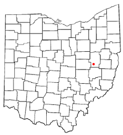
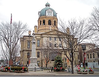
Tuscarawas County is a county located in the northeastern part of the U.S. state of Ohio. As of the 2020 census, the population was 93,263. Its county seat is New Philadelphia. Its name is a Delaware Indian word variously translated as "old town" or "open mouth". Tuscarawas County comprises the New Philadelphia–Dover, OH Micropolitan Statistical Area, which is also included in the Cleveland–Akron–Canton, OH Combined Statistical Area.

<span class="mw-page-title-main">Carroll County, Ohio</span> County in Ohio, United States

Carroll County is a county located in the state of Ohio. As of the 2020 census, the population was 26,721. Its county seat is Carrollton, while its largest village is Minerva. It is named for Charles Carroll of Carrollton, the last surviving signer of the Declaration of Independence.

<span class="mw-page-title-main">Leesville, Ohio</span> Village in Ohio, United States

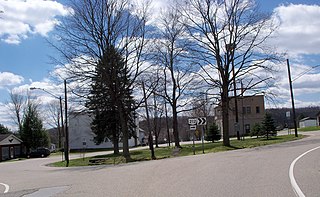
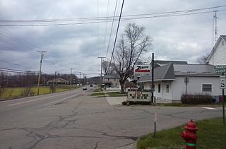
Leesville is a village in southwestern Carroll County, Ohio, United States. The population was 127 at the 2020 census. It is part of the Canton–Massillon metropolitan area.

<span class="mw-page-title-main">Addyston, Ohio</span> Village in Ohio, United States

Addyston is a village in Miami Township, Hamilton County, Ohio, United States. Located along the Ohio River, it is a western suburb of the neighboring city of Cincinnati. The population was 927 at the 2020 census.

<span class="mw-page-title-main">Laurelville, Ohio</span> Village in Ohio, United States

Laurelville is a village in Hocking County, Ohio, United States. The population was 512 at the 2020 census.

<span class="mw-page-title-main">Clarksburg, Ohio</span> Village in Ohio, United States

Clarksburg is a village in Ross County, Ohio, United States. The population was 409 at the 2020 census.

<span class="mw-page-title-main">Limaville, Ohio</span> Census-designated place in Ohio, United States

Limaville is a census-designated place (CDP) and former village in Stark County, Ohio, United States. The population was 151 at the 2020 census. It is part of the Canton–Massillon Metropolitan Statistical Area.

<span class="mw-page-title-main">Navarre, Ohio</span> Village in Ohio, United States

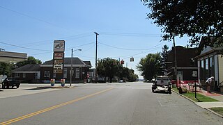
Navarre is a village in southwestern Stark County, Ohio, United States. The population was 1,846 at the 2020 census. It is part of the Canton–Massillon metropolitan area.

<span class="mw-page-title-main">Clinton, Ohio</span> Village in Ohio, United States

Clinton is a village in southwestern Summit County, Ohio, United States. The population was 1,197 at the 2020 Census. It is part of the Akron metropolitan area.

<span class="mw-page-title-main">Bolivar, Ohio</span> Village in Ohio, United States

Bolivar is a village in Tuscarawas County, Ohio, United States. The population was 1,000 at the 2020 census. Bolivar is also home to Fort Laurens, the only American Revolutionary War-era fort in what is now Ohio.

<span class="mw-page-title-main">Dennison, Ohio</span> Village in Ohio, United States

Dennison is a village in Tuscarawas County, Ohio, United States. The population was 2,709 at the 2020 census.

<span class="mw-page-title-main">Dover, Ohio</span> City in Ohio, United States

Dover is a city in Tuscarawas County, Ohio, United States, along the Tuscarawas River. The population was 13,112 at the 2020 census. It is a principal city of the New Philadelphia–Dover micropolitan area, approximately 68 miles (109 km) south of Cleveland and borders the city of New Philadelphia.

<span class="mw-page-title-main">Mineral City, Ohio</span> Village in Ohio, United States

Mineral City is a village in Tuscarawas County, Ohio, United States. The population was 652 at the 2020 census.

<span class="mw-page-title-main">Newcomerstown, Ohio</span> Village in Ohio, United States

Newcomerstown is a village in Tuscarawas County, Ohio, United States, 85 miles (137 km) east-northeast of Columbus. The population was 3,702 at the 2020 census.

<span class="mw-page-title-main">Parral, Ohio</span> Village in Ohio, United States

Parral is a village in Tuscarawas County, Ohio, United States. The population was 205 at the 2020 census.

<span class="mw-page-title-main">Roswell, Ohio</span> Village in Ohio, United States

Roswell is a village in Tuscarawas County, Ohio, United States. The population was 219 at the 2020 census.

<span class="mw-page-title-main">Stone Creek, Ohio</span> Village in Ohio, United States

Stone Creek is a village in Tuscarawas County, Ohio, United States. The population was 153 at the 2020 census.

<span class="mw-page-title-main">Strasburg, Ohio</span> Village in Ohio, United States

Strasburg is a village in Tuscarawas County, Ohio, United States. The population was 2,735 at the 2020 census.

<span class="mw-page-title-main">Sugarcreek, Ohio</span> Village in Ohio, United States

Sugarcreek is a village in Tuscarawas County, Ohio, United States. The population was 2,373 at the 2020 census. It is known as "The Little Switzerland of Ohio." Located in Ohio's Amish Country, the village is part of a large regional tourism industry. In the center of town stands one of the world's largest cuckoo clocks, which was previously featured on the cover of the Guinness World Records book in 1977.

<span class="mw-page-title-main">Tuscarawas, Ohio</span> Village in Ohio, United States

Tuscarawas, originally Trenton, is a village in Tuscarawas County, Ohio, United States. The population was 1,035 at the 2020 census.

References

  1. "ArcGIS REST Services Directory". United States Census Bureau. Retrieved September 20, 2022.
  2. 1 2 U.S. Geological Survey Geographic Names Information System: Port Washington, Ohio
  3. 1 2 "U.S. Census website". United States Census Bureau . Retrieved January 31, 2008.
  4. Overman, William Daniel (1958). Ohio Town Names. Akron, OH: Atlantic Press. p. 114.
  5. "Post offices". Jim Forte Postal History. Retrieved June 19, 2016.
  6. DeLorme (1991), Ohio Atlas & Gazetteer, Yarmouth, Maine ISBN   0-89933-233-1
  7. "US Gazetteer files 2010". United States Census Bureau. Archived from the original on January 25, 2012. Retrieved January 6, 2013.
  8. "Census of Population and Housing". Census.gov. Retrieved June 4, 2015.
  9. "U.S. Census website". United States Census Bureau . Retrieved January 6, 2013.