
The R27 is a provincial route in South Africa that consists of two disjoint segments. The first segment, also known as the West Coast Highway, connects Cape Town with Velddrif along the West Coast. The second runs from Vredendal via Vanrhynsdorp, Calvinia, Brandvlei and Kenhardt to Keimoes on the N14 near Upington. The connection between Velddrif and Vredendal has never been built, although it can be driven on various gravel roads.

The R50 is a provincial route in South Africa that connects Pretoria with Standerton via Delmas and Leandra.

The R63 is a tarred provincial route in South Africa that connects Calvinia with Komga via Carnarvon, Victoria West, Graaff-Reinet, Somerset East and King William's Town. It is cosigned with the N10 between Eastpoort and Cookhouse for 24 kilometres.
The R67 is a provincial route in Eastern Cape, South Africa that connects Port Alfred with Komani via Grahamstown.

The R75 is a provincial route in Eastern Cape, South Africa that connects Graaff-Reinet with Gqeberha via Despatch, Kariega and Jansenville.

The R82 is a provincial route in South Africa that connects Johannesburg with Kroonstad via Vereeniging and Sasolburg. It starts just south of the M1 Johannesburg Municipal Highway's interchange with the N12 Southern Bypass, going south, meeting the R59, R54, R42 & R28 routes at Vereeniging before crossing the Vaal River into the Free State & proceeding to Kroonstad. It is an alternative, but longer route to the N1 National Route between Johannesburg & Kroonstad.

The R310 is a Regional Route in South Africa that connects Muizenberg to the south-west with the R45 between Paarl and Franschhoek to the north-east, via Stellenbosch and Hellshoogte Pass. The section between Muizenberg and Stellenbosch is called Baden Powell Drive.
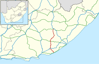
The R337 is a Regional Route in South Africa that connects Cradock and the R329 heading towards Willowmore via Jansenville.
The R344 is a Regional Route in South Africa that connects Grahamstown with Dordrecht.
The R346 is a Regional Route in Eastern Cape, South Africa that connects Kidd's Beach with Stutterheim via King William’s Town.
The R370 is a Regional Route in South Africa that connects Douglas with Jan Kempdorp.

Hogsback is a village in the Amathole Mountains in the Eastern Cape Province, South Africa.

Amatola, Amatole or Amathole are a range of densely forested mountains, situated in the Eastern Cape province of South Africa. The word Amathole means ‘calves’ in Xhosa, and Amathole District Municipality, which lies to the south, is named after these mountains.

The N6 is a national route in South Africa that connects East London with Bloemfontein, via Komani and Maletswai. It runs roughly from north to south, connecting the N1 with the N2.

The N9 is a national route in South Africa that connects George with the N1 at Colesberg, via Graaff-Reinet and Middelburg.

The N14 is a national route in South Africa which runs from Springbok in the Northern Cape to Pretoria in Gauteng. It passes through Upington, Kuruman, Vryburg, Krugersdorp and Centurion. The section between Pretoria and Krugersdorp is maintained by the Gauteng Provincial government and is also designated the P158.
Hogsback Pass is situated in the Eastern Cape province of South Africa on the regional road R345, between Alice and Cathcart.
The R554 is a Regional Route in Gauteng, South Africa. The road connects the southern suburbs of Soweto with Springs on the East Rand via Lenasia, Alberton and Brakpan.
M16 is a metropolitan route in Johannesburg, South Africa. It begins in the north-western suburb of Greenside and heads eastwards through some of Johannesburg's northern suburbs and through Edenvale to end at the East Rand town of Kempton Park.
