R72 (South Africa)

Last updated

SA road R72.svg
Provincial route R72
Map of the R72 (South Africa).svg
Route information
Maintained by ECDRPW
Length243 km (151 mi)
Major junctions
West endSA road N2 jct.svgSA road N10 jct.svg N2  / N10 near Coega
Major intersectionsSA road R67.svg R67 in Port Alfred
East endSA road N2 jct.svgSA road N6 jct.svg N2  / N6 in East London
Location
Country South Africa
Major cities
Highway system
SA road R71.svg R71 SA road R73.svg R73

The R72 is a provincial route in Eastern Cape, South Africa that connects the N2 north-east of Gqeberha with East London via Port Alfred. It provides an alternative to the N2 for travel between Gqeberha and East London. [1]

Contents

Route

The R72 begins in the city of East London in the Buffalo City Metropolitan Municipality, at an off-ramp junction with the N2 highway. North of this junction, it is the N6 national route to Bloemfontein.

The R72 begins by going southwards for 6 kilometres from the N2 interchange as the North East Expressway, immediately crossing the Nahoon River and becoming a partial highway with off-ramp junctions, up to the Fleet Street junction in the suburb of Quigney, where it becomes Fleet Street westwards. It goes westwards for 9 kilometres, through East London's Central Business District, crossing the Buffalo River, to become Settlers Way and reach the East London Airport entrance.

From the East London Airport, the R72 follows the Eastern Cape Coast westwards for 127 km, bypassing the East London Coast Nature Reserve, bypassing Kidd's Beach and meeting the southern terminus of the R346 road, bypassing the Great Fish River's mouth, to the town of Port Alfred, where it meets the southern terminus of the R67 road before passing through the town centre.

It crosses the Kowie River in the town centre before leaving Port Alfred westwards and continuing for 22 kilometres to the town of Kenton-on-Sea, where it crosses the Kariega River near its mouth and meets the southern terminus of the R343 road. It then crosses the Boesmans River near its mouth and passes through Boesmansriviermond before turning away from the coast and continuing westwards for 23 kilometres to the town of Alexandria.

From Alexandria, the R72 continues westwards for 50 kilometres as the Fonteinkloof Pass to reach its western terminus, where it forms another interchange with the N2 highway about 45 kilometres north-east of Gqeberha (35 kilometres north-east of Coega; 12 kilometres north-east of Colchester). It meets the southern terminus of the N10 national route at the same interchange.

Related Research Articles

<span class="mw-page-title-main">N1 (South Africa)</span> National road in South Africa

The N1 is a national route in South Africa that runs from Cape Town through Bloemfontein, Johannesburg, Pretoria and Polokwane to Beit Bridge on the border with Zimbabwe. It forms the first section of the famed Cape to Cairo Road.

<span class="mw-page-title-main">R33 (South Africa)</span> Road in South Africa

The R33 is a provincial route in South Africa that connects Pietermaritzburg with Lephalale via Greytown, Paulpietersburg, Carolina, Belfast and Vaalwater. It is a very long road, passing through 3 provinces.

<span class="mw-page-title-main">R34 (South Africa)</span> Road in South Africa

The R34 is a long provincial route in South Africa that connects Vryburg with Richards Bay via Kroonstad and Newcastle. It passes through three provinces, North West, the Free State and KwaZulu-Natal.

<span class="mw-page-title-main">R42 (South Africa)</span>

The R42 is a provincial route in South Africa that connects Vanderbijlpark with Bronkhorstspruit via Vereeniging, Heidelberg, Nigel and Delmas.

<span class="mw-page-title-main">R56 (South Africa)</span> Road in South Africa

The R56 is a provincial route in South Africa that connects Middelburg with Pietermaritzburg via Molteno, Maclear and Kokstad. It is co-signed with the N2 between Kokstad and Stafford's Post for 39 kilometres.

<span class="mw-page-title-main">R59 (South Africa)</span> Road in South Africa

The R59 is a provincial route in South Africa that connects Hertzogville with Alberton via Bothaville, Parys and Vereeniging. The R59 is a freeway from the R57 Junction in Sasolburg until the N12 Reading Interchange in Alberton, signposted as the Sybrand van Niekerk Freeway.

<span class="mw-page-title-main">R61 (South Africa)</span> Road in South Africa

The R61 is a long provincial route in South Africa that connects Beaufort West with Port Shepstone via Graaff-Reinet, Komani, Mthatha and Port Edward.

<span class="mw-page-title-main">R67 (South Africa)</span>

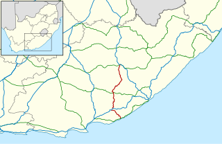
The R67 is a provincial route in Eastern Cape, South Africa that connects Port Alfred with Komani via Grahamstown.

<span class="mw-page-title-main">R75 (South Africa)</span> Regional route in South Africa

The R75 is a provincial route in Eastern Cape, South Africa that connects Graaff-Reinet with Gqeberha via Despatch, Kariega and Jansenville.

<span class="mw-page-title-main">R82 (South Africa)</span> Road in South Africa

The R82 is a provincial route in South Africa that connects Johannesburg with Kroonstad via Vereeniging and Sasolburg. It starts just south of the M1 Johannesburg Municipal Highway's interchange with the N12 Southern Bypass, going south, meeting the R59, R54, R42 & R28 routes at Vereeniging before crossing the Vaal River into the Free State & proceeding to Kroonstad. It is an alternative, but longer route to the N1 National Route between Johannesburg & Kroonstad.

The R103 is a Regional Route in South Africa that is the designation for some of the old sections of roads that were previously the N3, prior to upgrading. It only has 3 sections, from Hillcrest to Ladysmith, from Warden to Villiers and from Heidelberg to Johannesburg.

<span class="mw-page-title-main">N2 (South Africa)</span> National road in South Africa

The N2 is a national route in South Africa that runs from Cape Town through George, Gqeberha, East London, Mthatha, Port Shepstone and Durban to Ermelo. It is the main highway along the Indian Ocean coast of the country. Its current length of 2,255 kilometres (1,401 mi) makes it the longest numbered route in South Africa.

<span class="mw-page-title-main">Port Alfred</span> Place in Eastern Cape, South Africa

Port Alfred is a small town with a population of just under 26,000 in the Eastern Cape province of South Africa. It is situated on the eastern seaboard of the country at the mouth of the Kowie River, almost exactly halfway between the larger cities of Gqeberha and East London and 30 kilometres (19 mi) west of Cannon Rocks.

<span class="mw-page-title-main">N12 (South Africa)</span> National road in South Africa

The N12 is a national route in South Africa which runs from George through Beaufort West, Kimberley, Klerksdorp and Johannesburg to eMalahleni.

<span class="mw-page-title-main">N4 (South Africa)</span> National road in South Africa

The N4 is a national route in South Africa that runs from Skilpadshek on the Botswana border, past Rustenburg, Pretoria, eMalahleni and Mbombela, to Komatipoort on the Mozambique border. The entire route is a toll road.

<span class="mw-page-title-main">N6 (South Africa)</span> National road in South Africa

The N6 is a national route in South Africa that connects East London with Bloemfontein, via Komani and Maletswai. It runs roughly from north to south, connecting the N1 with the N2.

<span class="mw-page-title-main">N8 (South Africa)</span> National road in South Africa

The N8 is a national route in South Africa that connects Groblershoop with Maseru in Lesotho via Kimberley and Bloemfontein. It is maintained by the South African National Roads Agency.

<span class="mw-page-title-main">N10 (South Africa)</span> National road in South Africa

The N10 is a national route in South Africa connecting Gqeberha on the Eastern Cape coast with the Namibian border at Nakop, via Cradock, De Aar and Upington.

<span class="mw-page-title-main">N11 (South Africa)</span> National road in South Africa

The N11 is a national route in South Africa which runs from the Botswana border at Groblersbrug, through Mokopane, Middelburg, Ermelo and Newcastle to end at the N3 just after Ladysmith.

<span class="mw-page-title-main">N17 (South Africa)</span> National road in South Africa

The N17 is a national route in South Africa which runs from Johannesburg to Oshoek (Ngwenya) on the border with Eswatini. It passes through Springs, Bethal and Ermelo.

References

  1. "RDDA SOUTH AFRICAN NUMBERED ROUTE DESCRIPTION AND DESTINATION ANALYSIS". NATIONAL DEPARTMENT OF TRANSPORT. May 2012. Retrieved 25 March 2021.