The Appalachian Mountains, often called the Appalachians, are a system of mountains in eastern North America. The Appalachians first formed roughly 480 million years ago during the Ordovician Period. They once reached elevations similar to those of the Alps and the Rocky Mountains before experiencing natural erosion. The Appalachian chain is a barrier to east–west travel, as it forms a series of alternating ridgelines and valleys oriented in opposition to most highways and railroads running east–west.
Fayette County is a county in the U.S. state of West Virginia. As of the 2010 census, the population was 46,039. Its county seat is Fayetteville. It is part of the Beckley, WV Metropolitan Statistical Area in Southern West Virginia.
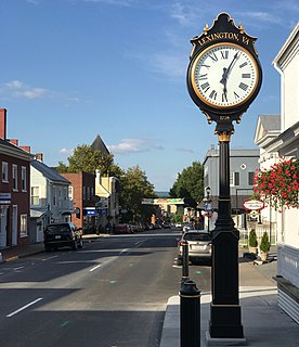
Lexington is an independent city in the Commonwealth of Virginia in the United States. At the 2010 census, the population was 7,042. It is the county seat of Rockbridge County, although the two are separate jurisdictions. The Bureau of Economic Analysis combines the city of Lexington with Rockbridge County for statistical purposes. Lexington is about 57 miles (92 km) east of the West Virginia border and is about 50 miles (80 km) north of Roanoke, Virginia. It was first settled in 1777.
Brookneal is an incorporated town in Campbell County, Virginia, United States. The population was 1,112 as of the 2010 census. It is part of the Lynchburg Metropolitan Statistical Area.

Owen Wister was an American writer and historian, considered the "father" of western fiction. He is best remembered for writing The Virginian and a biography of Ulysses S. Grant.

Red House is a small unincorporated community located in Putnam County in the U.S. state of West Virginia. The community is divided into two distinct areas: Red House (Proper) which follows the Kanawha River Valley along WV 62, and Red House Hill along WV 34 which is in the hills just off the Kanawha River Valley. The Red House Post Office is still in service and was founded on September 26, 1840. Some say the town was named for a red house which stood at the town site, while others believe nearby red rock formations account for the name.

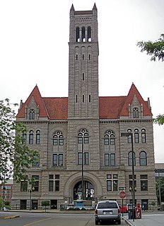
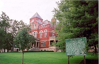
The National Register of Historic Places in the United States is a register including buildings, sites, structures, districts, and objects. The Register automatically includes all National Historic Landmarks as well as all historic areas administered by the U.S. National Park Service. Since its introduction in 1966, more than 90,000 separate listings have been added to the register.
In West Virginia folklore, the Flatwoods monster, also known as the Braxton County Monster or Phantom of Flatwoods, is an entity reported to have been sighted in the town of Flatwoods in Braxton County, West Virginia, United States, on September 12, 1952, following the appearance of a bright object crossing the night sky. Nearly fifty years later, investigators concluded that the light was a meteor and the creature was a barn owl perched in a tree, with shadows making it appear to be a large humanoid.
West Virginia Route 12 is a north–south route located in the southern portion of the U.S. state of West Virginia. The southern terminus of the route is at U.S. Route 219 in Peterstown, Monroe County, less than 300 yards (270 m) from the Virginia state line. It compromises a portion of the Farm Heritage Road byway between Peterstown and West Virginia Route 122. The northern terminus of the route is at U.S. Route 60 in Alta, Greenbrier County, near Interstate 64 exit 161.

Southern West Virginia is a culturally and geographically distinct region in the U.S. state of West Virginia. Generally considered the heart of Appalachia, Southern West Virginia is known for its coal mining heritage and Southern affinity. The region is also closely identified with southwestern Virginia and southeastern Kentucky, with close proximity to northwestern North Carolina and East Tennessee. Today, Southern West Virginia continues to grapple with poverty and continuing population loss. Almost the entire region is located in West Virginia's 3rd congressional district, which was represented by Evan Jenkins until he resigned on September 30, 2018 to take a seat as a Justice on the Supreme Court of Appeals of West Virginia.

The Huntington–Ashland metropolitan area is the largest metropolitan statistical area in West Virginia and includes seven counties across three states: West Virginia, Kentucky, and Ohio. New definitions from February 28, 2013 placed the population at 361,580. The MSA is nestled along the banks of the Ohio River within the Appalachian Plateau region. The area is referred to locally as the "Tri-State area". In addition, the three largest cities are referred to as the River Cities.

Mountain Lake Wilderness is a U.S. Wilderness Area in the George Washington and Jefferson National Forests. The wilderness area is located next to privately owned Mountain Lake, and consists of 8,314 acres (3,365 ha) in Virginia and 2,721 acres (1,101 ha) in West Virginia.

Sand Hill Wildlife Management Area is located near Parkersburg, West Virginia in Wood and Ritchie counties. Sand Hill WMA is located on 1,987 acres (804 ha) of rugged, hilly oak-hickory woodlands interspersed with timber, oil and gas development sites.

Shannondale Springs Wildlife Management Area is located near Charles Town, West Virginia in Jefferson County. Shannondale Springs WMA is located on 1,361 acres (551 ha) of hills covered with oak-hickory woodlands, brushy areas, and open fields.
Red Creek is an unincorporated community in Tucker County, West Virginia, United States. Red Creek is located on West Virginia Route 72 12 miles (19 km) southeast of Parsons. Red Creek has a post office with ZIP code 26289. Originally called Flanangan Hill after early settler Ebenezer Flanagan, the community was named Red Creek by the community's first postmaster William Raines. Being a Democrat, Raines refused to name the post office after the Republican Flanagan family, and thus named it for a nearby creek. The Red Creek post office was established in 1856.
Snow Hill is an unincorporated community in Kanawha County, West Virginia, United States. Snow Hill is 4 miles (6.4 km) southeast of downtown Charleston.
Burley Park is a neighborhood in southwestern Lexington, Kentucky, United States. It is named for the large number of tobacco warehouses that were once located in the neighborhood. Its boundaries are Waller Avenue and Mason Headley Road to the south, east of Beacon Hill Drive/ Summerville Drive/ Addison Park to the west, Red Mile Road and Virginia Avenue to the north, and RJ Corman railroad tracks to the east. The smaller Golf View Estates neighborhood is typically included in Burley Park.
Crown Hill is an unincorporated community in Kanawha County, West Virginia, United States. Crown Hill is located on the south bank of the Kanawha River along West Virginia Route 61 1.8 miles (2.9 km) west-southwest of Pratt. Crown Hill once had a post office, which closed on February 1, 1997.