Saint David Parish, New Brunswick

Last updated

Saint David
St. David
Charlotte County NB - Saint David Parish.png
Location within Charlotte County.
Country Flag of Canada (Pantone).svg  Canada
Province Flag of New Brunswick.svg  New Brunswick
County Charlotte County
Erected1786
Area
[1]
  Land190.39 km2 (73.51 sq mi)
Population
 (2021) [1]
  Total1,470
  Density7.7/km2 (20/sq mi)
  Change 2016-2021
Decrease2.svg 3.9%
  Dwellings
725
Time zone UTC-4 (AST)
  Summer (DST) UTC-3 (ADT)

Saint David is a geographic parish in Charlotte County, New Brunswick, Canada, [4] located northeast of St. Stephen and northwest of Saint Andrews.

Contents

For governance purposes, most of the parish is part of the town of the Municipal District of St. Stephen, [5] with Tower Hill and Honeydale belonging to the Southwest rural district, [6] both of which are members of the Southwest New Brunswick Service Commission. [7]

Prior to the 2023 governance reform, it comprised a single local service district (LSD), which was a member of the Southwest New Brunswick Service Commission (SNBSC). [8]

The Census subdivision of the same name shares the parish's boundaries. [9]

Origin of the name

William Francis Ganong believed the name suggested by other Saint names in the area. [10] Five of the original six mainland parishes of Charlotte County used names of major saints recognised by the Church of England: Andrew (Scotland), David (Wales), George (England), Patrick (Ireland), and Stephen.

History

Saint David was erected in 1786 as one of the original parishes of Charlotte County. [11]

Boundaries

Saint David Parish is bounded: [2] [12] [13]

Evolution of boundaries

Saint David joined the Cape Ann Association block in the north with the Penobscot Association block around Oak Bay and the Admiralty mast reserve between them. [14] Saint David's boundaries have changed the least of the original parishes of Charlotte County.

In 1881 five grants in Oak Bay to the northeast of the junction of Board Road and Route 760 were transferred from Saint Croix. [15]

Former local service district

The local service district of the parish of Saint David comprised the entire parish. [16]

The LSD was established in 1969 to assess for community services, [17] in this case to provide ambulance service after local funeral homes ceased doing so. [18] Fire protection was added in 1970, [19] non-fire related rescue in 2013. [20]

In 2022, the LSD assessed for community and recreation services in addition to the basic LSD services of fire protection, police services, land use planning, emergency measures, and dog control. [21] The taxing authority was 519.00 Saint David.

Communities

Communities at least partly within the parish. [12] [13] [22]

Bodies of water

Bodies of water [lower-alpha 1] at least partly within the parish. [12] [13] [22]

Islands

Islands at least partly within the parish. [12] [13] [22]

Demographics

Population

Canada census – Saint David community profile
2021 2016 2011
Population1,470 (-3.9% from 2016)1,529 (-4.7% from 2011)1,605 (+7.1% from 2006)
Land area190.39 km2 (73.51 sq mi)190.66 km2 (73.61 sq mi)189.93 km2 (73.33 sq mi)
Population density7.7/km2 (20/sq mi)8.0/km2 (21/sq mi)8.5/km2 (22/sq mi)
Median age51.6 (M: 51.2, F: 52)50.5 (M: 50.9, F: 50.0)47.8 (M: 47.9, F: 47.6)
Private dwellings640 (total) 743 (total) 787 (total) 
Median household income$54,240
References: 2021 [23] 2016 [24] 2011 [25] earlier [26] [27]
Historical Census Data - Saint David Parish, New Brunswick
YearPop.±%
1991 1,585    
1996 1,641+3.5%
YearPop.±%
2001 1,595−2.8%
2006 1,499−6.0%
YearPop.±%
2011 1,605+7.1%
2016 1,529−4.7%
[28] [29]

Language

Canada Census Mother Tongue - Saint David Parish, New Brunswick [28]
CensusTotal
English
French
English & French
Other
YearResponsesCountTrendPop %CountTrendPop %CountTrendPop %CountTrendPop %
2011
1,590
1,530Increase2.svg 5.9%96.23%40Increase2.svg 37.5%2.52%5Decrease2.svg 50.0%0.31%15Decrease2.svg 25.0%0.94%
2006
1,495
1,440Decrease2.svg 7.4%96.32%25Decrease2.svg 16.7%1.67%10Increase2.svg n/a%0.67%20Increase2.svg n/a%1.34%
2001
1,585
1,555Decrease2.svg 1.6%98.11%30Decrease2.svg 25.0%1.89%0Steady2.svg 0.0%0.00%0Decrease2.svg 100.0%0.00%
1996
1,630
1,580n/a96.93%40n/a2.45%0n/a0.00%10n/a0.61%

Access Routes

Highways and numbered routes that run through the parish, including external routes that start or finish at the parish limits: [30]

See also

Notes

  1. Not including brooks, ponds or coves.

Related Research Articles

<span class="mw-page-title-main">Dundas Parish, New Brunswick</span> Parish in Canada

Dundas is a geographic parish in Kent County, New Brunswick, Canada.

<span class="mw-page-title-main">Inkerman Parish, New Brunswick</span> Parish in New Brunswick, Canada

Inkerman is a geographic parish in Gloucester County, New Brunswick, Canada.

<span class="mw-page-title-main">Dalhousie Parish, New Brunswick</span> Parish in New Brunswick, Canada

Dalhousie is a geographic parish in Restigouche County, New Brunswick, Canada.

<span class="mw-page-title-main">Bathurst Parish, New Brunswick</span> Parish in New Brunswick, Canada

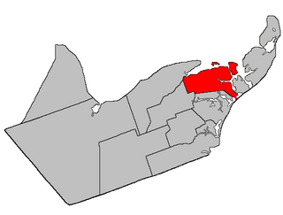
Bathurst is a geographic parish in Gloucester County, New Brunswick, Canada.

<span class="mw-page-title-main">New Bandon Parish, New Brunswick</span> Parish in New Brunswick, Canada

New Bandon is a geographic parish in Gloucester County, New Brunswick, Canada.

<span class="mw-page-title-main">Paquetville Parish, New Brunswick</span> Parish in New Brunswick, Canada

Paquetville is a geographic parish in Gloucester County, New Brunswick, Canada.

<span class="mw-page-title-main">Caraquet Parish, New Brunswick</span> Parish in New Brunswick, Canada

Caraquet is a geographic parish in Gloucester County, New Brunswick, Canada.

<span class="mw-page-title-main">Shippegan Parish, New Brunswick</span> Parish in New Brunswick, Canada

Shippegan is a geographic parish in Gloucester County, New Brunswick, Canada. Located in the northeastern corner of the province at the end of the Acadian Peninsula, the parish consists of the three main islands of Taylor, Lamèque, and Miscou, along with several smaller islands and tidal wetlands; Taylor Island is now joined to the mainland by an isthmus, which is crossed by a causeway.

<span class="mw-page-title-main">Allardville Parish, New Brunswick</span> Parish in New Brunswick, Canada

Allardville is a geographic parish in Gloucester County, New Brunswick, Canada,

<span class="mw-page-title-main">Woodstock Parish, New Brunswick</span> Parish in New Brunswick, Canada

Woodstock is a geographic parish in Carleton County, New Brunswick, Canada, surrounding the town of the same name on its landward side.

<span class="mw-page-title-main">Saint Andrews Parish, New Brunswick</span> Parish in Canada

Saint Andrews Parish is a geographic parish in Charlotte County, New Brunswick, Canada, located east of St. Stephen.

<span class="mw-page-title-main">Alma Parish, New Brunswick</span> Parish in New Brunswick, Canada

Alma is a geographic parish on the Bay of Fundy in the southwestern corner of Albert County, New Brunswick, Canada.

<span class="mw-page-title-main">Pennfield Parish, New Brunswick</span> Parish in Canada

Pennfield is a geographic parish in Charlotte County, New Brunswick, Canada, located west of Saint John located east of St. George and west of Saint John.

<span class="mw-page-title-main">Saint George Parish, New Brunswick</span> Parish in Canada

Saint George is a geographic parish in Charlotte County, New Brunswick, Canada, located between St. Stephen and Saint John.

<span class="mw-page-title-main">Dumbarton Parish, New Brunswick</span> Parish in Canada

Dumbarton is a geographic parish in Charlotte County, New Brunswick, Canada, located inland north of St. George and south of Harvey.

<span class="mw-page-title-main">Saint Patrick Parish, New Brunswick</span> Parish in Canada

Saint Patrick is a geographic parish in Charlotte County, New Brunswick, Canada, located west of St. George and Saint Andrews.

<span class="mw-page-title-main">Saint Croix Parish, New Brunswick</span> Parish in Canada

Saint Croix is a geographic parish in Charlotte County, New Brunswick, Canada, straddling Route 1 to the north of the original town of Saint Andrews.

<span class="mw-page-title-main">Dufferin Parish, New Brunswick</span> Parish in Canada

Dufferin is a geographic parish in Charlotte County, New Brunswick, Canada, located east of St. Stephen.

<span class="mw-page-title-main">Saint Stephen Parish, New Brunswick</span> Parish in Canada

Saint Stephen is a geographic parish in Charlotte County, New Brunswick, Canada, located in the southwestern corner of the province.

<span class="mw-page-title-main">Saint James Parish, New Brunswick</span> Parish in Canada

Saint James is a geographic parish in Charlotte County, New Brunswick, Canada, located north of St. Stephen.

References

  1. 1 2 "Census Profile". Statistics Canada. 26 October 2022. Retrieved 30 October 2022.
  2. 1 2 "Chapter T-3 Territorial Division Act". Government of New Brunswick. Retrieved 5 June 2023.
  3. "Chapter I-13 Interpretation Act". Government of New Brunswick. Retrieved 5 June 2023.
  4. The Territorial Division Act [2] divides the province into 152 parishes, the cities of Saint John and Fredericton, and one town of Grand Falls. The Interpretation Act [3] clarifies that parishes include any local government within their borders.
  5. "Southwest Regional Service Commission: RSC 10". Government of New Brunswick. Retrieved 5 June 2023.
  6. "Southwest Regional Service Commission: RD 10". Government of New Brunswick. Retrieved 5 June 2023.
  7. "Regions Regulation – Regional Service Delivery Act". Government of New Brunswick. 21 July 2022. Retrieved 5 June 2023.
  8. "Communities in each of the 12 Regional Service Commissions (RSC) / Les communautés dans chacune des 12 Commissions de services régionaux (CSR)" (PDF), Government of New Brunswick, July 2017, retrieved 1 February 2021
  9. "New Brunswick Regulation 84-168 under the Municipalities Act (O.C. 84-582)". Government of New Brunswick. Retrieved 14 August 2020.
  10. Ganong, William F. (1896). A Monograph of the Place-Nomenclature of the Province of New Brunswick. Royal Society of Canada. p. 268. Retrieved 17 March 2021.
  11. "26 Geo. III Chapter I. An Act for the better ascertaining and confirming the Boundaries of the several Counties within this Province, and for subdividing them into Towns or Parishes.". Acts of the General Assembly of His Majesty's Province of New-Brunswick, passed in the year 1786. Saint John, New Brunswick: Government of New Brunswick. 1786. pp. 3–12. Retrieved 20 March 2021.
  12. 1 2 3 4 "No. 153". Provincial Archives of New Brunswick. Department of Natural Resources and Energy Development. Retrieved 4 July 2021. Remainder of parish on maps 154, 160, and 161 at same site.
  13. 1 2 3 4 "467" (PDF). Transportation and Infrastructure. Government of New Brunswick. Retrieved 4 July 2021. Remainder of parish on mapbooks 468, 478, 479, 488, and 489 at same site.
  14. "1785 St. David Parish" (PDF). RootsWeb. Retrieved 16 April 2021. Map contains anachronist parish boundaries but is useful for boundaries of Association blocks.
  15. "44 Vic. c. 31 An Act to alter the Boundary Lines of the Parish of Saint Croix, in the County of Charlotte.". Acts of the General Assembly of Her Majesty's Province of New Brunswick. Passed in the Month of March 1881. Fredericton: Government of New Brunswick. 1881. pp. 66–67. Available as a free ebook from Google Books.
  16. "New Brunswick Regulation 84-168 under the Municipalities Act (O.C. 84-582)". Government of New Brunswick. Retrieved 7 February 2021.
  17. "Regulation 69–17 under the Municipalities Act (O. C. 69–161)". The Royal Gazette. 127. Fredericton: 149. 12 March 1969.
  18. "St. Stephen – Milltown Ambulance Brigade". The New Brunswick Municipal Monthly. 25 (3). Fredericton, NB: Department of Municipal Affairs: 5. March 1969.
  19. "Regulation 70–63 under the Municipalities Act (O. C. 70–385)". The Royal Gazette. 128. Fredericton: 343–344. 17 June 1970.
  20. "Regulation 2013-60 under the Municipalities Act (O. C. 2013-270)" (PDF). The Royal Gazette. 171. Fredericton: 1290. 25 September 2013. ISSN   1714-9428.
  21. "2020 Local Government Statistics for New Brunswick" (PDF). Department of Environment and Local Government. p. 55. Retrieved 7 February 2021.
  22. 1 2 3 "Search the Canadian Geographical Names Database (CGNDB)". Government of Canada. Retrieved 4 July 2021.
  23. "2021 Community Profiles". 2021 Canadian Census . Statistics Canada. 4 February 2022. Retrieved 27 April 2022.
  24. "2016 Community Profiles". 2016 Canadian Census . Statistics Canada. 12 August 2021. Retrieved 30 August 2019.
  25. "2011 Community Profiles". 2011 Canadian Census . Statistics Canada. 21 March 2019. Retrieved 17 March 2014.
  26. "2006 Community Profiles". 2006 Canadian Census . Statistics Canada. 20 August 2019.
  27. "2001 Community Profiles". 2001 Canadian Census . Statistics Canada. 18 July 2021.
  28. 1 2 Statistics Canada: 1996, 2001, 2006, 2011 census
  29. "Census Profile, 2016 Census: Saint David, Parish [Census subdivision], New Brunswick". Statistics Canada. Retrieved 30 August 2019.
  30. Atlantic Canada Back Road Atlas ISBN   978-1-55368-618-7 Pages 4, 12


45°16′52″N67°11′06″W / 45.280986°N 67.184873°W / 45.280986; -67.184873 (Saint David Parish, New Brunswick)