
Jennings County is a county located in the U.S. state of Indiana. As of 2020, the population was 27,613. The county seat is Vernon.
Lexington is an unincorporated community in Lexington Township, Scott County, in the U.S. state of Indiana, located about 10 miles west of the Ohio River and 28 miles north of Louisville, Kentucky. The town itself was founded before Indiana became the 19th state in 1816 and was located in Jefferson County at the time it was platted. It was the original county seat from 1820 to 1874, before local leaders decided on a more central location at nearby Scottsburg, which created animosity between the residents of the two towns for several decades afterwards.

South Boston is an unincorporated community in Franklin Township, Washington County, in the U.S. state of Indiana.

Blue Lick is an unincorporated community in Monroe Township, Clark County, Indiana, United States.
Hamburg is an unincorporated community in Silver Creek Township, Clark County, Indiana. Parts of Hamburg are within the municipal boundaries of Clarksville and Sellersburg.
Owen is an unincorporated community in Owen Township, Clark County, Indiana.
Bryantsburg is an unincorporated community in Monroe Township, Jefferson County, Indiana.
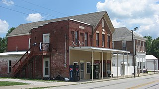
Kent is an unincorporated community and census-designated place (CDP) in Republican Township, Jefferson County, Indiana, United States. As of the 2010 census it had a population of 70.
Grayford is an unincorporated community in Vernon Township, Jennings County, Indiana.
Hilltown is an unincorporated community in Montgomery Township, Jennings County, Indiana.
Lovett is an unincorporated community in Lovett Township, Jennings County, Indiana.
Nebraska is an unincorporated community in Campbell Township, Jennings County, Indiana.
Queensville is an unincorporated community in Geneva Township, Jennings County, Indiana.

Scipio is an unincorporated community and census-designated place (CDP) in Geneva Township, Jennings County, Indiana, United States. As of the 2010 census it had a population of 153.
Walnut Ridge is an unincorporated community in Vernon Township, Jennings County, Indiana.
Zenas is an unincorporated community in Columbia Township, Jennings County, Indiana.
Wellsboro is an unincorporated community in Noble Township, LaPorte County, Indiana.
Paris Crossing is an unincorporated community in southern Montgomery Township, Jennings County, Indiana, United States. It lies along State Road 250, south of the town of Vernon, the county seat of Jennings County. Its elevation is 623 feet (190 m), and it is located at 38°49′46″N85°38′53″W. Although Paris Crossing is unincorporated, it has a post office, with the ZIP code of 47270.

Hayden is an unincorporated community and census-designated place (CDP) in central Spencer Township, Jennings County, Indiana, United States. As of the 2020 census it had a population of 501.

Butlerville is an unincorporated community and census-designated place (CDP) in central Campbell Township, Jennings County, Indiana, United States. As of the 2010 census it had a population of 282.


