Rada is an unincorporated community in Hampshire County in the U.S. state of West Virginia. Rada is located on U.S. Highway 220/West Virginia Route 28 between Junction and Purgitsville in southwest Hampshire County along Mill Creek. It lies at an intersection of US 220/WV 28 with Rada Road.

Big Four is an unincorporated community located in McDowell County, West Virginia, United States. Their post office has been closed. Originally known as Cirrus, Big Four is reported to have been renamed for the four men who operated the coal mines in the area.

Algoma is an unincorporated community in McDowell County, West Virginia, United States. Algoma is located adjacent to the town of Northfork. Its post office was established in 1891 and discontinued in 1988. Algoma most likely was derived from the Algonquin language.

Jenkinjones is an unincorporated community and coal town in McDowell County, West Virginia, United States. It lies on the western flanks of Stone Ridge near the border with Tazewell County, Virginia.
Looneyville is an unincorporated community on Flat Creek of the Pocatalico River in Roane County, West Virginia, United States. It is located on West Virginia Route 36. The community is named for Robert Looney, a pioneer settler. The post office was established in 1870.
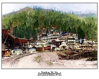
Nuriva is an unincorporated community in Wyoming County, West Virginia, United States.It was also known as Trace Fork and Tracoal. Its post office is closed.
Thursday is an unincorporated community located in Ritchie County, West Virginia, United States. It is near the community of Burnt House.

Eight was an unincorporated community located in McDowell County, West Virginia, United States. The Eight post office closed in 1936.
Blue Pennant is an unincorporated community in Boone County, West Virginia, United States. At one time, it was known as Red Dragon, which has closed its post office. Red Dragon as a community was also called Kam and then Mordue.
Leatherbark is an unincorporated community in Calhoun County, West Virginia, United States. Its post office is closed.
Euclid is an unincorporated community in Calhoun County, West Virginia, United States. Its post office has closed.
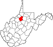
Fink is an unincorporated community in Lewis County, West Virginia, United States. Its post office is closed.
Link is an unincorporated community in Tyler County, West Virginia, United States. Its post office is closed.
Copenhaver was an unincorporated community in Kanawha County, West Virginia, United States. Its post office is closed.
Enon is an unincorporated community in Nicholas County, West Virginia, United States. Its post office is closed.
Maynor is an unincorporated community in Raleigh County, West Virginia, United States. Its post office is closed.
Wheat is an unincorporated community in Wetzel County, West Virginia, United States. Its post office opened in 1837, closed in 1950.
Wevaco is an unincorporated community and former coal town in Kanawha County, West Virginia, United States. Its post office is closed.
Woodyard was an unincorporated community in Roane County, West Virginia. Its post office is closed.
Lawford is an unincorporated community in Ritchie County, in the U.S. state of West Virginia.