Seth Ward, Texas

Last updated

Seth Ward, Texas
TXMap-doton-Plainview.PNG
Location of Seth Ward, Texas
Hale County SethWard.svg
Coordinates: 34°12′45″N101°41′46″W / 34.21250°N 101.69611°W / 34.21250; -101.69611
Country United States
State Texas
County Hale
Area
  Total2.2 sq mi (5.8 km2)
  Land2.2 sq mi (5.8 km2)
  Water0.0 sq mi (0.0 km2)
Elevation
3,373 ft (1,028 m)
Population
 (2010)
  Total2,025
  Density903/sq mi (348.7/km2)
Time zone UTC-6 (Central (CST))
  Summer (DST) UTC-5 (CDT)
FIPS code 48-66848 [1]
GNIS feature ID1367965 [2]

Seth Ward is an unincorporated community and census-designated place (CDP) in Hale County, Texas, United States. The population was 2,025 at the 2010 census. [3]

Contents

History

It is named for Seth Ward College, which was founded in 1910 by Methodist bishop Seth Ward, who took over Central Plains College and Conservatory of Music (founded in 1907) to form Seth Ward College. The school burned in 1916 and was not rebuilt. [4]

Country singer Jimmy Dean was born in Seth Ward. [5]

Geography

Seth Ward is located in northeastern Hale County at 34°12′45″N101°41′46″W / 34.21250°N 101.69611°W / 34.21250; -101.69611 (34.212421, -101.696088). [6] It is bordered to the southwest by the city of Plainview, the county seat. Interstate 27 passes just north of Seth Ward, with access from Exit 53. I-27 leads north 74 miles (119 km) to Amarillo and south 50 miles (80 km) to Lubbock.

According to the United States Census Bureau, the CDP has a total area of 2.2 square miles (5.8 km2), all of it land. [3]

Demographics

2020 census

Seth Ward racial composition [7]
(NH = Non-Hispanic) [lower-alpha 1]
RaceNumberPercentage
White (NH)29418.34%
Black or African American (NH)110.69%
Native American or Alaska Native (NH)50.31%
Pacific Islander (NH)10.06%
Mixed/Multi-Racial (NH)181.12%
Hispanic or Latino 1,27479.48%
Total1,603

As of the 2020 United States census, there were 1,603 people, 509 households, and 387 families residing in the CDP.

2000 census

As of the census [1] of 2000, there were 1,926 people, 586 households, and 467 families residing in the CDP. The population density was 1,198.7 inhabitants per square mile (462.8/km2). There were 693 housing units at an average density of 431.3 per square mile (166.5/km2). The racial makeup of the CDP was 60.02% White, 3.63% African American, 1.04% Native American, 0.05% Asian, 32.76% from other races, and 2.49% from two or more races. Hispanic or Latino of any race were 64.07% of the population.

There were 586 households, out of which 48.8% had children under the age of 18 living with them, 56.0% were married couples living together, 16.0% had a female householder with no husband present, and 20.3% were non-families. 16.7% of all households were made up of individuals, and 6.0% had someone living alone who was 65 years of age or older. The average household size was 3.29 and the average family size was 3.69.

In the CDP, the population was spread out, with 38.0% under the age of 18, 9.8% from 18 to 24, 27.9% from 25 to 44, 15.4% from 45 to 64, and 8.9% who were 65 years of age or older. The median age was 27 years. For every 100 females, there were 91.5 males. For every 100 females age 18 and over, there were 99.0 males.

The median income for a household in the CDP was $24,167, and the median income for a family was $28,000. Males had a median income of $22,152 versus $18,583 for females. The per capita income for the CDP was $9,663. About 19.2% of families and 25.7% of the population were below the poverty line, including 28.9% of those under age 18 and 44.5% of those age 65 or over.

Education

Seth Ward is served by the Plainview Independent School District.

Related Research Articles

<span class="mw-page-title-main">Hale County, Texas</span> County in Texas, United States

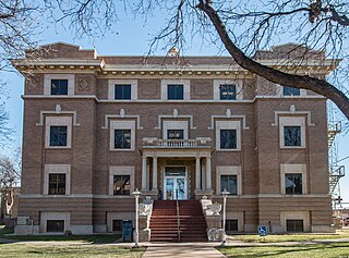
Hale County is a county located in the U.S. state of Texas. As of the 2020 census, its population was 32,522. The county seat is Plainview. The county was created in 1876 and organized in 1888. It is named for Lt. John C. Hale, a hero of the Battle of San Jacinto. Hale County comprises the Plainview, Texas micropolitan statistical area.

<span class="mw-page-title-main">Floyd County, Texas</span> County in Texas, United States

Floyd County is a county in the U.S. state of Texas. As of the 2020 census, its population was 5,402. The seat of the county is Floydada. The county was created in 1876 and later organized in 1890. It is named for Dolphin Ward Floyd, who died on his 32nd birthday, March 6, 1836, defending the Alamo.

<span class="mw-page-title-main">Collinsville, Mississippi</span> Census-designated place in Mississippi, United States

Collinsville is an unincorporated community and census-designated place (CDP) in Lauderdale County, Mississippi, United States. The population was 1,984 at the 2020 census.

<span class="mw-page-title-main">Five Points, Warren County, Ohio</span> CDP in Ohio, United States

Five Points is a census-designated place (CDP) in Clearcreek Township, Warren County, Ohio, United States. The population was 2,247 at the 2020 census.

<span class="mw-page-title-main">Lakehills, Texas</span> CDP in Texas, United States

Lakehills is a census-designated place (CDP) in Bandera County, Texas, United States. The population was 5,150 at the 2010 census, making it the most populous place in Bandera county. It is part of the San Antonio Metropolitan Statistical Area.

<span class="mw-page-title-main">Cameron Park, Texas</span> CDP in Texas, United States

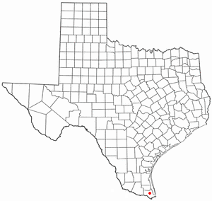
Cameron Park is a census-designated place (CDP) in Cameron County, Texas, United States. The population was 6,963 at the 2010 census. It is part of the Brownsville–Harlingen Metropolitan Statistical Area.

<span class="mw-page-title-main">Lozano, Texas</span> Census-designated place in Texas, United States

Lozano is a census-designated place (CDP) in Cameron County, Texas, United States. The population was 404 at the 2010 census, up from 324 at the 2000 census. It is part of the Brownsville–Harlingen Metropolitan Statistical Area.

<span class="mw-page-title-main">Hart, Texas</span> City in Texas, United States

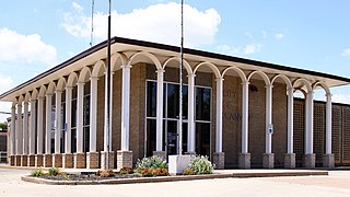
Hart is a city in Castro County, Texas, United States. The population was 1,114 at the 2010 census.

<span class="mw-page-title-main">Agua Dulce, El Paso County, Texas</span> Census-designated place in Texas, United States

Agua Dulce is a census-designated place (CDP) in El Paso County, Texas, United States. The population was 3,218 at the 2020 census. It is part of the El Paso Metropolitan Statistical Area. The ZIP Code encompassing the CDP area is 79928.

<span class="mw-page-title-main">Westway, Texas</span> Census-designated place in Texas, United States

Westway is a census-designated place (CDP) in El Paso County, Texas, United States. The population was 4,188 at the 2010 census. It is part of the El Paso Metropolitan Statistical Area. It is located east of Interstate 10 about 2 miles (3 km) from the New Mexico - Texas state line. The ZIP Code encompassing the CDP area is 79835.

<span class="mw-page-title-main">Edmonson, Texas</span> Town in Texas, United States

Edmonson is a town in Hale County, Texas, United States. The population was 111 at the 2010 census.

<span class="mw-page-title-main">Plainview, Texas</span> City in Texas, United States

Plainview is a city in and the county seat of Hale County, Texas, United States. As of the 2010 census, the population was 22,194.

<span class="mw-page-title-main">Lipscomb, Texas</span> Census-designated place in Texas, United States

Lipscomb is an unincorporated community and census-designated place (CDP) in Lipscomb County, Texas, United States. It is the Lipscomb county seat. The population was 37 at the 2010 census.

<span class="mw-page-title-main">Buchanan Dam, Texas</span> Census-designated place in Texas, United States

Buchanan Dam is a census-designated place (CDP) in Llano County, Texas, United States. The population was 1,519 at the 2010 census, down from 1,688 at the 2000 census.

<span class="mw-page-title-main">Idalou, Texas</span> City in Texas, United States

Idalou is a city in Lubbock County, Texas, United States. It is located 7 miles (11 km) northeast of Lubbock near the intersection of Farm to Market Road 400 and US 62/US 82/SH 114. The population was 2,250 at the 2010 census. It is part of the Lubbock Metropolitan Statistical Area.

<span class="mw-page-title-main">Eidson Road, Texas</span> CDP in Texas, United States

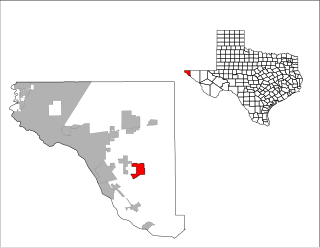
Eidson Road is a census-designated place (CDP) in Maverick County, Texas, United States. The population was 8,960 at the 2010 census.

<span class="mw-page-title-main">South Toledo Bend, Texas</span> CDP in Texas, United States

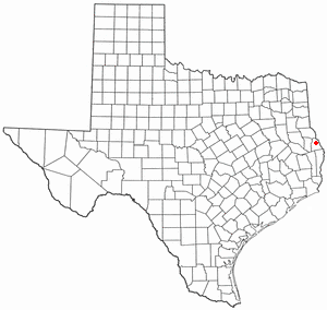
South Toledo Bend is a census-designated place (CDP) in Newton County, Texas, United States. The population was 434 at the 2020 census, down from 524 at the 2010 census.

<span class="mw-page-title-main">Milam, Texas</span> CDP in Texas, United States

Milam is a census-designated place (CDP) in Sabine County, Texas, United States. It is located along the Sabine River at the junction of Highway 87 and Highway 21. The population was 1,355 at the 2020 census. Milam is the largest city in Sabine County.

<span class="mw-page-title-main">San Isidro, Texas</span> CDP in Texas, United States

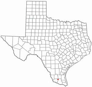
San Isidro is a census-designated place (CDP) in Starr County, Texas, United States. The population was 240 at the 2010 census. The town is named for St. Isidore the Laborer, the patron saint of farmers. A large Southwestern Barrel Cactus growing just east of town is said to be the largest in Texas.

<span class="mw-page-title-main">Cienegas Terrace, Texas</span> CDP in Texas, United States

Cienegas Terrace is a census-designated place (CDP) in Val Verde County, Texas, United States. The population was 3,424 at the 2010 census.

References

  1. 1 2 "U.S. Census website". United States Census Bureau . Retrieved January 31, 2008.
  2. "US Board on Geographic Names". United States Geological Survey. October 25, 2007. Retrieved January 31, 2008.
  3. 1 2 "Geographic Identifiers: 2010 Census Summary File 1 (G001): Seth Ward CDP, Texas". American Factfinder. U.S. Census Bureau. Archived from the original on February 13, 2020. Retrieved February 2, 2018.
  4. Seth Ward, Texas profile - tshaonline.com
  5. Weber, Bruce (June 14, 2010). "Jimmy Dean, Singer and Businessman, Dies at 81". The New York Times . Archived from the original on October 3, 2017. Retrieved June 14, 2010. Jimmy Ray Dean was born in Seth Ward, just outside Plainview, at the base of the Texas panhandle, on Aug. 10, 1928.
  6. "US Gazetteer files: 2010, 2000, and 1990". United States Census Bureau. February 12, 2011. Retrieved April 23, 2011.
  7. "Explore Census Data". data.census.gov. Retrieved May 20, 2022.
  8. https://www.census.gov/ [ not specific enough to verify ]
  9. "About the Hispanic Population and its Origin". www.census.gov. Retrieved May 18, 2022.
  1. Note: the US Census treats Hispanic/Latino as an ethnic category. This table excludes Latinos from the racial categories and assigns them to a separate category. Hispanics/Latinos can be of any race. [8] [9]