As of the 2020 United States census, there were 2,865 people, 1,176 households, and 865 families residing in the city.
2000 census
As of the census[10] of 2000, 2,839 people, 996 households, and 800 families resided in the city. The population density was 2,402.0 inhabitants per square mile (927.4/km2). The 1,081 housing units were at an average density of 914.6 per square mile (353.1/km2). The racial makeup of the city was 76.15% White, 2.47% African American, 0.77% Native American, 0.14% Asian, 18.63% from other races, and 1.83% from two or more races. Hispanics or Latinos of any race were 43.15% of the population.
Of the 996 households, 38.8% had children under the age of 18 living with them, 65.5% were married couples living together, 10.9% had a female householder with no husband present, and 19.6% were not families. About 18.2% of all households were made up of individuals, and 11.5% had someone living alone who was 65 years of age or older. The average household size was 2.85 and the average family size was 3.23.
In the city, the population was distributed as 30.1% under the age of 18, 8.0% from 18 to 24, 25.5% from 25 to 44, 21.4% from 45 to 64, and 15.1% who were 65 years of age or older. The median age was 35 years. For every 100 females, there were 95.9 males. For every 100 females age 18 and over, there were 88.5 males.
The median income for a household in the city was $31,377, and for a family was $35,399. Males had a median income of $25,635 versus $21,198 for females. The per capita income for the city was $13,919. About 9.6% of families and 9.3% of the population were below the poverty line, including 8.3% of those under age 18 and 9.4% of those age 65 or over.
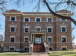
History
Abernathy from above
The Santa Fe Railroad wanted to follow a straight line from Plainview to Lubbock. A straight-line survey was run and it went east of the present site of Abernathy. This route did not please the residents of Hale Center, which had been established since the 1890s. They influenced the Santa Fe to come southwest out of Plainview to serve them, and from there the Santa Fe followed an approximate straight line into Lubbock.
The developers of the town sites along the new railroad wanted to organize a town on a section 4 miles (6km) north of the present town of Abernathy.[11] The owners, who lived in Wisconsin, were contacted. They thought gold might be on the land and refused to sell. Therefore, the last section south in Hale County was chosen as the town site.
Originally owned by John Y. Ligon, the section that was to become the Abernathy town site was purchased by J.C. Roberds from E.S. and W.L. Stanfield. When the South Plains Investment Company was formed by Roberds, Dr. M.C. Overton, and Monroe Abernathy, Mr. Roberds deeded the section to the firm and became the president of the firm.[11] Dr. Overton was secretary and Mr. Abernathy was treasurer.
On June 18, 1909, the official survey of the town site was recognized by Gov. T.M. Campbell. The town site was platted on July 8, 1909, and was named for M.C. Abernathy. Mr. Monk was the resident agent for the company, and a small frame office building was built. Lots and blocks were sold from there.
Since several buildings were already in Bartonsite and none in Abernathy, the founding fathers here contracted with J.J. Barton to move some of the buildings to Abernathy. In the late summer of 1909, the move began. Buildings were placed on rollers. The latest equipment—steam-driven tractors—hooked on. The exodus began to huff and puff toward the new town. The tractors did not move but about three or four miles per hour, so it was a long trip. A two-story yellow hotel, a lumberyard, blacksmith shop, and three or four residences were some of the roughly 10 buildings moved.
The first train came to Abernathy in the early fall of 1909.[11] This was not a regular train, but some cars added to the work train.
The depot was constructed in 1909. C.E. Stout was the first local agent for the Santa Fe.
The section where the town of Abernathy was being developed was fenced, and gates had to be opened when entering and leaving town. The streets and block corners were laid off with 2 x 4 stubs. These stubs denoted streets for the next few years, until a grader finally came in to run ditches.
Town residents had free range on the section, and their milk cows and horses and mules were turned loose to graze. The stock would stray out of the section, and range cattle would come into town, when someone happened to leave the gates open. The ladies had to stand guard at their clotheslines to keep the livestock from ruining their laundry. When a load of feed was brought to town, the cattle and horses had to be chased away until it was unloaded in stack lots or barns. Trains running through the town section frequently hit the livestock.
Behind most of the houses were outhouses, barns, and windmills. Nearly every home had its own windmill, although a few families hauled water. Generally, gardens and cow lots were integral parts of each household.
Although the City of Abernathy was founded in 1909, it was not incorporated until 1924.[11] An election was called for September 12, 1924. The first mayor was F.W. Struve, and aldermen elected were R.M. Hardesty, N.C. Hix, Sam W. Smith, T.B. Stone, and E.B. Lindsey.
Abernathy is featured in the Branson musical 3 Redneck Tenors as the home of Billy Ray, the "Dead Tenor". A funeral is held for Billy Ray in Abernathy, the "Gateway to Lubbock".
Swisher County is a county in the U.S. state of Texas. As of the 2020 census, its population was 6,971. Its county seat is Tulia. The county was created in 1876 and later organized in 1890. It is named for James G. Swisher, a soldier of the Texas Revolution and signer of the Texas Declaration of Independence.
Lubbock County is a county located in the U.S. state of Texas. The 2020 census placed the population at 310,639. Its county seat and largest city is Lubbock. The county was created in 1876 and organized in 1891. It is named for Thomas Saltus Lubbock, a Confederate colonel and Texas Ranger.
Hale County is a county located in the U.S. state of Texas. As of the 2020 census, its population was 32,522. Its county seat is Plainview. The county was created in 1876 and organized in 1888. It is named for Lt. John C. Hale, a hero of the Battle of San Jacinto. Hale County comprises the Plainview, Texas micropolitan statistical area.
Garza County is a county located in the U.S. state of Texas. As of the 2020 census, its population was 5,816, of which most of the population were residing in its county seat, and only incorporated municipality, Post. The county was created in 1876 and later organized in 1907. Garza is named for a pioneer Bexar County family, as it was once a part of that county.
Floyd County is a county in the U.S. state of Texas. As of the 2020 census, its population was 5,402. The seat of the county is Floydada. The county was created in 1876 and later organized in 1890. It is named for Dolphin Ward Floyd, who died on his 32nd birthday, March 6, 1836, defending the Alamo.
Whiteface is a town in Cochran County, Texas, United States. The population was 449 at the 2010 census.
Crosbyton is a city in and the county seat of Crosby County, Texas, United States. The population was 1,741 at the 2010 census. Crosbyton is part of the Lubbock Metropolitan Statistical Area.
Edmonson is a town in Hale County, Texas, United States. The population was 86 at the 2020 census.
Hale Center is a city in Hale County, Texas. The population was 2,062 at the 2020 census, down from 2,252 in 2010.
Petersburg is a city in Hale County, Texas, United States. As of the 2020 census, it had a population of 1,014.
Plainview is a city in and the county seat of Hale County, Texas, United States. As of the 2020 census, its population was 20,187.
Seth Ward is an unincorporated community and census-designated place (CDP) in Hale County, Texas, United States. The population was 2,025 at the 2010 census.
Anton is a city in Hockley County, Texas, United States. The population was 907 at the 2020 census.
Littlefield is a city in and the county seat of Lamb County, Texas, United States. Its population was 5,943 at the 2020 census. It is located in a significant cotton-growing region, northwest of Lubbock on the Llano Estacado just south of the Texas Panhandle. Littlefield had a large denim-manufacturing plant operated by American Cotton Growers.
Idalou is a city in Lubbock County, Texas, United States. It is located 7 miles (11 km) northeast of Lubbock near the intersection of Farm to Market Road 400 and US 62/US 82/SH 114. The population was 2,250 at the 2010 census. It is part of the Lubbock Metropolitan Statistical Area.
New Deal is a U.S. town in Lubbock County, Texas. The population was 794 at the 2010 census. It is part of the Lubbock Metropolitan Statistical Area and the Llano Estacado region.
Shallowater is a city in Lubbock County, Texas, United States. Shallowater is on U.S. Route 84 and the Burlington Northern Santa Fe line, 12 miles (19 km) northwest of Lubbock. Its population was 2,484 at the 2010 census. It is part of the Lubbock metropolitan statistical area.
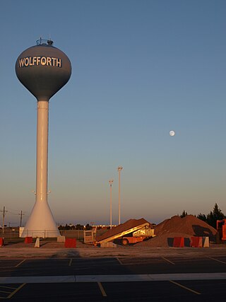
Wolfforth is a town located in Lubbock County, Texas, United States. It is a southwestern suburb of Lubbock. The population was 5,521 at the 2020 census.
The Lubbock metropolitan area is a metropolitan statistical area (MSA) in the South Plains region of West Texas, United States, that covers three counties – Crosby, Lubbock, and Lynn. As of the 2010 census, the Lubbock MSA had a population of 290,805, though a 2019 estimate placed the population at 322,257, which ranks it the 157th-most populated MSA in the United States. It is also part of the larger Lubbock–Plainview combined statistical area.
The Lubbock–Plainview Combined Statistical Area consists of the Lubbock Metropolitan Area and the Plainview Micropolitan Area and comprises eight counties: in the South Plains region of west Texas. The Levelland Micropolitan Statistical Area was a separate statistical area within the CSA until 2023 when it was added to the Lubbock MSA. In the 2010 census, the CSA had a population of 350,013, though a July 1, 2019 estimate placed the population at 381,664. The CSA's principal city is Lubbock.
↑ Note: the US Census treats Hispanic/Latino as an ethnic category. This table excludes Latinos from the racial categories and assigns them to a separate category. Hispanics/Latinos can be of any race.[9]
This page is based on this Wikipedia article Text is available under the CC BY-SA 4.0 license; additional terms may apply. Images, videos and audio are available under their respective licenses.