Ransom Canyon, Texas

Last updated

Ransom Canyon
Ransom Canyon Water Tower 2009.jpg
Ransom Canyon water tower
Relief map of Texas.png
Red pog.svg
Ransom Canyon
Coordinates: 33°32′00″N101°40′47″W / 33.53333°N 101.67972°W / 33.53333; -101.67972 [1]
CountryFlag of the United States.svg  United States
StateFlag of Texas.svg  Texas
County Lubbock
Region Llano Estacado
Established1965
Area
[2]
  Total0.94 sq mi (2.44 km2)
  Land0.79 sq mi (2.04 km2)
  Water0.15 sq mi (0.40 km2)
Elevation
[1]
3,104 ft (946 m)
Population
 (2010)
  Total1,096
  Estimate 
(2019) [3]
1,124
  Density1,428.21/sq mi (551.30/km2)
Time zone UTC-6 (CST)
ZIP code
79364, 79366
Area code 806
FIPS code 48-60672
Website www.ci.ransom-canyon.tx.us

Ransom Canyon is a town in Lubbock County of West Texas, United States. The population was 1,096 at the 2010 census. [4] It is part of the Lubbock Metropolitan Statistical Area.

Contents

Geography

The town of Ransom Canyon is located within Yellow House Canyon, at the eastern edge of the Llano Estacado. Yellow House Canyon was carved by the North Fork Double Mountain Fork Brazos River. This stream has been dammed multiple times to form Buffalo Springs Lake and Lake Ransom Canyon. [5]

According to the United States Census Bureau, the town has a total area of 0.93 square miles (2.4 km2), of which 0.77 square miles (2.0 km2) is land and 0.15 square miles (0.4 km2), or 16.38%, is water. [4]

Climate

According to the Köppen Climate Classification system, Ransom Canyon has a semi-arid climate, abbreviated "BSk" on climate maps. [6]

Demographics

Historical population
CensusPop.Note
1980 561
1990 75033.7%
2000 1,01134.8%
2010 1,0968.4%
2019 (est.)1,124 [3] 2.6%
U.S. Decennial Census [7]

2020 census

Ransom Canyon racial composition [8]
(NH = Non-Hispanic) [lower-alpha 1]
RaceNumberPercentage
White (NH)95680.4%
Black or African American (NH)181.51%
Native American or Alaska Native (NH)10.08%
Asian (NH)60.5%
Some Other Race (NH)10.08%
Mixed/Multi-Racial (NH)524.37%
Hispanic or Latino 15513.04%
Total1,189

As of the 2020 United States census, there were 1,189 people, 400 households, and 309 families residing in the town.

2000 census

As of the census [11] of 2000, there were 1,011 people, 404 households, and 338 families residing in the town. The population density was 1,213.1 inhabitants per square mile (468.4/km2). There were 412 housing units at an average density of 494.4 per square mile (190.9/km2). The racial makeup of the town was 95.25% White, 0.40% African American, 0.20% Native American, 0.40% Asian, 2.57% from other races, and 1.19% from two or more races. Hispanic or Latino of any race were 4.85% of the population.

There were 404 households, out of which 31.2% had children under the age of 18 living with them, 80.0% were married couples living together, 3.2% had a female householder with no husband present, and 16.1% were non-families. 14.6% of all households were made up of individuals, and 6.9% had someone living alone who was 65 years of age or older. The average household size was 2.50 and the average family size was 2.76.

In the town, the population was spread out, with 22.0% under the age of 18, 4.5% from 18 to 24, 23.5% from 25 to 44, 36.5% from 45 to 64, and 13.5% who were 65 years of age or older. The median age was 45 years. For every 100 females, there were 94.4 males. For every 100 females age 18 and over, there were 90.6 males.

The median income for a household in the town was $78,427, and the median income for a family was $85,944. Males had a median income of $50,000 versus $34,500 for females. The per capita income for the town was $45,675. None of the families and 0.6% of the population were living below the poverty line, including no under eighteens and 0.7% of those over 64.

Education

Ransom Canyon is served by the Roosevelt and Slaton Independent School Districts.

Robert Bruno

Robert R. Bruno Jr. (1945–2008) was a sculptor and inventor who was born in Los Angeles in 1945, Robert grew up in Mexico and the United States before attending Dominican College in Racine, Wisconsin and graduate school at the University of Notre Dame. He moved to Lubbock in 1971 to teach art at Texas Tech University's school of architecture. He started working on The Steel House in 1973, two years after sculpting a similar piece of art, (now a permanent installation in front of the TTU School of Architecture) which inspired him to build something bigger to live in. Made of weathering steel and weighing 110 tons on four hollow legs, the 2,200 square foot house on three levels was completed 10 months before his death in 2008. In 1982, he and wife, Patricia Mills, founded P&R Surge Systems. Robert, General contractor, Rick Denser, Master Stone Mason, Manfred Kaiter and Venture Capitalist, Mark Lawson started work on Lawson's 460 ton Rock House in 1991, which was inspired by the work of Antoni Gaudi. [12]

On June 25 and 26, 2013, Ransom Canyon was the site of a Vogue (magazine) fall-fashion photo shoot. Three models, Raquel Zimmermann, Toni Garrn and brother Niklas Garrn, were photographed by Steven Klein in and around Robert Bruno's steel house, sometimes wearing Google Glass. Photographs appear in the September 2013 issue of Vogue. [13]

The Steel House was featured on an episode of Texas Country Reporter with Bob Phillips shortly before Bruno's death.

See also

Related Research Articles

<span class="mw-page-title-main">Lubbock County, Texas</span> County in Texas, United States

Lubbock County is a county located in the U.S. state of Texas. The 2020 census placed the population at 310,639. Its county seat and largest city is Lubbock. The county was created in 1876 and organized in 1891. It is named for Thomas Saltus Lubbock, a Confederate colonel and Texas Ranger.

<span class="mw-page-title-main">Hockley County, Texas</span> County in Texas, United States

Hockley County is a county located in the U.S. state of Texas. As of the 2020 census, its population was 21,537. Its county seat is Levelland. The county was created in 1876, but not organized until 1921. It is named for George Washington Hockley, a secretary of war of the Republic of Texas.

<span class="mw-page-title-main">Garza County, Texas</span> County in Texas, United States

Garza County is a county located in the U.S. state of Texas. As of the 2020 census, its population was 5,816, of which most of the population were residing in its county seat, and only incorporated municipality, Post. The county was created in 1876 and later organized in 1907. Garza is named for a pioneer Bexar County family, as it was once a part of that county.

<span class="mw-page-title-main">Crosby County, Texas</span> County in Texas, United States

Crosby County is a county located in the U.S. state of Texas. As of the 2020 census, its population was 5,133. The county seat is Crosbyton. The county was founded in 1876 and later organized in 1886. Both the county and its seat are named for Stephen Crosby, a land commissioner in Texas.

<span class="mw-page-title-main">Briscoe County, Texas</span> County in Texas, United States

Briscoe County is a county located in the U.S. state of Texas. As of the 2020 census, the population was 1,435. Its county seat is Silverton. The county was created in 1876 and later organized in 1892. It is named for Andrew Briscoe, a soldier during the Texas Revolution.

<span class="mw-page-title-main">Whiteface, Texas</span> Community in Texas, United States

Whiteface is a town in Cochran County, Texas, United States. The population was 449 at the 2010 census.

<span class="mw-page-title-main">Ralls, Texas</span> City in Texas, United States

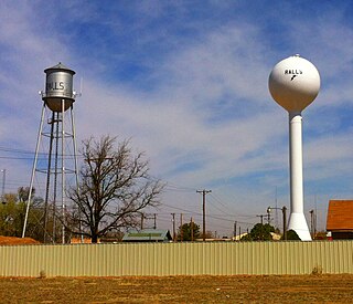
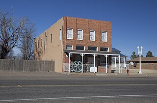
Ralls is a city in Crosby County, Texas, United States. It was named after John Robinson Ralls, who, with the help of W.E. McLaughlin, laid out the townsite in July 1911. As of the 2010 census, it had a population of 1,944, down from 2,252 at the 2000 census. Ralls is surrounded by productive farmlands that primarily produce cotton and grains, with lesser amounts of soybean, sunflower seed, and vegetables.

<span class="mw-page-title-main">Post, Texas</span> City in Texas, United States of America

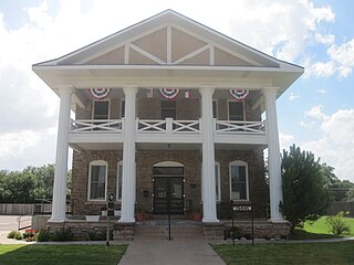
Post is a city in and the county seat of Garza County, Texas, United States. Its population was 5,376 at the 2010 census.

<span class="mw-page-title-main">Hale Center, Texas</span> City in Texas, United States

Hale Center is a city in Hale County, Texas. The population was 2,062 at the 2020 census, down from 2,252 in 2010.

<span class="mw-page-title-main">Levelland, Texas</span> City in Texas, United States

Levelland is a city and the county seat of Hockley County, Texas, United States. As of the 2020 census, the city population was 12,652, down from 13,542 at the 2010 census. It is located on the Llano Estacado, 30 miles (48 km) west of Lubbock. Major industries include cotton farming and petroleum production. It is the home of South Plains College. Levelland is the principal city of the Levelland micropolitan statistical area, which includes all of Hockley County and part of the larger Lubbock–Levelland combined statistical area. Levelland was so named on account of the flat land at the town site.

<span class="mw-page-title-main">Smyer, Texas</span> Town in Texas, United States

Smyer is a town in Hockley County, Texas, United States. It is located near the Old Spade Ranch House where the current ranch headquarters is. The population was 474 at the 2010 census. in 2023, the population declined to 433.

<span class="mw-page-title-main">Earth, Texas</span> City in Texas, United States

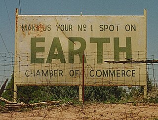
Earth is a small, rural city in Lamb County, West Texas, United States. As of the 2010 Census, the population was 1,065.

<span class="mw-page-title-main">Buffalo Springs, Texas</span> Village in Texas, United States

Buffalo Springs is a village in Lubbock County, Texas, United States. The population was 453 at the 2010 census. It is part of the Lubbock Metropolitan Statistical Area.

New Deal is a U.S. town in Lubbock County, Texas. The population was 794 at the 2010 census. It is part of the Lubbock Metropolitan Statistical Area and the Llano Estacado region.

<span class="mw-page-title-main">Slaton, Texas</span> City in Texas, United States

Slaton is a city in Lubbock County, Texas, United States. Founded by German immigrants, Slaton was the westernmost German settlement in Texas. The population was 6,121 at the 2010 census. Slaton is part of the Lubbock Metropolitan Statistical Area.

<span class="mw-page-title-main">Wilson, Texas</span> City in Texas, United States

Wilson is a small rural city in the northeastern quadrant of Lynn County, Texas, United States. As of the 2020 census, the population was 434.

<span class="mw-page-title-main">Brownfield, Texas</span> City in Texas, United States

Brownfield is a city in Terry County, Texas, United States. Its population was 8,936 at the 2020 census. Brownfield is 39 miles southwest of Lubbock, it is the county seat of Terry County.

<span class="mw-page-title-main">O'Donnell, Texas</span> City in Texas, United States

O'Donnell is a West Texas city that lies primarily in Lynn County, with a small portion extending south into Dawson County, Texas, United States. Its population was 831 at the 2010 census, down from 1,011 at the 2000 census. The Lynn county portion of O'Donnell is part of the Lubbock Metropolitan area.

<span class="mw-page-title-main">Abernathy, Texas</span> City in Texas, United States

Abernathy is a city in Hale and Lubbock counties in the U.S. state of Texas. The population was 2,805 at the 2010 census.

<span class="mw-page-title-main">Yellow House Canyon</span>

Yellow House Canyon is about 32 km (20 mi) long, heading in Lubbock, Texas, at the junction of Blackwater Draw and Yellow House Draw, and trending generally southeastward to the edge of the Llano Estacado about 10 km (6.2 mi) east of Slaton, Texas; it forms one of three major canyons along the east side of the Llano Estacado and carries the waters of the North Fork Double Mountain Fork Brazos River.

References

  1. 1 2 U.S. Geological Survey Geographic Names Information System: Ransom Canyon
  2. "2019 U.S. Gazetteer Files". United States Census Bureau. Retrieved August 7, 2020.
  3. 1 2 "Population and Housing Unit Estimates". United States Census Bureau. May 24, 2020. Retrieved May 27, 2020.
  4. 1 2 "Geographic Identifiers: 2010 Demographic Profile Data (G001): Ransom Canyon town, Texas". U.S. Census Bureau, American Factfinder. Archived from the original on February 12, 2020. Retrieved January 18, 2013.
  5. Davis, Charles G. "Ransom Canyon, TX". Handbook of Texas Online. Texas State Historical Association. Retrieved January 1, 2014.
  6. Climate Summary for Ransom Canyon, Texas
  7. "Census of Population and Housing". Census.gov. Retrieved June 4, 2015.
  8. "Explore Census Data". data.census.gov. Retrieved May 20, 2022.
  9. https://www.census.gov/ [ not specific enough to verify ]
  10. "About the Hispanic Population and its Origin". www.census.gov. Retrieved May 18, 2022.
  11. "U.S. Census website". United States Census Bureau . Retrieved January 31, 2008.
  12. Lamster, Mark (January 30, 2015). "Unfinished". The Dallas Morning News. Retrieved May 30, 2016.
  13. Bilton, Nick (August 16, 2013). "Trying to Make Google Glass Fashionable". The New York Times. Retrieved January 1, 2014.
  1. Note: the US Census treats Hispanic/Latino as an ethnic category. This table excludes Latinos from the racial categories and assigns them to a separate category. Hispanics/Latinos can be of any race. [9] [10]