New Deal, Texas

Last updated

New Deal, Texas
Town
New Deal Texas Cotton Gin 2010.jpg
New Deal, Texas - Terraserver image.png
New Deal Cotton Gin near the tracks and an aerial image of New Deal
Relief map of Texas.png
Red pog.svg
New Deal
Location of New Deal in Texas
Coordinates: 33°44′14″N101°50′12″W / 33.73722°N 101.83667°W / 33.73722; -101.83667 [1]
Country United States
State Texas
County Lubbock
Established1909
Area
[2]
  Total2.33 sq mi (6.04 km2)
  Land2.31 sq mi (5.99 km2)
  Water0.02 sq mi (0.05 km2)
Elevation
[1]
3,300 ft (1,000 m)
Population
 (2010)
  Total794
  Estimate 
(2019) [3]
827
  Density357.70/sq mi (138.13/km2)
Time zone UTC-6 (CST)
ZIP code
79350
Area code 806
FIPS code 48-50916
Website www.cityofnewdealtx.com

New Deal is a U.S. town in Lubbock County, Texas. The population was 794 at the 2010 census. [4] It is part of the Lubbock Metropolitan Statistical Area and the Llano Estacado region.

Contents

History

New Deal was originally known as Monroe, named for Monroe G. Abernathy, a local landowner. [5] The town was originally developed as a train station loading site. People began to settle there and that is why the town was built alongside the railroad tracks and highway. The train identification name for the township still reads Monroe alongside the railroad tracks. Some time afterward the town wanted a post office and requested the permit for the Monroe Postal Station. Because there was already a town in Texas with the name Monroe City, the U.S. postal department changed the name of the town to New Deal after Franklin D. Roosevelt's programs and to go along with the consolidated school system's name. [5] This information was all developed when the school system had to write a history when applying for a federal grant. In 1970, the township was incorporated by the vote of its citizens. The city of Lubbock, Texas, was planning some annexation of surrounding lands and the people of the New Deal area decided to incorporate rather than be annexed to the city of Lubbock. A local farmer, Billy Fortenberry, was the first mayor. In 1970, Ray Edell West, a city councilman for three years, became the mayor. Under his mayoral direction in the next 7 years, the town built a City Hall and a Volunteer Fire Department building.

Geography

New Deal is located on the level plains of the Llano Estacado, just to the north of Lubbock at 33°44′03″N101°50′09″W / 33.734048°N 101.835862°W / 33.734048; -101.835862 (33.734048, –101.835862). [6]

According to the United States Census Bureau, the town has a total area of 1.1 square miles (2.9 km2), of which 0.015 square miles (0.04 km2), or 1.25%, is water. [4]

Demographics

Historical population
CensusPop.Note
1980 637
1990 521−18.2%
2000 70835.9%
2010 79412.1%
2019 (est.)827 [3] 4.2%
U.S. Decennial Census [7]

2020 census

New Deal racial composition [8]
(NH = Non-Hispanic) [lower-alpha 1]
RaceNumberPercentage
White (NH)41356.58%
Black or African American (NH)141.92%
Some Other Race (NH)20.27%
Mixed/Multi-Racial (NH)172.33%
Hispanic or Latino 28438.9%
Total730

As of the 2020 United States census, there were 730 people, 360 households, and 269 families residing in the town.

2000 census

At the 2000 census, [11] there were 708 people, 235 households and 192 families residing in the town. The population density was 684.1 inhabitants per square mile (264.1/km2). There were 262 housing units at an average density of 253.2 per square mile (97.8/km2). The racial makeup of the town was 74.72% White, 0.99% African American, 0.14% Native American, 21.47% from other races, and 2.68% from two or more races. Hispanic or Latino of any race were 41.10% of the population.

There were 235 households, of which 46.8% had children under the age of 18 living with them, 62.1% were married couples living together, 14.5% had a female householder with no husband present, and 17.9% were non-families. 16.2% of all households were made up of individuals, and 5.1% had someone living alone who was 65 years of age or older. The average household size was 3.01 and the average family size was 3.35.

Age distribution was 34.2% under the age of 18, 9.5% from 18 to 24, 30.2% from 25 to 44, 17.7% from 45 to 64, and 8.5% who were 65 years of age or older. The median age was 30 years. For every 100 females, there were 104.6 males. For every 100 females age 18 and over, there were 87.1 males.

The median household income was $38,077, and the median family income was $40,573. Males had a median income of $25,625 versus $19,091 for females. The per capita income for the town was $12,695. About 11.8% of families and 15.3% of the population were below the poverty line, including 25.6% of those under age 18 and 19.8% of those age 65 or over.

Education

The Town of New Deal is served by the New Deal Independent School District. The school system was segregated until fall 1968. The school system was originally known as Monroe Schools but, in later years, as small school systems began to close, the Monroe schools incorporated with several others and took the name of the New Deal Consolidated Schools.

See also

Climate

According to the Köppen Climate Classification system, New Deal has a semi-arid climate, abbreviated "BSk" on climate maps. [12]

Related Research Articles

<span class="mw-page-title-main">Lubbock County, Texas</span> County in Texas, United States

Lubbock County is a county located in the U.S. state of Texas. The 2020 census placed the population at 310,639. Its county seat and largest city is Lubbock. The county was created in 1876 and organized in 1891. It is named for Thomas Saltus Lubbock, a Confederate colonel and Texas Ranger.

<span class="mw-page-title-main">Hockley County, Texas</span> County in Texas, United States

Hockley County is a county located in the U.S. state of Texas. As of the 2020 census, its population was 21,537. Its county seat is Levelland. The county was created in 1876, but not organized until 1921. It is named for George Washington Hockley, a secretary of war of the Republic of Texas.

<span class="mw-page-title-main">Crosby County, Texas</span> County in Texas, United States

Crosby County is a county located in the U.S. state of Texas. As of the 2020 census, its population was 5,133. The county seat is Crosbyton. The county was founded in 1876 and later organized in 1886. Both the county and its seat are named for Stephen Crosby, a land commissioner in Texas.

<span class="mw-page-title-main">Whiteface, Texas</span> Community in Texas, United States

Whiteface is a town in Cochran County, Texas, United States. The population was 449 at the 2010 census.

<span class="mw-page-title-main">Post, Texas</span> City in Texas, United States of America

Post is a city in and the county seat of Garza County, Texas, United States. Its population was 5,376 at the 2010 census.

<span class="mw-page-title-main">Hale Center, Texas</span> City in Texas, United States

Hale Center is a city in Hale County, Texas. The population was 2,062 at the 2020 census, down from 2,252 in 2010.

<span class="mw-page-title-main">Anton, Texas</span> City in Texas, United States

Anton is a city in Hockley County, Texas, United States. The population was 1,126 at the 2010 census.

<span class="mw-page-title-main">Levelland, Texas</span> City in Texas, United States

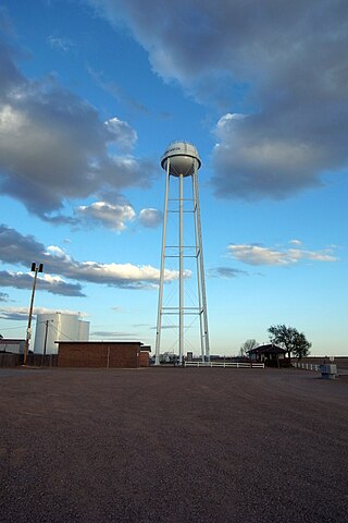
Levelland is a city and the county seat of Hockley County, Texas, United States. As of the 2020 census, the city population was 12,652, down from 13,542 at the 2010 census. It is located on the Llano Estacado, 30 miles (48 km) west of Lubbock. Major industries include cotton farming and petroleum production. It is the home of South Plains College. Levelland is the principal city of the Levelland micropolitan statistical area, which includes all of Hockley County and part of the larger Lubbock–Levelland combined statistical area. Levelland was so named on account of the flat land at the town site.

<span class="mw-page-title-main">Ropesville, Texas</span> City in Texas, United States

Ropesville is a city in Hockley County, Texas, United States. Its population was 434 at the 2010 census, down from 517 at the 2000 census.

<span class="mw-page-title-main">Smyer, Texas</span> Town in Texas, United States

Smyer is a town in Hockley County, Texas, United States. It is located near the Old Spade Ranch House where the current ranch headquarters is. The population was 474 at the 2010 census. in 2023, the population declined to 433.

<span class="mw-page-title-main">Earth, Texas</span> City in Texas, United States

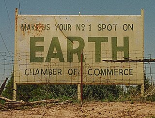
Earth is a small, rural city in Lamb County, West Texas, United States. As of the 2010 Census, the population was 1,065.

<span class="mw-page-title-main">Sudan, Texas</span> City in Texas, United States

Sudan is a city in Lamb County in Texas, United States. Its population was 958 at the 2010 census.

<span class="mw-page-title-main">Buffalo Springs, Texas</span> Village in Texas, United States

Buffalo Springs is a village in Lubbock County, Texas, United States. The population was 453 at the 2010 census. It is part of the Lubbock Metropolitan Statistical Area.

<span class="mw-page-title-main">Ransom Canyon, Texas</span> Town in Texas, United States

Ransom Canyon is a town in Lubbock County of West Texas, United States. The population was 1,096 at the 2010 census. It is part of the Lubbock Metropolitan Statistical Area.

<span class="mw-page-title-main">Shallowater, Texas</span> Community in Texas, United States

Shallowater is a city in Lubbock County, Texas, United States. Shallowater is on U.S. Route 84 and the Burlington Northern Santa Fe line, 12 miles (19 km) northwest of Lubbock. Its population was 2,484 at the 2010 census. It is part of the Lubbock metropolitan statistical area.

<span class="mw-page-title-main">Slaton, Texas</span> City in Texas, United States

Slaton is a city in Lubbock County, Texas, United States. Founded by German immigrants, Slaton was the westernmost German settlement in Texas. The population was 6,121 at the 2010 census. Slaton is part of the Lubbock Metropolitan Statistical Area.

<span class="mw-page-title-main">Wolfforth, Texas</span> City in Texas, United States

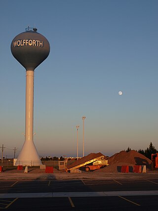
Wolfforth is a town located in Lubbock County, Texas, United States. It is a southwestern suburb of Lubbock. The population was 5,521 at the 2020 census.

<span class="mw-page-title-main">Wilson, Texas</span> City in Texas, United States

Wilson is a small rural city in the northeastern quadrant of Lynn County, Texas, United States. As of the 2020 census, the population was 434.

<span class="mw-page-title-main">O'Donnell, Texas</span> City in Texas, United States

O'Donnell is a West Texas city that lies primarily in Lynn County, with a small portion extending south into Dawson County, Texas, United States. Its population was 831 at the 2010 census, down from 1,011 at the 2000 census. The Lynn county portion of O'Donnell is part of the Lubbock Metropolitan area.

<span class="mw-page-title-main">Abernathy, Texas</span> City in Texas, United States

Abernathy is a city in Hale and Lubbock counties in the U.S. state of Texas. The population was 2,805 at the 2010 census.

References

  1. 1 2 "New Deal". Geographic Names Information System . United States Geological Survey, United States Department of the Interior.
  2. "2019 U.S. Gazetteer Files". United States Census Bureau. Retrieved August 7, 2020.
  3. 1 2 "Population and Housing Unit Estimates". United States Census Bureau. May 24, 2020. Retrieved May 27, 2020.
  4. 1 2 "Geographic Identifiers: 2010 Demographic Profile Data (G001): New Deal town, Texas". U.S. Census Bureau, American Factfinder. Archived from the original on February 12, 2020. Retrieved January 18, 2013.
  5. 1 2 Davis, Charles G. (November 27, 2010). "New Deal, TX". Handbook of Texas Online. Retrieved December 3, 2010.
  6. "US Gazetteer files: 2010, 2000, and 1990". United States Census Bureau. February 12, 2011. Retrieved April 23, 2011.
  7. "Census of Population and Housing". Census.gov. Retrieved June 4, 2015.
  8. "Explore Census Data". data.census.gov. Retrieved May 20, 2022.
  9. https://www.census.gov/ [ not specific enough to verify ]
  10. "About the Hispanic Population and its Origin". www.census.gov. Retrieved May 18, 2022.
  11. "U.S. Census website". United States Census Bureau . Retrieved January 31, 2008.
  12. Climate Summary for New Deal, Texas
  1. Note: the US Census treats Hispanic/Latino as an ethnic category. This table excludes Latinos from the racial categories and assigns them to a separate category. Hispanics/Latinos can be of any race. [9] [10]