Sharon, Vermont

Last updated

Sharon, Vermont
Town
Baxter library sharon vt.jpg
Baxter Memorial Library
Windsor County Vermont incorporated and unincorporated areas Sharon highlighted.svg
Location in Windsor County and the state of Vermont.
Map of USA VT.svg
Location of Vermont in the United States
Coordinates: 43°46′25″N72°26′38″W / 43.77361°N 72.44389°W / 43.77361; -72.44389
Country United States
State Vermont
County Windsor
Chartered1761
Area
  Total40.1 sq mi (103.8 km2)
  Land39.6 sq mi (102.6 km2)
  Water0.5 sq mi (1.2 km2)
Elevation
500 ft (449 m)
Population
 (2020)
  Total1,560
  Density39/sq mi (15/km2)
Time zone UTC-5 (EST)
  Summer (DST) UTC-4 (EDT)
ZIP code
05065
Area code 802
FIPS code 50-63775 [1]
GNIS feature ID1462204 [2]
Website sharonvt.net

Sharon is a town in Windsor County, Vermont, United States. It had a population of 1,560 at the 2020 census. [3]

Contents

Sharon is the birthplace of Joseph Smith, founder of the Latter Day Saint movement, and as such is an important historical site for members of that religion. The town is also home to The Sharon Academy, an independent middle and high school.

History

Street scene c. 1906 Street Scene, Sharon, VT.jpg
Street scene c.1906

One of the New Hampshire grants, the township was created on August 17, 1761, by a royal charter which King George III of the United Kingdom issued to Governor Benning Wentworth. [4] It was granted to John Taylor and 61 others, many from Sharon, Connecticut. The town was first settled about 1765 by Robert Havens and family. In 1780 during the Revolution, the village was attacked in the Royalton Raid, [5] when a combined British-Mohawk force attacked and burnt the town.

Although the surface of the town is broken, the intervales contain fertile soil, and farming became an important industry. On June 26, 1848, the Vermont Central Railroad opened from White River Junction to Bethel, traversing Sharon and accelerating its development. The White River and its tributaries provided water power for mills. By 1859, when the population reached 1,240, Sharon had 12 sawmills, a gristmill, and a bobbin factory. [5] Many of Sharon's most historic homes still line the White River.

In the mid-20th century the main form of employment in Sharon was still the lumber industry. [6]

Geography

According to the United States Census Bureau, the town has a total area of 40.1 square miles (103.9 km2), of which 39.6 square miles (102.6 km2) is land and 0.5 square mile (1.2 km2) (1.20%) is water. Sharon is drained by the White River and its tributaries.

The town is crossed by Interstate 89 and Vermont routes 14 and 132.

Demographics

Historical population
CensusPop.Note
1790 569
1800 1,158103.5%
1810 1,36317.7%
1820 1,4315.0%
1830 1,4592.0%
1840 1,371−6.0%
1850 1,240−9.6%
1860 1,111−10.4%
1870 1,013−8.8%
1880 1,012−0.1%
1890 737−27.2%
1900 709−3.8%
1910 585−17.5%
1920 545−6.8%
1930 5694.4%
1940 530−6.9%
1950 470−11.3%
1960 4853.2%
1970 54111.5%
1980 82853.0%
1990 1,21146.3%
2000 1,41116.5%
2010 1,5026.4%
2020 1,5603.9%
U.S. Decennial Census [7]

As of the census [1] of 2000, there were 1,411 people, 553 households, and 378 families residing in the town. The population density was 35.6 people per square mile (13.8/km2). There were 663 housing units at an average density of 16.7 per square mile (6.5/km2). The racial makeup of the town was 97.17% White, 0.57% African American, 0.43% Native American, 0.64% Asian, and 1.20% from two or more races. Hispanic or Latino of any race were 0.99% of the population.

There were 553 households, out of which 36.5% had children under the age of 18 living with them, 58.0% were married couples living together, 7.4% had a female householder with no husband present, and 31.5% were non-families. 24.6% of all households were made up of individuals, and 6.9% had someone living alone who was 65 years of age or older. The average household size was 2.55 and the average family size was 3.06.

In the town, the population was spread out, with 27.8% under the age of 18, 5.7% from 18 to 24, 30.4% from 25 to 44, 28.2% from 45 to 64, and 7.9% who were 65 years of age or older. The median age was 38 years. For every 100 females, there were 102.4 males. For every 100 females age 18 and over, there were 102.2 males. The median age of the population was 37.

The median income for a household in the town was $40,952, and the median income for a family was $47,500. Males had a median income of $32,112 versus $28,472 for females. The per capita income for the town was $20,824. About 5.3% of families and 7.3% of the population were below the poverty line, including 5.5% of those under age 18 and 9.4% of those age 65 or over.

2010 census

As of the 2010 Census Sharon had a population of 1,502. The median age was 44 years old. The population was 95.5% non-Hispanic white, 0.9% African-American, 0.4% Native American, 0.7% Asian, 0.1% reporting some other race, 1.3% reporting two or more races and 1.2% Hispanic or Latino. [8]

Sites of interest

Notable people

Related Research Articles

<span class="mw-page-title-main">Windsor County, Vermont</span> County in Vermont, United States

Windsor County is a county located in the U.S. state of Vermont. As of the 2020 census, the population was 57,753. The shire town is the town of Woodstock. The county's largest municipality is the town of Hartford.

<span class="mw-page-title-main">New Sharon, Maine</span> Town in the state of Maine, United States

New Sharon is a town in Franklin County, Maine, incorporated in 1794. The population was 1,458 at the 2020 census. The town is roughly bisected by the Sandy River, a tributary of the Kennebec River.

<span class="mw-page-title-main">Hancock, Vermont</span> Town in Vermont, United States

Hancock is a town in Addison County, Vermont, United States. The town was named for John Hancock. The population was 359 at the 2020 census. Hancock is home to the Middlebury College Snow Bowl and contains Middlebury Gap through the Green Mountains.

<span class="mw-page-title-main">Sandgate, Vermont</span> Town in Vermont, United States

Sandgate is a town in Bennington County, Vermont, United States. The population was 387 at the 2020 census.

<span class="mw-page-title-main">Stamford, Vermont</span> Town in Vermont, United States

Stamford is a town in Bennington County, Vermont, United States. The population was 861 at the 2020 census.

<span class="mw-page-title-main">Lemington, Vermont</span> Town in Vermont, United States

Lemington is a town in Essex County, Vermont, United States. The population was 87 as of the 2020 census. It is part of the Berlin, NH–VT Micropolitan Statistical Area.

<span class="mw-page-title-main">Fairfield, Vermont</span> Town in Vermont, United States

Fairfield is a town in Franklin County, Vermont, United States, chartered in 1763. The population was 2,044 at the 2020 census. President Chester A. Arthur was born in Fairfield in 1829, and lived there for the first three years of his life. A replica of his home, the Chester Alan Arthur State Historic Site, is open seasonally.

<span class="mw-page-title-main">Hubbardton, Vermont</span> Town in Vermont, United States

Hubbardton is a town in Rutland County, Vermont, United States. The town was named for Thomas Hubbard, a landholder. The population was 735 at the 2020 census.

<span class="mw-page-title-main">Sudbury, Vermont</span> Town in Vermont, United States

Sudbury is a town in Rutland County, Vermont, United States. The population was 545 at the 2020 census.

<span class="mw-page-title-main">Duxbury, Vermont</span> Town in Vermont, United States

Duxbury is a town in Washington County, Vermont, United States. The population was 1,413 at the 2020 census. It claims to be the only municipality in the United States that has an elected position of dogcatcher.

<span class="mw-page-title-main">Londonderry, Vermont</span> Town in Vermont, United States

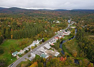
Londonderry is a town in Windham County, Vermont, United States. It is bounded on the north by Landgrove and Weston, on the east by Windham, on the south by Jamaica and on the west by Winhall and Landgrove. The population was 1,919 in the 2020 census. The town contains the villages of Londonderry and South Londonderry.

<span class="mw-page-title-main">Baltimore, Vermont</span> Town in Vermont, United States

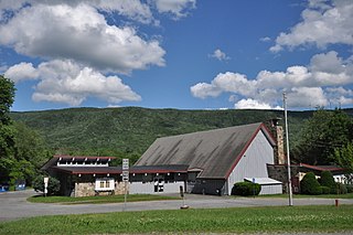
Baltimore is a town located in Windsor County, Vermont, United States. As of the 2020 census, the population of Baltimore was recorded as 229.

<span class="mw-page-title-main">Bridgewater, Vermont</span> Town in Vermont, United States

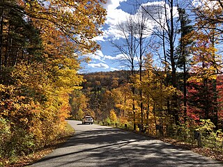
Bridgewater is a town in Windsor County, Vermont, United States. The population was 903 at the 2020 census. Bridgewater contains the hamlets of Bridgewater Village, Bridgewater Corners, West Bridgewater, and Bridgewater Center.

<span class="mw-page-title-main">Royalton, Vermont</span> Town in Vermont, United States

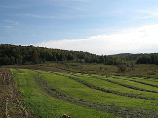
Royalton is a town in Windsor County, Vermont, United States. The population was 2,750 at the 2020 census. It includes the villages of Royalton, South Royalton, and North Royalton. Vermont Law School, the state's only accredited law school, is located in South Royalton.

<span class="mw-page-title-main">Vermont, Wisconsin</span> Town in Wisconsin, United States

Vermont is a town located in Dane County, Wisconsin, United States. The population was 871 at the 2020 Census. The unincorporated communities of Elvers and Vermont are located in the town.

<span class="mw-page-title-main">Sharon, Walworth County, Wisconsin</span> Town in Wisconsin, United States

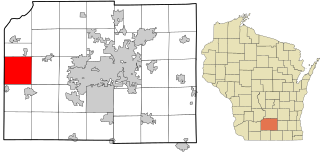
Sharon is a town in Walworth County, Wisconsin, United States. The population was 861 at the 2020 census. The Village of Sharon is located within the town. The unincorporated community of Allen's Grove is also located partially in the town.

<span class="mw-page-title-main">Wallingford, Vermont</span> Town in Vermont, United States

Wallingford is a town in Rutland County, Vermont, United States. The population was 2,129 at the 2020 census. Wallingford also contains the villages of East Wallingford and South Wallingford.

<span class="mw-page-title-main">Marshfield, Vermont</span> Town in Vermont, United States

Marshfield is a town in Washington County, Vermont, United States. The population was 1,583 at the 2020 census.

<span class="mw-page-title-main">Waterbury (CDP), Vermont</span> Census-designated place in Vermont, United States

Waterbury is an unincorporated village and census-designated place (CDP) in the town of Waterbury, Washington County, Vermont, United States. The population was 1,897 at the 2020 census. The former village of Waterbury was dissolved in 2017, and its governmental functions were merged with the town of Waterbury.

<span class="mw-page-title-main">Sharon, Portage County, Wisconsin</span> Town in Wisconsin, United States

Sharon is a town in Portage County, Wisconsin, United States. The population was 2,123 at the 2020 census. The unincorporated communities of Ellis, Little Waupon, North Star, and Polonia are located within the town.

References

  1. 1 2 "U.S. Census website". United States Census Bureau . Retrieved January 31, 2008.
  2. "US Board on Geographic Names". United States Geological Survey. October 25, 2007. Retrieved January 31, 2008.
  3. "Census - Geography Profile: Sharon town, Windsor County, Vermont". United States Census Bureau . Retrieved January 6, 2022.
  4. "Sharon, Vermont, New England, USA". www.virtualvermont.com.
  5. 1 2 A. J. Coolidge & J. B. Mansfield, A History and Description of New England; Boston, Massachusetts 1859
  6. Columbia Lippincott Gazetteer, 1952 edition, p. 1745.
  7. "U.S. Decennial Census". United States Census Bureau. Retrieved May 16, 2015.
  8. Bureau, U.S. Census. "U.S. Census website". United States Census Bureau . Retrieved August 29, 2016.
  9. Heintz, Paul (September 18, 2013). "Take Back Virginia? Old Dominion Dems Are Counting on Vermont-Born Robby Mook". Seven Days . Retrieved October 4, 2013.