The geography of Egypt relates to two regions: North Africa and Southwest Asia.

Carshalton is a town, with a historic village centre, in south London, England, within the London Borough of Sutton. It is situated 9.5 miles (15.3 km) south-southwest of Charing Cross, in the valley of the River Wandle, one of the sources of which is Carshalton Ponds in the middle of the village. Prior to the creation of Greater London in 1965, Carshalton was in the administrative county of Surrey.

Khoekhoen are the traditionally nomadic pastoralist indigenous population of southwestern Africa. They are often grouped with the hunter-gatherer San peoples. The designation "Khoekhoe" is actually a kare or praise address, not an ethnic endonym, but it has been used in the literature as an ethnic term for Khoe-speaking peoples of Southern Africa, particularly pastoralist groups, such as the !Ora, !Gona, Nama, Xiri and ǂNūkhoe nations.

Hhohho is a region of Eswatini, located in the north western part of the country. Hhohho was named after the capital of King Mswati II, who expanded the Swazi territory to the north and west, taking in the districts of Barberton, Nelspruit, Carolina and Piet Retief. These areas were later acquired by what was the Province of Transvaal and today they form part of the Mpumalanga Province of South Africa. It has an area of 3,625.17 km², a population of 320,651 (2017), and is divided into 14 tinkhundla. The administrative center is the national capital of Mbabane. It borders Lubombo Region on the southeast and Manzini Region in the southwest.

Centurion is an area with 236,580 inhabitants in the Gauteng Province of South Africa, between Pretoria and Midrand. Formerly an independent municipality, with its own town council, it has been part of the City of Tshwane Metropolitan Municipality since 2000. Its heart is at the intersection of the N1 and N14 freeways. The R21 freeway also passes through the eastern part of Centurion.

The Swazi or Swati are a Bantu ethnic group native to Southern Africa, inhabiting Eswatini, a sovereign kingdom in Southern Africa. EmaSwati are part of the Nguni-language speaking peoples whose origins can be traced through archaeology to East Africa where similar traditions, beliefs and cultural practices are found.

The Damara, plural Damaran are an ethnic group who make up 8.5% of Namibia's population. They speak the Khoekhoe language and the majority live in the northwestern regions of Namibia, however they are also found widely across the rest of the country.

Molepolole is a large village in Kweneng District, Botswana.

Makobo Modjadji VI was the sixth in a line of the Balobedu tribe's Rain Queens. It is believed that Makobo Modjadji had the ability to control the clouds and rivers. Makobo was crowned on 16 April 2003 at the age of 25, after the death of her predecessor and grandmother, Queen Mokope Modjadji. This made her the youngest Queen in the history of the Balobedu tribe. It is still argued who will be her successor, but it's thought her son will be the first Rain King in 200 years.
The Lobedu or Balobedu(also known as the BaLozwi or Bathobolo) are a southern African ethnic group. Their area is called Bolobedu. They are initially known as Bakwebo. The name "balobedu" means "the mineral miners" lobela / go loba - to mine, their ancestors are part of the great Mapungbuwe early civilization. They have their own kingdom, the Balobedu Kingdom, within the Limpopo Province of South Africa with a female ruler, the Rain Queen Modjadji.
Queen Modjadji, or the Rain Queen, is the hereditary queen of Balobedu, a people of the Limpopo Province of South Africa. The Rain Queen is believed to have special powers, including the ability to control the clouds and rainfall.

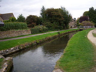
Ashton Keynes is a village and civil parish in north Wiltshire, England which borders with Gloucestershire. The village is about 5 miles (8 km) south of Cirencester and 3.5 miles (5.6 km) west of Cricklade. At the 2011 census the population of the parish, which includes the hamlet of North End, was 1,400.

Evandale is an historic town in northern Tasmania, Australia. It sits on the banks of the South Esk River, 18 km south of Launceston. Named after early colonial explorer and Surveyor-General George Evans, the town is famous for its late-Georgian and early-Victorian buildings with relatively untouched streetscape, a popular Sunday market and as a host to the annual World Penny Farthing bicycle Championships. At the 2016 census, Evandale had a population of 1,345.

Greyton is a small town in the Overberg area in the Western Cape, South Africa.

South African Bantu-speaking peoples are the majority of black South Africans. Occasionally grouped as Bantu, the term itself is derived from the word for "people" common to many of the Bantu languages. The Oxford Dictionary of South African English describes its contemporary usage in a racial context as "obsolescent and offensive" because of its strong association with white minority rule with their apartheid system. However, Bantu is used without pejorative connotations in other parts of Africa and is still used in South Africa as the group term for the language family.

The Venḓa are a Southern African Bantu people living mostly near the South African-Zimbabwean border.

The Khoikhoi–Dutch Wars were a series of conflicts that took place in the last half of the 17th century in what was known then as the Cape of Good Hope, in the area of present-day Cape Town, South Africa, between Dutch colonizers who came from the Netherlands and the local African people, the indigenous Khoikhoi, who had lived in that part of the world for millennia.

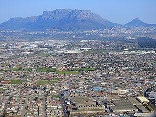
Elsie's River is a suburb of Cape Town, South Africa.

The Shilluk Kingdom, dominated by the Shilluk people, was located along the left bank of the White Nile river in what is now South Sudan and southern Sudan. Its capital and royal residence was in the town of Fashoda. According to Shilluk folk history and neighboring accounts, the kingdom was founded by Nyikang, who probably lived in the second half of the 15th century. As the only Nilotic people, the Shilluk managed to establish a centralized kingdom that reached its apogee in the late 18th and early 19th centuries, during the decline of the northern Funj Sultanate. In the 19th century, the Shilluk were affected by military assaults from the Ottoman Empire, resulting in the destruction of the kingdom in the early 1860s. The Shilluk king is currently not an independent political leader, but a traditional chieftain within the governments of South Sudan and Sudan. The current Shilluk king is His Majesty Reth Kwongo Dak Padiet who ascended to the throne in 1993.
The Molototsi River is a non-perennial river that runs amongst villages in Bolobedu, South Africa. This river ascends from a village called Bodupe. Its stream flows to the Modjadji Dam in Ga-Matswi. It flows down to join the Great Letaba River near the Kruger National Park. Molototsi is one of the sandy rivers in Limpopo Province.


