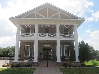
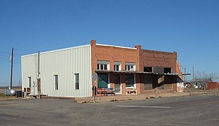
Garza County is a county located in the U.S. state of Texas. As of the 2020 census, its population was 5,816, of which most of the population were residing in its county seat, and only incorporated municipality, Post. The county was created in 1876 and later organized in 1907. Garza is named for a pioneer Bexar County family, as it was once a part of that county.
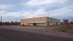
Post is a city in and the county seat of Garza County, Texas, United States. Its population was 5,376 at the 2010 census.
Fluvanna is an unincorporated community in Scurry County, Texas, United States. It lies just south of the Llano Estacado high atop the caprock, where Farm to Market Road 1269 and Farm to Market Road 612 intersect.

The Caprock Escarpment is a term used in West Texas and Eastern New Mexico to describe the geographical transition point between the level High Plains of the Llano Estacado and the surrounding rolling terrain. In Texas, the escarpment stretches around 200 mi (320 km) south-southwest from the northeast corner of the Texas Panhandle near the Oklahoma border. The escarpment is especially notable, from north to south, in Briscoe, Floyd, Motley, Crosby, Dickens, Garza, and Borden Counties. In New Mexico, a prominent escarpment exists along the northernmost extension of the Llano Estacado, especially to the south of San Jon and Tucumcari, both in Quay County, New Mexico. Along the western edge of the Llano Estacado, the portion of the escarpment that stretches from Caprock to Maljamar, New Mexico, is called the Mescalero Ridge.
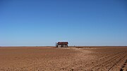
Justiceburg is an unincorporated community in Garza County, Texas, United States. It is located along the Double Mountain Fork Brazos River, 15 miles (24 km) southeast of the county seat, Post.
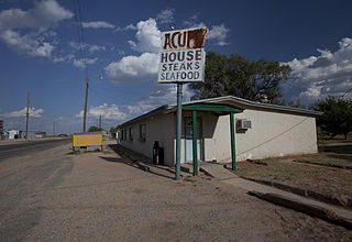
Acuff is an unincorporated farming community in northeastern Lubbock County, Texas, United States. It is part of the Lubbock Metropolitan Statistical Area.

Slide is an unincorporated community in Lubbock County, Texas, United States. It lies at the junction of FM 1730 and FM 41, 13 miles south of Lubbock, and has an estimated population of 44. The community is part of the Lubbock metropolitan area.
Woodrow is an unincorporated community in southern Lubbock County, Texas, United States. It lies on U.S. Route 87, ten miles south of Lubbock, and has an estimated population of 85. It is part of the Lubbock Metropolitan Statistical Area.

South Plains is an unincorporated community in northern Floyd County, Texas, United States. It lies along State Highway 207 north of the city of Floydada, the county seat of Floyd County. Its elevation is 3,215 feet (980 m). Although South Plains is unincorporated, it has a post office, with the ZIP code of 79258.

Grassland is an unincorporated community in Lynn County, West Texas, United States. According to the Handbook of Texas, the community had an estimated population of 61 in 2000.

Estacado is a ghost town in Crosby and Lubbock Counties in the U.S. state of Texas. Located along Farm to Market Road 1527, it was established in 1879 as a Religious Society of Friends (Quaker) colony by Paris Cox and originally named Maryetta after his wife. In 1886, it became the first government seat of Crosby County. In 1936, Recorded Texas Historic Landmark number 4779 was designated to commemorate the founding of Estacado.

Posey is a small, unincorporated, community located on the level plains of the Llano Estacado about 11 mi (18 km) southeast of Lubbock in southeastern Lubbock County, Texas.

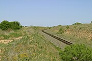
Barwise is a small, unincorporated community located on the level plains of the Llano Estacado about 10 mi (16 km) west of Floydada in western Floyd County, Texas. The town was founded in 1928 after the Fort Worth and Denver South Plains Railway Company laid tracks through the area. The rail spur that passes through Barwise extended from the Fort Worth and Denver Railway junction at Estelline to Lubbock and Plainview.
Heckville is an unincorporated community located on the high plains of the Llano Estacado about 16 mi (26 km) northeast of Lubbock or 7 mi (11 km) north of Idalou in northeastern Lubbock County, Texas. This small town was named after Henry Heck, who built a cotton gin to serve the community in 1948.

Becton is an unincorporated community in northeast Lubbock County, about 18 mi (29 km) northeast of Lubbock, Texas. This small rural community lies on the high plains of the Llano Estacado in West Texas.

Close City is an unincorporated community in western Garza County, approximately 6.5 mi (10.5 km) west-northwest of Post. The small rural community lies on the High Plains of the Llano Estacado in West Texas.
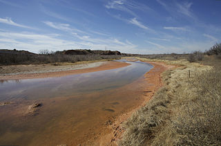
The Salt Fork Brazos River is a braided, highly intermittent stream about 150 mi (240 km) long, heading along the edge of the Llano Estacado about 26 mi (42 km) east-southeast of Lubbock, Texas. From its source, it flows generally east-southeastward to join the Double Mountain Fork to form the Brazos River about 18 mi (29 km) west-northwest of Haskell, Texas. The Salt Fork stretches across portions of Crosby, Garza, Kent, and Stonewall counties of West Texas.

Wastella is a ghost town in northwest Nolan County, Texas, United States. It is located at the intersection of U.S. Highway 84 and Farm to Market Road 1982, about 8 mi (13 km) northwest of Roscoe. It lies within the physiographic region known as the Rolling Plains to the southeast of the high plains of the Llano Estacado.

Roundup is an unincorporated community located in northeastern Hockley County. The town is located on the high plains of the Llano Estacado at the intersection of U.S. Route 84 and Farm to Market Road 2130 between Anton and Shallowater.

Whiteflat is a ghost town in Motley County, Texas, United States. The population was estimated to be 3 at the 2000 census.