Post, Texas

Last updated

Post, Texas
Revised photo of Garza County Historical Museum IMG 4643.JPG
TXMap-doton-Post.PNG
Location of Post, Texas
Garza County Post.svg
Coordinates: 33°11′30″N101°22′50″W / 33.19167°N 101.38056°W / 33.19167; -101.38056
Country United States of America
State Texas
County Garza
Area
[1]
  Total3.77 sq mi (9.77 km2)
  Land3.75 sq mi (9.70 km2)
  Water0.03 sq mi (0.08 km2)
Elevation
2,605 ft (794 m)
Population
 (2010)
  Total5,376
  Estimate 
(2019) [2]
5,115
  Density1,365.82/sq mi (527.38/km2)
Time zone UTC-6 (Central (CST))
  Summer (DST) UTC-5 (CDT)
ZIP code
79356
Area code 806
FIPS code 48-59012 [3]
GNIS feature ID1365627 [4]
Website www.cityofposttexas.com

Post is a city in and the county seat of Garza County, Texas, United States. [5] Its population was 5,376 at the 2010 census.

Contents

History

Post is located on the edge of the caprock escarpment of the Llano Estacado, the southeastern edge of the Great Plains. It is at the crossroads of U.S. Routes 84 and 380.

The land belonged to John Bunyan Slaughter, as it was on his U Lazy S Ranch. [6] In 1906, Slaughter sold it to C. W. Post, the breakfast cereal manufacturer, who founded "Post City" as a utopian colonizing venture in 1907. Post devised the community as a model town. [7] [8] He purchased 200,000 acres (810 km2) of ranchland and established the Double U Company to manage the town's construction. The company built trim houses and numerous structures, which included the Algerita Hotel, a gin, and a textile plant. They planted trees along every street and prohibited alcoholic beverages and brothels. The Double U Company rented and sold farms and houses to settlers. A post office began in a tent during the year of Post City's founding, being established (with the name Post) July 18, 1907, with Frank L. Curtis as first postmaster. [9] Two years later, the town had a school, a bank, and a newspaper, the Post City Post, the same name as the daily in St. Louis, Missouri. The Garza County paper today is called the Post Dispatch—by coincidence, also the same as the current daily in St. Louis. The railroad reached the town in 1910. The town changed its name to "Post" when it incorporated in 1914, the year of C. W. Post's death. By then, Post had a population of 1000, 10 retail businesses, a dentist, a physician, a sanitarium, and Baptist, Methodist, and Presbyterian churches.

From 1910 to 1913, Post experimented with attempts at rainmaking. Explosives were detonated in the atmosphere at timed intervals. Precipitation records, however, showed that the efforts failed. [10]

The C. W. Post estate pledged $75,000, and the town raised $35,000 in 1916 to bid unsuccessfully to become the site of the proposed West Texas Agricultural and Mechanical College.

Postex Cotton Mills began production in 1913 with 250 employees. When the Post interests sold the business in 1945 to Ely and Walker Dry Goods Company of St. Louis, the plant was producing six million yards of cloth a year and employed 375 workers, who manufactured Postex cotton sheets and Garza pillow cases. Ely and Walker sold Postex in 1955 to Burlington Industries, the world's largest textile manufacturer at that time. By 1973, the company employed 450 persons. The mill has since closed.

Oilfield service companies have been important to the economy, as have farming and ranching. In 1989, Post had two libraries, a hospital, a nursing home, an airport, the Post Dispatch (founded 1926), and 90 businesses. The population reached 3,400 in 1928, declined to 2,000 in 1940, and increased to 3,100 during the 1950s. With the development of the local oil industry, the town's population attained its highest level of 4,800 in 1964. The 1980 census showed a population of 3,864, but by 1988, the Texas Almanac reported 4,162. In 1990, the population was 3,768.

Many ranchers and civic boosters live in Garza County, among them Giles McCrary, a former mayor, who until his death in 2011, operated the OS Museum, a hybrid of exhibits from both the American West and Asia, which are changed three times per year. Two baseball fields in Post are named for former resident Norm Cash.

Geography

Post is located on the rolling plains at the foot of the Llano Estacado at 33°11′30″N101°22′50″W / 33.19167°N 101.38056°W / 33.19167; -101.38056 (33.191789, –101.380432). [11]

According to the United States Census Bureau, the city has a total area of 3.8 square miles (9.8 km2), of which 3.8 square miles (9.8 km2) are land and 0.04 square miles (0.10 km2) of it (0.53%) is covered by water.

Climate

According to the Köppen climate classification, Post has a semiarid climate. [12] According to other climatic maps, it falls in a subtropical climate (Köppen: Cfa). Surpassing the 100° meridian, it is the city more to the west in the USA with such categorization. In any case, the city suffers influence from both sides, being the transition from a humid to dry environment in the subtropics. [13]

Climate data for Post, Texas (1991–2020 normals, extremes 1962–present)
MonthJanFebMarAprMayJunJulAugSepOctNovDecYear
Record high °F (°C)84
(29)
93
(34)
99
(37)
105
(41)
110
(43)
115
(46)
112
(44)
111
(44)
107
(42)
103
(39)
91
(33)
84
(29)
115
(46)
Mean daily maximum °F (°C)55.9
(13.3)
60.5
(15.8)
68.6
(20.3)
77.4
(25.2)
85.1
(29.5)
92.5
(33.6)
95.2
(35.1)
94.2
(34.6)
86.4
(30.2)
77.5
(25.3)
65.5
(18.6)
56.5
(13.6)
76.3
(24.6)
Daily mean °F (°C)42.3
(5.7)
46.0
(7.8)
53.8
(12.1)
62.1
(16.7)
71.1
(21.7)
79.2
(26.2)
82.5
(28.1)
81.4
(27.4)
73.8
(23.2)
63.8
(17.7)
51.9
(11.1)
43.5
(6.4)
62.6
(17.0)
Mean daily minimum °F (°C)28.8
(−1.8)
31.5
(−0.3)
39.0
(3.9)
46.9
(8.3)
57.2
(14.0)
66.0
(18.9)
69.8
(21.0)
68.7
(20.4)
61.1
(16.2)
50.0
(10.0)
38.2
(3.4)
30.5
(−0.8)
49.0
(9.4)
Record low °F (°C)0
(−18)
−1
(−18)
5
(−15)
22
(−6)
34
(1)
45
(7)
56
(13)
51
(11)
37
(3)
19
(−7)
8
(−13)
−1
(−18)
−1
(−18)
Average precipitation inches (mm)0.79
(20)
0.97
(25)
1.00
(25)
1.66
(42)
2.72
(69)
3.28
(83)
2.36
(60)
2.46
(62)
2.83
(72)
1.73
(44)
1.31
(33)
0.98
(25)
22.09
(561)
Average snowfall inches (cm)0.9
(2.3)
1.5
(3.8)
0.0
(0.0)
0.0
(0.0)
0.0
(0.0)
0.0
(0.0)
0.0
(0.0)
0.0
(0.0)
0.0
(0.0)
0.0
(0.0)
0.5
(1.3)
1.2
(3.0)
4.1
(10)
Average precipitation days (≥ 0.01 in)2.22.93.43.45.35.53.54.84.73.72.62.444.4
Average snowy days (≥ 0.1 in)0.50.50.00.00.00.00.00.00.00.10.20.51.8
Source: NOAA [14] [15]

Major roads and highways

Demographics

Historical population
CensusPop.Note
1920 1,436
1930 1,66816.2%
1940 2,04622.7%
1950 3,14153.5%
1960 4,66348.5%
1970 3,854−17.3%
1980 3,9612.8%
1990 3,768−4.9%
2000 3,708−1.6%
2010 5,37645.0%
2019 (est.)5,115 [2] −4.9%
U.S. Decennial Census [16]

2020 census

Post racial composition [17]
(NH = Non-Hispanic) [lower-alpha 1]
RaceNumberPercentage
White (NH)1,38628.94%
Black or African American (NH)2294.78%
Native American or Alaska Native (NH)230.48%
Asian (NH)230.48%
Some Other Race (NH)100.21%
Mixed/Multi-Racial (NH)741.54%
Hispanic or Latino 3,04563.57%
Total4,790

As of the 2020 United States census, there were 4,790 people, 1,278 households, and 911 families residing in the city.

2000 census

As of the census [3] of 2000, 3,708 people, 1,243 households, and 873 families resided in the city. The population density was 988.8 people/sq mi (381.8/km2). The 1,419 housing units averaged 378.4/sq mi (146.1/km2). The racial makeup of the city was 51.54% White, 5.47% African American, 0.24% Native American, 0.11% Asian, 18.69% from other races, and 2.91% from two or more races. About 42.64% of the population was Hispanic or Latino of any race.

Of the 1,243 households, 34.8% had children under the age of 18 living with them, 53.5% were married couples living together, 13.0% had a female householder with no husband present, and 29.7% were not families. About 26.6% of all households were made up of individuals, and 13.9% had someone living alone who was 65 or older. The average household size was 2.62 and the average family size was 3.17.

In the city, the age distribution was as 27.5% under 18, 8.8% from 18 to 24, 29.4% from 25 to 44, 20.0% from 45 to 64, and 14.4% who were 65 or older. The median age was 34 years. For every 100 females, there were 114.5 males. For every 100 females age 18 and over, there were 115.8 males.

The median income for a household in the city was $25,034, and for a family was $29,135. Males had a median income of $26,318 versus $17,266 for females. The per capita income for the city was $11,113. About 23.0% of families and 27.8% of the population were below the poverty line, including 34.2% of those under age 18 and 25.9% of those age 65 or over.

Post is served by two weekly newspapers, nearby (Lamesa) stations KJJT (FM) and KPET (AM), and the various Lubbock radio and TV stations. KPOS(AM) was licensed to Post, but was deleted (license turned into FCC) for cancellation in 1998 when the sister FM was upgraded to cover Slaton and the Lubbock area. KSSL (FM)is licensed to Post, but operates primarily from offices and studios in Slaton.

Education

The City of Post is served by the Post Independent School District and home to the Post High School Antelopes.

See also

Related Research Articles

<span class="mw-page-title-main">Lubbock County, Texas</span> County in Texas, United States

Lubbock County is a county located in the U.S. state of Texas. The 2020 census placed the population at 310,639. Its county seat and largest city is Lubbock. The county was created in 1876 and organized in 1891. It is named for Thomas Saltus Lubbock, a Confederate colonel and Texas Ranger.

<span class="mw-page-title-main">Garza County, Texas</span> County in Texas, United States

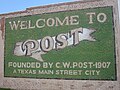
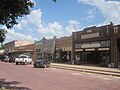
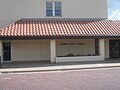
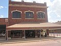
Garza County is a county located in the U.S. state of Texas. As of the 2020 census, its population was 5,816, of which most of the population were residing in its county seat, and only incorporated municipality, Post. The county was created in 1876 and later organized in 1907. Garza is named for a pioneer Bexar County family, as it was once a part of that county.

<span class="mw-page-title-main">Crosby County, Texas</span> County in Texas, United States

Crosby County is a county located in the U.S. state of Texas. As of the 2020 census, its population was 5,133. The county seat is Crosbyton. The county was founded in 1876 and later organized in 1886. Both the county and its seat are named for Stephen Crosby, a land commissioner in Texas.

<span class="mw-page-title-main">Texico, New Mexico</span> City in New Mexico, United States

Texico is a city in Curry County, New Mexico, United States. Its population was 1,130 at the 2010 census. The city is located on the Texas-New Mexico border with the town of Farwell across the border.

<span class="mw-page-title-main">Whiteface, Texas</span> Community in Texas, United States

Whiteface is a town in Cochran County, Texas, United States. The population was 449 at the 2010 census.

<span class="mw-page-title-main">Paducah, Texas</span> Town in Texas, United States

Paducah is a town in Cottle County, Texas, United States. The population was 1,186 at the 2010 census, down from 1,498 in 2000. It is the county seat of Cottle County. It is just south of the Texas Panhandle and east of the Llano Estacado.

<span class="mw-page-title-main">Ralls, Texas</span> City in Texas, United States

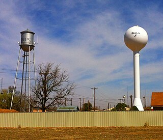
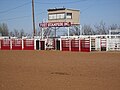
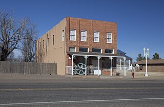
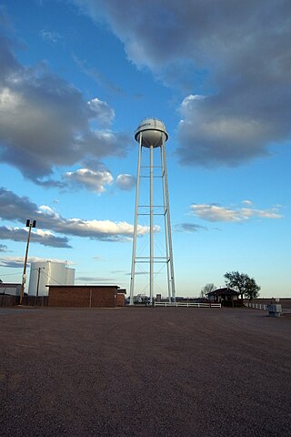
Ralls is a city in Crosby County, Texas, United States. It was named after John Robinson Ralls, who, with the help of W.E. McLaughlin, laid out the townsite in July 1911. As of the 2010 census, it had a population of 1,944, down from 2,252 at the 2000 census. Ralls is surrounded by productive farmlands that primarily produce cotton and grains, with lesser amounts of soybean, sunflower seed, and vegetables.

<span class="mw-page-title-main">Lockney, Texas</span> Town in Texas, United States

Lockney is a town in Floyd County, Texas, United States. The population was 1,842 at the 2010 census, down from 2,056 at the 2000 census.

<span class="mw-page-title-main">Hale Center, Texas</span> City in Texas, United States

Hale Center is a city in Hale County, Texas. The population was 2,062 at the 2020 census, down from 2,252 in 2010.

<span class="mw-page-title-main">Petersburg, Texas</span> City in Texas, United States

Petersburg is a city in Hale County, Texas, United States. As of the 2010 census, it had a population of 1,202.

<span class="mw-page-title-main">Levelland, Texas</span> City in Texas, United States

Levelland is a city in Hockley County, Texas, United States. As of the 2020 census, the city population was 12,652, down from 13,542 at the 2010 census. It is the county seat of Hockley County. It is located on the Llano Estacado, 30 miles (48 km) west of Lubbock. Major industries include cotton farming and petroleum production. It is the home of South Plains College. Levelland is the principal city of the Levelland micropolitan statistical area, which includes all of Hockley County and part of the larger Lubbock–Levelland combined statistical area. Levelland was so named on account of the flat land at the town site.

<span class="mw-page-title-main">Earth, Texas</span> City in Texas, United States

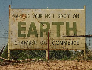
Earth is a small, rural city in Lamb County, West Texas, United States. As of the 2010 Census, the population was 1,065.

<span class="mw-page-title-main">Olton, Texas</span> City in Texas, United States

Olton is a city in Lamb County, Texas, United States. The population was 2,215 at the 2010 census.

New Deal is a U.S. town in Lubbock County, Texas. The population was 794 at the 2010 census. It is part of the Lubbock Metropolitan Statistical Area and the Llano Estacado region.

<span class="mw-page-title-main">Ransom Canyon, Texas</span> Town in Texas, United States

Ransom Canyon is a town in Lubbock County of West Texas, United States. The population was 1,096 at the 2010 census. It is part of the Lubbock Metropolitan Statistical Area.

<span class="mw-page-title-main">Shallowater, Texas</span> Community in Texas, United States

Shallowater is a city in Lubbock County, Texas, United States. Shallowater is on U.S. Route 84 and the Burlington Northern Santa Fe line, 12 miles (19 km) northwest of Lubbock. Its population was 2,484 at the 2010 census. It is part of the Lubbock metropolitan statistical area.

<span class="mw-page-title-main">Slaton, Texas</span> City in Texas, United States

Slaton is a city in Lubbock County, Texas, United States. Founded by German immigrants, Slaton was the westernmost German settlement in Texas. The population was 6,121 at the 2010 census. Slaton is part of the Lubbock Metropolitan Statistical Area.

<span class="mw-page-title-main">Wilson, Texas</span> City in Texas, United States

Wilson is a small rural city in the northeastern quadrant of Lynn County, Texas, United States. As of the 2010 census, the population was 489.

<span class="mw-page-title-main">Bovina, Texas</span> City in Texas, United States

Bovina is a city in Parmer County, Texas, United States. The population was 1,868 at the 2010 census.

<span class="mw-page-title-main">O'Donnell, Texas</span> City in Texas, United States

O'Donnell is a West Texas city that lies primarily in Lynn County, with a small portion extending south into Dawson County, Texas, United States. Its population was 831 at the 2010 census, down from 1,011 at the 2000 census. The Lynn county portion of O'Donnell is part of the Lubbock Metropolitan area.

References

  1. "2019 U.S. Gazetteer Files". United States Census Bureau. Retrieved August 7, 2020.
  2. 1 2 "Population and Housing Unit Estimates". United States Census Bureau. May 24, 2020. Retrieved May 27, 2020.
  3. 1 2 "U.S. Census website". United States Census Bureau . Retrieved January 31, 2008.
  4. "US Board on Geographic Names". United States Geological Survey. October 25, 2007. Retrieved January 31, 2008.
  5. "Find a County". National Association of Counties. Retrieved June 7, 2011.
  6. Anderson, H. Allen (June 15, 2010). "SLAUGHTER, JOHN BUNYAN". Handbook of Texas Online . Texas State Historical Association . Retrieved December 31, 2015.
  7. Post, Texas profile, Texas State Historical Association
  8. "From Post to present: Failed utopia offers lessons for modern planners, experts say". Fort Worth Star-Telegram . June 25, 2001. p. 1.
  9. Schmidt, Walter G. (1993) An Encyclopaedia of Texas Post Offices, p. 173, Chicago, Illinois: The Collectors' Club of Chicago.
  10. Texas State Travel Guide 2011, p. 131
  11. "US Gazetteer files: 2010, 2000, and 1990". United States Census Bureau. February 12, 2011. Retrieved April 23, 2011.
  12. Climate Summary for Post, Texas
  13. "Interactive United States Koppen-Geiger Climate Classification Map". www.plantmaps.com. Retrieved October 11, 2018.
  14. "NOWData - NOAA Online Weather Data". National Oceanic and Atmospheric Administration. Retrieved December 29, 2023.
  15. "Summary of Monthly Normals 1991-2020". National Oceanic and Atmospheric Administration. Retrieved December 29, 2023.
  16. "Census of Population and Housing". Census.gov. Retrieved June 4, 2015.
  17. "Explore Census Data". data.census.gov. Retrieved May 20, 2022.
  18. https://www.census.gov/ [ not specific enough to verify ]
  19. "About the Hispanic Population and its Origin". www.census.gov. Retrieved May 18, 2022.
  1. Note: the US Census treats Hispanic/Latino as an ethnic category. This table excludes Latinos from the racial categories and assigns them to a separate category. Hispanics/Latinos can be of any race. [18] [19]