Spring Bay, Illinois

Last updated

Spring Bay
Woodford County Illinois Incorporated and Unincorporated areas Spring Bay Highlighted.svg
Location of Spring Bay in Woodford County, Illinois.
Illinois in United States (US48).svg
Location of Illinois in the United States
Coordinates: 40°49′27″N89°31′24″W / 40.82417°N 89.52333°W / 40.82417; -89.52333
CountryUnited States
StateIllinois
County Woodford
Area
[1]
  Total0.91 sq mi (2.35 km2)
  Land0.68 sq mi (1.77 km2)
  Water0.22 sq mi (0.57 km2)
Elevation
489 ft (149 m)
Population
 (2020)
  Total474
  Density692.98/sq mi (267.44/km2)
Time zone UTC-6 (CST)
  Summer (DST) UTC-5 (CDT)
ZIP Code(s)
61611
Area code 309
FIPS code 17-71604
Wikimedia CommonsSpring Bay, Illinois
Website https://www.villageofspringbay.org/

Spring Bay is a village in Woodford County, Illinois, United States. As of the 2010 United States census, the village population was 452, up from 436 in 2000. The village is part of the Peoria, Illinois Metropolitan Statistical Area.

Contents

Geography

Spring Bay is located at 40°49′27″N89°31′24″W / 40.82417°N 89.52333°W / 40.82417; -89.52333 (40.824261, -89.523330). [2]

According to the 2010 census, Spring Bay has a total area of 1.149 square miles (2.98 km2), of which 0.82 square miles (2.12 km2) (or 71.37%) is land and 0.329 square miles (0.85 km2) (or 28.63%) is water. [3]

Demographics

Historical population
CensusPop.Note
1870 235
1880 175−25.5%
1890 147−16.0%
1900 128−12.9%
1910 119−7.0%
1920 89−25.2%
1930 85−4.5%
1940 15784.7%
1950 20329.3%
1960 28540.4%
1970 42749.8%
1980 49616.2%
1990 439−11.5%
2000 436−0.7%
2010 4523.7%
2020 4744.9%
U.S. Decennial Census [4]

As of the census [5] of 2000, there were 436 people, 173 households, and 125 families residing in the village. The population density was 541.0 inhabitants per square mile (208.9/km2). There were 187 housing units at an average density of 232.0 units per square mile (89.6 units/km2). The racial makeup of the village was 98.85% White, 0.46% African American, 0.23% Native American, and 0.46% from two or more races. Hispanic or Latino of any race were 0.69% of the population.

There were 173 households, out of which 28.3% had children under the age of 18 living with them, 57.8% were married couples living together, 9.2% had a female householder with no husband % of all households were made up of individuals, and 9.2% had someone living alone who was 65 years of age or older. The average household size was 2.52 and the average family size was 2.95.

In the village, the population was spread out, with 23.9% under the age of 18, 9.4% from 18 to 24, 31.0% from 25 to 44, 24.1% from 45 to 64, and 11.7% who were 65 years of age or older. The median age was 37 years. For every 100 females, there were 93.8 males.

Related Research Articles

<span class="mw-page-title-main">Malvern, Alabama</span> Town in Alabama, United States

Malvern is a town in Geneva County, Alabama, United States. It is part of the Dothan, Alabama Metropolitan Statistical Area. At the 2010 census the population was 1,448, up from 1,215 in 2000.

<span class="mw-page-title-main">Norris, Illinois</span> Village in Illinois, United States

Norris is a village in Fulton County, Illinois, United States. The population was 173 at the 2020 census.

<span class="mw-page-title-main">Plymouth, Illinois</span> Village in Illinois, United States

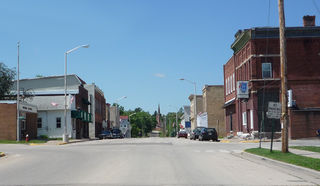
Plymouth is a village in Hancock and McDonough counties, Illinois, United States. The population was 436 at the 2020 census, down from 505 in 2010.

Lake Catherine is an unincorporated community and census-designated place (CDP) in Lake County, Illinois, United States. Per the 2020 census, the population was 1,279.

<span class="mw-page-title-main">Washburn, Illinois</span> Village in Illinois, United States

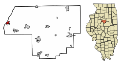
Washburn is a village mostly in Woodford County, with a small northerly portion in Marshall County, Illinois, United States. The population was 1,032 at the 2020 census. It is part of the Peoria Metropolitan Statistical Area.

<span class="mw-page-title-main">Ellis Grove, Illinois</span> Village in Illinois, United States

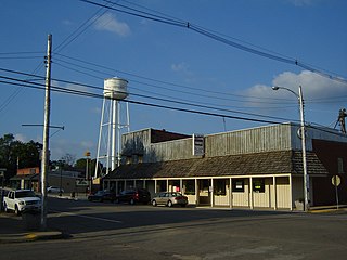
Ellis Grove is a village in Randolph County, Illinois, United States. The population was 328 at the 2020 census.

<span class="mw-page-title-main">Bay View Gardens, Illinois</span> Village in Illinois, United States

Bay View Gardens is a village in Woodford County, Illinois, United States. The population was 378 at the 2010 census, up from 366 in 2000. The village is part of the Peoria, Illinois Metropolitan Statistical Area.

<span class="mw-page-title-main">Whitneyville, Maine</span> Town in the state of Maine, United States

Whitneyville is a town in Washington County, Maine, United States. The town was named after Colonel Joseph Whitney, a mill owner. The population was 202 at the 2020 census.

<span class="mw-page-title-main">West Hills, New York</span> Hamlet and census-designated place in New York, United States

West Hills is a hamlet and census-designated place (CDP) in the Town of Huntington, Suffolk County, New York. The population was 5,592 at the 2010 census. Residents share a post office with the hamlet of Huntington but much earlier in its history, West Hills had its own post office, located on Jericho Turnpike. Also, it is adjacent to the hamlet of Woodbury. It is considered part of the greater Huntington area, which is anchored by Huntington.

<span class="mw-page-title-main">Warrensville Heights, Ohio</span> City in Ohio, United States

Warrensville Heights is a city in Cuyahoga County, Ohio, United States. It is an eastern suburb of Cleveland. The population was 13,789 at the 2020 census.

<span class="mw-page-title-main">Branchdale, Pennsylvania</span> CDP in Pennsylvania, United States

Branchdale is a census-designated place (CDP) in Schuylkill County, Pennsylvania, United States. The population was 436 at the 2000 census.

<span class="mw-page-title-main">Clearview, West Virginia</span> Village in West Virginia, United States

Clearview is a village in Ohio County, West Virginia, United States. It is part of the Wheeling, West Virginia Metropolitan Statistical Area. The population was 565 at the 2010 census.

<span class="mw-page-title-main">Allouez, Wisconsin</span> Village in Wisconsin, United States

Allouez is a village in Brown County in the U.S. state of Wisconsin. The population was 14,156 at the 2020 census. It is part of the Green Bay Metropolitan Statistical Area.

<span class="mw-page-title-main">Rio, Wisconsin</span> Village in Wisconsin, United States

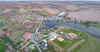
Rio is a village in Columbia County, Wisconsin, United States. The population was 1,133 at the 2022 United States Census. It is part of the Madison Metropolitan Statistical Area. The village rests primarily in the town of Otsego. The Village of Rio calls itself "Camper Country USA" due to several campgrounds located near the village. Rio is halfway between Columbus and Portage on Highway 16.

<span class="mw-page-title-main">Rockdale, Wisconsin</span> Village in Wisconsin, United States

Rockdale is a village in Dane County, Wisconsin, United States. The population was 207 at the 2020 census, making it the smallest incorporated municipality in Dane County. The village is split in half by the Koshkonong Creek. It is part of the Madison Metropolitan Statistical Area.

<span class="mw-page-title-main">Whiting, Wisconsin</span> Village in Wisconsin, United States

Whiting is a village in Portage County, Wisconsin, United States and is a suburb of Stevens Point. It is included in the Stevens Point Micropolitan Statistical Area. The population was 1,601 at the 2020 census.

<span class="mw-page-title-main">Cazenovia, Wisconsin</span> Village in Wisconsin, United States

Cazenovia is a village in Richland and Sauk Counties in the U.S. state of Wisconsin. The population was 318 at the 2010 census. Of this, 314 were in Richland County, and only 4 were in Sauk County.

<span class="mw-page-title-main">Birnamwood, Wisconsin</span> Village in Wisconsin, United States

Birnamwood is a village in Marathon and Shawano counties in the U.S. state of Wisconsin. It is part of the Wausau, Wisconsin Metropolitan Statistical Area. The population was 818 at the 2010 census. Of this, 802 were in Shawano County, and 16 were in Marathon County. The village is located mostly within the town of Birnamwood in Shawano County; only a small portion extends into the town of Norrie in adjacent Marathon County.

<span class="mw-page-title-main">Aniwa, Wisconsin</span> Village in Wisconsin, United States

Aniwa is a village in Shawano County, Wisconsin, United States. The population was 260 at the 2010 census. The village is located within the Town of Aniwa. U.S. Route 45 runs north–south through the village.

<span class="mw-page-title-main">Wittenberg, Wisconsin</span> Village in Wisconsin, United States

Wittenberg is a village in Shawano County, Wisconsin, United States. The population was 1,081 at the 2010 census. The village is located within the Town of Wittenberg.

References

  1. "2020 U.S. Gazetteer Files". United States Census Bureau. Retrieved March 15, 2022.
  2. "US Gazetteer files: 2010, 2000, and 1990". United States Census Bureau. February 12, 2011. Retrieved April 23, 2011.
  3. "G001 - Geographic Identifiers - 2010 Census Summary File 1". United States Census Bureau. Archived from the original on February 13, 2020. Retrieved December 25, 2015.
  4. "Census of Population and Housing". Census.gov. Retrieved June 4, 2015.
  5. "U.S. Census website". United States Census Bureau . Retrieved January 31, 2008.