Hampshire County is a county in the U.S. state of West Virginia. As of the 2010 census, the population was 23,964. Its county seat is Romney, West Virginia's oldest town (1762). The county was created by the Virginia General Assembly in 1754, from parts of Frederick and Augusta Counties (Virginia) and is the state's oldest county. The county lies in both West Virginia's Eastern Panhandle and Potomac Highlands regions.

Rockingham County is a county located in the U.S. state of Virginia. As of the 2010 census, the population was 76,314. Its county seat is the independent city of Harrisonburg.
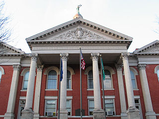
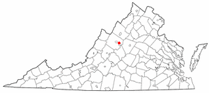
Augusta County is a county in the Shenandoah Valley on the western edge of the Commonwealth of Virginia. The second-largest county of Virginia by total area, it completely surrounds the independent cities of Staunton and Waynesboro. Its county seat is Staunton, but most of the administrative services have offices in neighboring Verona.

Albemarle County is a county located in the Piedmont region of the Commonwealth of Virginia. Its county seat is Charlottesville, which is an independent city and enclave entirely surrounded by the county. Albemarle County is part of the Charlottesville Metropolitan Statistical Area. As of the 2010 census, the population was 98,970, in 2018, it was estimated at 108,718.

Columbia County is a county located in the east central portion of the US state of Georgia. As of the 2010 census, the population was 124,035. The legal county seat is Appling, but the de facto seat of county government is Evans.

Springhill Township is a township in Fayette County, Pennsylvania, United States. The population was 2,907 at the 2010 census. The Albert Gallatin Area School District serves the region.
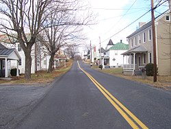
Fishersville is a census-designated place (CDP) in Augusta County, Virginia, United States. The population was 7,462 at the 2010 census, an increase of nearly fifty percent from the 4,998 reported in 2000. It is part of the Staunton–Waynesboro Micropolitan Statistical Area. Fishersville is also home to Barren Ridge Vineyards, winner of the 2009 Best in Show wine at the Virginia State Fair.
Falling Spring is a town in Greenbrier County, West Virginia, in the United States. It is also known as Renick from the name of its post office. The population was 211 at the 2010 census.

North Augusta is a city in Aiken and Edgefield counties in the U.S. state of South Carolina, on the north bank of the Savannah River. The population was 21,348 at the 2010 census. The city is included in the Central Savannah River Area (CSRA) and is part of the Augusta, Georgia, metropolitan area.
Chapel Hill or Chapelhill may refer to:

Ladd is an unincorporated community in Augusta County, Virginia, United States. Ladd is located just outside the independent city of Waynesboro, Virginia and inside Augusta County. Founded in 1854, the only notable buildings of Ladd left as of 2005 are the Bethlehem Lutheran Church, the General Store, and two homes dating to the early 1900s.

Rio is an unincorporated community in southern Hampshire County in the U.S. state of West Virginia. Rio is located just north of the Hardy County line at the crossroads of Augusta-Ford Hill Road and Delray Road in the North River Valley. According to the 2000 census, the Rio community has a population of 154.

Caryville is an unincorporated community in the town of Rock Creek, in Dunn County, Wisconsin, United States. The community is on the south shore of the Chippewa River, along State Highway 85, near where Dunn County Highway H crosses the river.

Odricks Corner is an unincorporated community in Fairfax County, Virginia, United States. Odricks Corner lies north of the Dulles Toll Road at the intersection of Spring Hill and Lewinsville Roads.

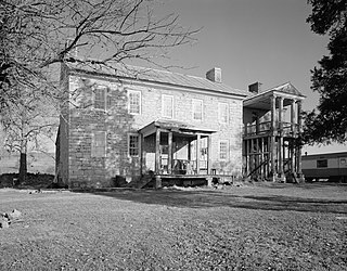
Fort Defiance is an unincorporated community in Augusta County, Virginia, United States. It is part of the Staunton–Waynesboro Micropolitan Statistical Area.

Churchville is a census-designated place (CDP) in the western part of Augusta County, Virginia, United States. The population as of the 2010 Census was 194. Churchville is part of the Staunton–Waynesboro Micropolitan Statistical Area.

The Staunton–Waynesboro Metropolitan Statistical Area is a United States Metropolitan Statistical Area (MSA) in Virginia, as defined by the Office of Management and Budget (OMB). As of the 2010 census, the MSA had a population of 118,502.

Callaway is an unincorporated community in Franklin County, Virginia, United States. Callaway is 8.8 miles (14.2 km) west of Rocky Mount. Callaway has a post office with ZIP code 24067, which opened on July 14, 1871.
Mint Spring is an unincorporated community in Augusta County, Virginia, United States. Mint Spring is located 6.1 miles (9.8 km) south-southwest of Staunton on U.S. Route 11 and has a post office with ZIP code 24463.