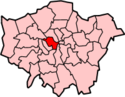
Westminster is the main settlement of the City of Westminster in London, England. It extends from the River Thames to Oxford Street and has many famous landmarks, including the Palace of Westminster, Buckingham Palace, Westminster Abbey, Westminster Cathedral, Trafalgar Square and much of the West End cultural centre including the entertainment precinct of West End Theatre.

Holborn, an area in central London, covers the south-eastern part of the London Borough of Camden and a part of the Ward of Farringdon Without in the City of London.

Covent Garden is a district in London, on the eastern fringes of the West End, between St Martin's Lane and Drury Lane. It is associated with the former fruit-and-vegetable market in the central square, now a popular shopping and tourist site, and with the Royal Opera House, itself known as "Covent Garden". The district is divided by the main thoroughfare of Long Acre, north of which is given over to independent shops centred on Neal's Yard and Seven Dials, while the south contains the central square with its street performers and most of the historical buildings, theatres and entertainment facilities, including the London Transport Museum and the Theatre Royal, Drury Lane.

The Metropolitan Borough of Westminster was a metropolitan borough in the County of London, England, from 1900 to 1965.

Mount Street Gardens is a public garden off Mount Street in the west of the Mayfair area of London, England. The gardens were created in 1889 out of a former burial ground of St George's, Hanover Square, and named after the Mount Field, an area including a fortification dating from the English Civil War named Oliver's Mount.
Shoreditch (St Leonard) was an ancient parish in the county of Middlesex. It was both a civil parish, used for administrative purposes, and an ecclesiastical parish of the Church of England. The parish church is St Leonard's, Shoreditch, often simply called "Shoreditch Church".

The City and Liberty of Westminster was a unit of local government in the county of Middlesex, England. It was located immediately to the west of the City of London. Originally under the control of Westminster Abbey, the local authority for the area was the Westminster Court of Burgesses from 1585 to 1900. The area now forms the southern part of the City of Westminster in Greater London.
The Liberty of the Rolls was a liberty, and civil parish, in the metropolitan area of London, England.
Strand was a local government district within the metropolitan area of London, England, from 1855 to 1900.

St George Hanover Square was a civil parish in the metropolitan area of Westminster, Middlesex, later Greater London, England. The creation of the parish accompanied the building of the Church of St George's, Hanover Square, constructed by the Commission for Building Fifty New Churches to meet the demands of the growing population. The parish was formed in 1724 from part of the ancient parish of St Martin in the Fields in the Liberty of Westminster and county of Middlesex. It included some of the most fashionable areas of the West End, including Belgravia and Mayfair. Civil parish administration, known as a select vestry, was dominated by members of the British nobility until the parish adopted the Vestries Act 1831. The vestry was reformed again in 1855 by the Metropolis Management Act. In 1889 the parish became part of the County of London and the vestry was abolished in 1900, replaced by Westminster City Council. The parish continued to have nominal existence until 1922. As created, it was a parish for both church and civil purposes, but the boundaries of the ecclesiastical parish were adjusted in 1830, 1835 and 1865.
Westminster St James was a civil parish in the metropolitan area of London, England. The creation of the parish followed the building of the Church of St James, Piccadilly, in 1684. After several failed attempts, the parish was formed in 1685 from part of the ancient parish of St Martin in the Fields in the Liberty of Westminster and county of Middlesex. It included part of the West End of London, taking in sections of Soho, Mayfair and St James's. Civil parish administration was in the hands of a select vestry until the parish adopted the Vestries Act 1831. The vestry was reformed again in 1855 by the Metropolis Management Act. In 1889 the parish became part of the County of London and the vestry was abolished in 1900, replaced by Westminster City Council. The parish continued to have nominal existence until 1922.
St Clement Danes was a civil parish in the metropolitan area of London, England; an ecclesiastical version remains. The parish was split between the Liberty of Westminster and the Liberty of the Duchy of Lancaster. The area is colloquially split between Aldwych and Adelphi areas associated with the larger Strand area in the extreme east of the City of Westminster. It includes hotels, restaurants, the Indian and Australian High Commissions and the London School of Economics. To its west is Charing Cross station which faces Trafalgar Square.
St Mary le Strand was an ancient parish in the county of Middlesex, England. It was partly within the Liberty of the Savoy and partly within the Liberty of Westminster. It took its name from the church of St Mary and the Innocents. The church was demolished in 1548, during the construction of Somerset House, and not rebuilt until 1723. The parish was de facto merged with the Precinct of the Savoy as "St Mary Savoy", but an attempt to merge the parishes de jure in the early 18th century failed. It was restored as a separate parish following the construction of the New Church in the Strand in 1723. The parish was grouped into the Strand Poor Law Union in 1836 and the Strand District in 1855. In 1889 it became part of the County of London and from 1900 also part of the Metropolitan Borough of Westminster. It was abolished as a civil parish in 1922.
St Martin in the Fields was a civil parish in the county of Middlesex, later part of the new County of London, England. It took its name from the Church of St Martin-in-the-Fields and was within the Liberty of Westminster. Within its boundaries were the former extra-parochial areas of Buckingham Palace and St James's Palace.
St Anne Within the Liberty of Westminster, also known as St Anne Soho, was a civil parish in the county of Middlesex, later part of the new County of London, England.
St Margaret was an ancient parish in the City and Liberty of Westminster and the county of Middlesex. It included the core of modern Westminster, including the Palace of Westminster and the area around, but not including Westminster Abbey. It was divided into St Margaret's and St John's in 1727, to coincide with the building of the Church of St John the Evangelist, constructed by the Commission for Building Fifty New Churches in Smith Square to meet the demands of the growing population, but there continued to be a single vestry for the parishes of St Margaret and St John. This was reformed in 1855 by the Metropolis Management Act, and the two parishes formed the Westminster District until 1887. St Margaret and St John became part of the County of London in 1889. The vestry was abolished in 1900, to be replaced by Westminster City Council, but St Margaret and St John continued to have a nominal existence until 1922.
The Close of the Collegiate Church of St Peter was an extra-parochial area, and later civil parish, in the metropolitan area of London, England. It corresponded to the area of Westminster Abbey and was an enclave between the parishes of St Margaret and St John, within the City and Liberty of Westminster. The Collegiate Church of St Peter is an alternative name for Westminster Abbey.
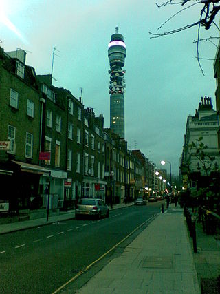
Cleveland Street in central London runs north to south from Euston Road (A501) to the junction of Mortimer Street and Goodge Street. It lies within Fitzrovia, in the W1 post code area. Cleveland Street also runs along part of the border between Bloomsbury (ward) which is located in London Borough of Camden, and West End (ward) in the City of Westminster. In the 17th century, the way was known as the Green Lane, when the area was still rural, or Wrastling Lane, after a nearby amphitheatre for boxing and wrestling.

The Cleveland Street Workhouse is a Georgian property in Cleveland Street, Marylebone, built between 1775 and 1778 for the care of the sick and poor of the parish of St Paul Covent Garden under the Old Poor Law. From 1836, it became the workhouse of the Strand Union of parishes. The building remained in operation until 2005 after witnessing the complex evolution of the healthcare system in England. After functioning as a workhouse, the building became a workhouse infirmary before being acquired by the Middlesex Hospital and finally falling under the NHS. In the last century it was known as the Middlesex Hospital Annexe and the Outpatient Department. It closed to the public in 2005 and it has since been vacated. On 14 March 2011 the entire building became Grade II Listed. Development of the site began in 2019 by current owner University College London Hospitals (UCLH) Charity as a mixed-use development including residential, commercial and open space, but construction has been held up by the necessity to remove human remains stemming from the use of the area around the workhouse as a parish burial ground between 1780 and 1853. There has also been controversy about the amount of social housing to be included in the development.

Saffron Hill, Hatton Garden, Ely Rents and Ely Place was a liberty and from 1866 to 1930 a civil parish in the metropolitan area of London, England. It was part of the ancient parish of St Andrew Holborn.