Terril, Iowa

Last updated
Terril, Iowa
Dickinson County Iowa Incorporated and Unincorporated areas Terril Highlighted.svg
Location of Terril, Iowa
Coordinates: 43°18′20″N94°58′17″W / 43.30556°N 94.97139°W / 43.30556; -94.97139 Coordinates: 43°18′20″N94°58′17″W / 43.30556°N 94.97139°W / 43.30556; -94.97139
Country Flag of the United States.svg  United States
State Flag of Iowa.svg  Iowa
County Dickinson
Area
[1]
  Total0.54 sq mi (1.41 km2)
  Land0.54 sq mi (1.41 km2)
  Water0.00 sq mi (0.00 km2)
Elevation
1,434 ft (437 m)
Population
 (2020)
  Total334
  Density615.10/sq mi (237.67/km2)
Time zone UTC-6 (Central (CST))
  Summer (DST) UTC-5 (CDT)
ZIP code
51364
Area code 712
FIPS code 19-77520
GNIS feature ID0462198
[2]

Terril is a city in Dickinson County, Iowa, United States. The population was 334 at the time of the 2020 census. [3]

Contents

History

Terril (formerly spelled Terrill) was platted in 1895. [4]

Geography

According to the United States Census Bureau, the city has a total area of 0.55 square miles (1.42 km2), all land. [5]

Demographics

Historical populations
YearPop.±%
1900 217    
1910 253+16.6%
1920 440+73.9%
1930 416−5.5%
1940 452+8.7%
1950 425−6.0%
1960 382−10.1%
1970 397+3.9%
1980 420+5.8%
1990 383−8.8%
2000 404+5.5%
2010 367−9.2%
2020 334−9.0%
Source: "U.S. Census website". United States Census Bureau . Retrieved 2020-03-29. and Iowa Data Center
Source:
U.S. Decennial Census [6] [3]

2010 census

As of the census [7] of 2010, there were 367 people, 164 households, and 106 families living in the city. The population density was 667.3 inhabitants per square mile (257.6/km2). There were 178 housing units at an average density of 323.6 per square mile (124.9/km2). The racial makeup of the city was 94.8% White, 0.5% African American, 1.1% Asian, 1.6% from other races, and 1.9% from two or more races. Hispanic or Latino of any race were 2.2% of the population.

There were 164 households, of which 26.2% had children under the age of 18 living with them, 48.8% were married couples living together, 7.9% had a female householder with no husband present, 7.9% had a male householder with no wife present, and 35.4% were non-families. 30.5% of all households were made up of individuals, and 9.7% had someone living alone who was 65 years of age or older. The average household size was 2.24 and the average family size was 2.74.

The median age in the city was 39.4 years. 21.8% of residents were under the age of 18; 9.2% were between the ages of 18 and 24; 25.6% were from 25 to 44; 28.1% were from 45 to 64; and 15.3% were 65 years of age or older. The gender makeup of the city was 52.9% male and 47.1% female.

2000 census

As of the census [8] of 2000, there were 404 people, 171 households, and 108 families living in the city. The population density was 740.0 inhabitants per square mile (285.7/km2). There were 186 housing units at an average density of 340.7 per square mile (131.5/km2). The racial makeup of the city was 99.01% White, 0.25% African American, 0.50% Asian, and 0.25% from two or more races. Hispanic or Latino of any race were 0.25% of the population.

There were 171 households, out of which 29.8% had children under the age of 18 living with them, 53.8% were married couples living together, 5.8% had a female householder with no husband present, and 36.8% were non-families. 32.7% of all households were made up of individuals, and 15.8% had someone living alone who was 65 years of age or older. The average household size was 2.36 and the average family size was 2.99.

In the city, the population was spread out, with 25.7% under the age of 18, 9.9% from 18 to 24, 27.2% from 25 to 44, 18.8% from 45 to 64, and 18.3% who were 65 years of age or older. The median age was 35 years. For every 100 females, there were 104.0 males. For every 100 females age 18 and over, there were 101.3 males.

The median income for a household in the city was $34,583, and the median income for a family was $39,250. Males had a median income of $25,592 versus $19,306 for females. The per capita income for the city was $16,283. About 8.8% of families and 13.8% of the population were below the poverty line, including 32.5% of those under age 18 and 8.3% of those age 65 or over.

Education

Terril is served by the Graettinger–Terril Community School District, formed by the 2010 merger of the Terril and Graettinger districts. [9]

Notable People

Related Research Articles

<span class="mw-page-title-main">Willey, Iowa</span> City in Iowa, United States

Willey is a city in Carroll County, Iowa, United States. The population was 73 at the time of the 2020 census.

<span class="mw-page-title-main">Graettinger, Iowa</span> City in Iowa, United States

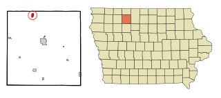
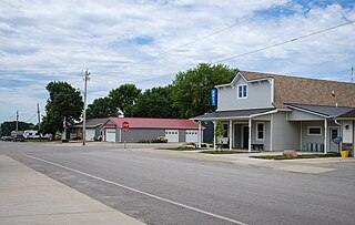
Graettinger is a city in Palo Alto County, Iowa, United States. The population was 832 at the time of the 2020 census.

<span class="mw-page-title-main">McCausland, Iowa</span> City in Iowa, USA

McCausland is a city in Butler Township, Scott County, Iowa, United States. The population was 313 at the time of the 2020 census.

<span class="mw-page-title-main">Felton, Minnesota</span> City in Minnesota, United States

Felton is a city in Clay County, Minnesota, United States. The population was 177 at the 2020 census.

<span class="mw-page-title-main">Coleraine, Minnesota</span> City in Minnesota, United States

Coleraine is a city in Itasca County, Minnesota, United States. The population was 1,970 at the 2010 census. The community was named after Thomas F. Cole, President of the Oliver Iron Mining Company.

<span class="mw-page-title-main">Lake Bronson, Minnesota</span> City in Minnesota, United States

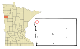
Lake Bronson is a city in Kittson County, Minnesota, United States. The population was 178 at the 2020 census. Lake Bronson State Park is nearby.

<span class="mw-page-title-main">Harding, Minnesota</span> City in Minnesota, United States

Harding is a city in Morrison County, Minnesota, United States, along the Platte River. The population was 123 at the 2020 census.

<span class="mw-page-title-main">Lastrup, Minnesota</span> City in Minnesota, United States

Lastrup is a city in Morrison County, Minnesota, United States. The population was 120 at the 2020 census.

<span class="mw-page-title-main">Shelly, Minnesota</span> City in Minnesota, United States

Shelly is a city in Norman County, Minnesota, United States. The population was 179 at the 2020 census.

<span class="mw-page-title-main">Bluffton, Minnesota</span> City in Minnesota, United States

Bluffton is a city in Otter Tail County, Minnesota, United States, along the Leaf River. The population was 210 at the 2020 census.

<span class="mw-page-title-main">Mentor, Minnesota</span> City in Minnesota, United States

Mentor is a city in Polk County, Minnesota, United States. It is part of the Grand Forks-ND-MN Metropolitan Statistical Area. The population was 104 at the 2020 census. The city is near Maple Lake.

<span class="mw-page-title-main">Lake Henry, Minnesota</span> City in Minnesota, United States

Lake Henry is a city in Stearns County, Minnesota, United States. The population was 103 at the 2010 census. It is part of the St. Cloud Metropolitan Statistical Area.

<span class="mw-page-title-main">Country Club Hills, Missouri</span> City in Missouri, United States

Country Club Hills is a city in St. Louis County, Missouri, United States. The population was 1,274 at the 2010 census.

<span class="mw-page-title-main">Greendale, Missouri</span> City in Missouri, United States

Greendale is a city in St. Louis County, Missouri, United States. The population was 651 at the 2010 census.

<span class="mw-page-title-main">Fort Calhoun, Nebraska</span> City in Nebraska, United States

Fort Calhoun is a city in Washington County, Nebraska, United States. The population was 908 at the 2010 census. The city includes Fort Atkinson, the first fort built west of the Missouri River.

<span class="mw-page-title-main">Lake Annette, Missouri</span> City in Missouri, United States

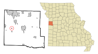
Lake Annette is a city in Cass County, Missouri, United States. The population was 100 at the 2010 census. It is part of the Kansas City metropolitan area.

<span class="mw-page-title-main">Nome, North Dakota</span> City in North Dakota, United States

Nome is a city in Barnes County, North Dakota, United States. The population was 51 at the 2020 census. Nome was founded in 1901.

<span class="mw-page-title-main">Edinburg, North Dakota</span> City in North Dakota, United States

Edinburg is a city in Walsh County, North Dakota, United States. The population was 199 at the 2020 census.

<span class="mw-page-title-main">Harrisburg, Oregon</span> City in Oregon, United States

Harrisburg is a city in Linn County, Oregon, United States. The population was 3,567 at the 2010 census.

<span class="mw-page-title-main">Belmont, West Virginia</span> Town in West Virginia, United States

Belmont is a town in Pleasants County, West Virginia, United States. It is part of the Parkersburg-Marietta-Vienna, WV-OH Metropolitan Statistical Area. The population was 872 at the 2020 census.

References

  1. "2020 U.S. Gazetteer Files". United States Census Bureau. Retrieved March 16, 2022.
  2. "US Gazetteer files: 2010, 2000, and 1990". United States Census Bureau. 2011-02-12. Retrieved 2011-04-23.
  3. 1 2 "2020 Census State Redistricting Data". census.gov. United states Census Bureau. Retrieved August 12, 2021.
  4. History of Emmet County and Dickinson County, Iowa. Pioneer Publishing Company. 1917. pp.  354.
  5. "US Gazetteer files 2010". United States Census Bureau. Archived from the original on 2012-01-25. Retrieved 2012-05-11.
  6. "Census of Population and Housing". Census.gov. Retrieved June 4, 2015.
  7. "U.S. Census website". United States Census Bureau . Retrieved 2012-05-11.
  8. "U.S. Census website". United States Census Bureau . Retrieved 2008-01-31.
  9. "REORGANIZATION & DISSOLUTION ACTIONS SINCE 1965-66." Iowa Department of Education. Retrieved on January 17, 2019.