Texas State Highway Loop 250

Last updated

Texas Loop 250.svg

State Highway Loop 250

Texas State Highway Loop 250
Route information
Maintained by TxDOT
Length12.245 mi [1]  (19.706 km)
Existed1977 [1] –present
Major junctions
West endI-20.svgTexas 158.svgTexas 349.svg I-20  / SH 158  / SH 349 in Midland
East endI-20.svg I-20 near Midland
Location
Country United States
State Texas
Counties Midland
Highway system
Texas Loop 249.svg Loop 249 Texas Loop 251.svg Loop 251

Texas State Highway Loop 250 (Loop 250) is a bypass of northern Midland. The highway runs along the western, northern and eastern edges of the city. From the western terminus at I-20/SH 158/SH 349 to Bus. SH 349, the highway is a freeway.

Contents

Route description

Loop 250 begins at an interchange with I-20/SH 158/SH 349 in southwest Midland, with SH 158 beginning at concurrency with Loop 250. The highway runs near many industrial parks with exits for Industrial Avenue and BL I-20 (W. Wall Street). Near Thomason Drive, the freeway passes near many subdivisions on the city's west side. The concurrency with SH 158 ends at an interchange with SH 191 near Grande Communications Stadium and Security Bank Ballpark. Near Wadley Avenue, the freeway turns from a more north direction towards the east. The corridor of Loop 250 from Midland Drive to Garfield Street is the sight of many restaurants and shopping centers, including Midland Park Mall. Between Garfield Street and Bus. SH 349 (Big Spring Street), the southern frontage road serves as the northern boundary for Midland Airpark. Just east of Fairgrounds Road, freeway status ends and Loop 250 continues as a divided highway. Phases of new projects are planned and/or underway to extend the highway's freeway status further east and to the south, following the planned and existing route. The highway leaves the city limits of Midland just east of County Road 1160. Loop 250 has an interchange with BL I-20 before a terminus at I-20, east of Midland.

History

Texas Spur 250.svg

Loop 250 was originally designated on March 31, 1952 and ran from US 183 near the Montopolis Bridge to US 81 in north Austin. This highway was cancelled on August 17, 1954 with the mileage being transferred to US 183. [2] The Loop 250 designation was used again as Spur 250 on August 27, 1959 as a connector route between Interstate 45 and U.S. Route 75 in Texas near Mossy Grove. This route was cancelled on October 8, 1965 with the mileage being transferred to FM 2989. [3] The current Loop 250 was designated on August 31, 1977. On July 24, 1984, it replaced FM 1369, which was decommissioned, and the section of FM 868 from Loop 250 to SH 349.

Junction list

The entire highway is in Midland County.

Locationmi [4] kmDestinationsNotes
Midland 0.00.0I-20.svgEast plate.svg
Texas 158.svg
I-20  / SH 158 east El Paso, Garden City
At-grade interchange; west end of SH 158 overlap
0.20.32I-20 Frontage RoadWestbound exit and eastbound entrance
0.30.48Industrial AvenueEastbound exit and westbound entrance
0.91.4Business Loop 20.svg I-20 BL  Odessa, Midland Former US 80
1.32.1Anetta DriveEastbound exit and westbound entrance
2.13.4Thomason Drive
3.25.1West plate.svg
Texas 158.svg
West plate.svg
Texas 191.svg
East plate.svg
Business plate.svg
Texas 158.svg
SH 158 west / SH 191 west / Bus. SH 158 east Andrews, Odessa, Midland
East end of SH 158 overlap
4.36.9Wadley Avenue, Tremont Avenue
5.79.2Texas FM 868.svg FM 868 (Midland Drive)
6.710.8Midkiff Road Midland Park Mall
7.912.7Garfield Street Midland College, Midland Airpark
8.814.2A StreetWestbound exit via the Lamesa Road exit
9.515.3Business plate.svg
Texas 349.svg
Bus. SH 349  Lamesa, Rankin
9.915.9Lamesa Road
10.717.2Fairgrounds RoadEast end of freeway
11.819.0Todd DriveAt-grade intersection
12.820.6Elkins Road, E County Road 60West end of freeway
14.022.5N County Road 1140
15.324.6Business Loop 20.svg I-20 BL  Big Spring, Midland Former US 80
16.326.2I-20.svg I-20  Abilene, El Paso
CR 1130
At-grade interchange; roadway continues south as CR 1130
1.000 mi = 1.609 km; 1.000 km = 0.621 mi

Related Research Articles

<span class="mw-page-title-main">Interstate 27</span> Interstate in the Texas Panhandle

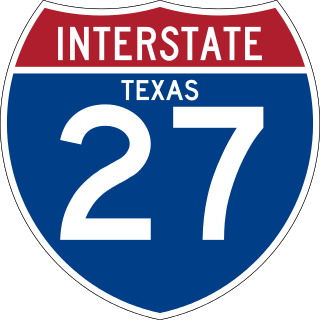
Interstate 27 (I-27) is an Interstate Highway, entirely in the US state of Texas, running north from Lubbock to I-40 in Amarillo. These two cities are the only control cities on I-27; other cities and towns served by I-27 include New Deal, Abernathy, Hale Center, Plainview, Kress, Tulia, Happy, and Canyon. In Amarillo, I-27 is commonly known as the Canyon Expressway, although it is also called Canyon Drive on its access roads. I-27 was officially designated the Marshall Formby Memorial Highway after former attorney and Texas State Senator Marshall Formby in 2005. The entire length of I-27 replaced U.S. Route 87 (US 87) for through traffic.

<span class="mw-page-title-main">Interstate 820</span> Highway in Texas

Interstate 820 (I-820) is a loop of I-20 in Fort Worth, Texas, of approximately 35.17 miles (56.60 km) around the city and some of its suburbs. Exit numbers begin at its intersection with I-20 in southwest Fort Worth, and continue in a clockwise direction around the city until it ends at its intersection with I-20 in southeast Fort Worth. A portion of I-820 in the northeast quadrant is cosigned with State Highway 121 (SH 121) as well as SH 183.

<span class="mw-page-title-main">U.S. Route 290</span> Highway in Texas

U.S. Route 290 is an east–west U.S. Highway located entirely within the state of Texas. Its western terminus is at Interstate 10 southeast of Segovia, and its eastern terminus is at Interstate 610 in northwest Houston. It is the main highway between Houston and Austin and is a cutoff for travelers wanting to bypass San Antonio on Interstate 10. Throughout its length west of Austin, US 290 cuts across mountainous hills comprising the Texas Hill Country and the Edwards Plateau; between Austin and Houston, the highway then travels through gradually hilly grasslands and pine forests comprising the Gulf Coastal Plains.

<span class="mw-page-title-main">Texas State Highway 121</span> Highway in Texas

State Highway 121 is a state highway angling from southwest to northeast through north central Texas. It runs from downtown Fort Worth, Texas at the junction of Interstate 35W to Bonham, Texas, just north of a junction with U.S. Highway 82.

<span class="mw-page-title-main">Texas State Highway 46</span> State highway in Texas

State Highway 46 is a 71.4-mile (114.9 km) state highway in the U.S. state of Texas that runs from SH 16 east of Bandera to the intersection of SH 123 and SH 123 Business just south of Seguin.

<span class="mw-page-title-main">Texas State Highway 183</span> Highway in Texas

State Highway 183 is a state highway in the Dallas–Fort Worth metroplex in Texas. Its most heavily used section is designated Airport Freeway where it serves the southern entrance of Dallas–Fort Worth International Airport.

<span class="mw-page-title-main">Texas State Highway Loop 1604</span> Loop highway around San Antonio, Texas

Loop 1604 is the outer highway loop encircling San Antonio, Texas, spanning approximately 95.6 miles (153.9 km). Originally constructed as a two-lane highway, the northern segment of the route, from US 90 in western San Antonio to Kitty Hawk Road in northeastern Bexar County, has been upgraded to a four-lane freeway. Loop 1604 is designated the Charles W. Anderson Loop in honor of former Bexar County Judge Charles W. Anderson, who died from cancer in 1964 after serving for 25 years.

<span class="mw-page-title-main">Texas State Highway 158</span>

State Highway 158 is a state highway running from near Goldsmith, Texas eastward to Ballinger, Texas.

<span class="mw-page-title-main">Texas State Highway 349</span> Highway in Texas

State Highway 349 is a 194.43-mile-long (312.90 km) state highway in the western part of Texas, United States.

<span class="mw-page-title-main">Texas State Highway 191</span> Highway in Texas

State Highway 191 (SH 191) is a Texas state highway running from the north side of Odessa east to the western edge of Midland. The highway is usually used as a reliever route for local traffic between the two cities, as opposed to I-20 a few miles to the south.

<span class="mw-page-title-main">Farm to Market Road 1171</span>

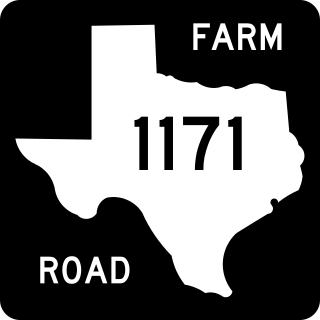
Farm to Market Road 1171 is a farm to market road in Denton County, Texas.

<span class="mw-page-title-main">Texas State Highway Loop 20</span> Loop highway around Laredo, Texas

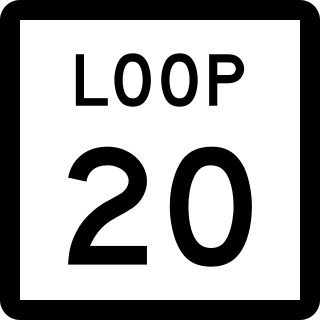
Loop 20, also known as the Bob Bullock Loop and Cuatro Vientos Road, is a highway loop that runs to the north and east of the city of Laredo, Texas. Loop 20 extends from the World Trade International Bridge at its northern point to Mangana-Hein Road at its southern point. The current route varies in construction from a 2-lane road to a freeway with frontage roads.

<span class="mw-page-title-main">Business routes of Interstate 35</span>

There are fourteen business routes of Interstate 35 (I-35): nine are in Texas, two are in Iowa, and three are in Minnesota.

<span class="mw-page-title-main">Texas State Highway 140</span>

State Highway 140 (SH 140) is a 2.3-mile-long (3.7 km) state highway located entirely in Midland, Texas. It is located along Florida Avenue and Garden City Highway in the southeastern portion of the city beginning at its western terminus at Business Highway 349-C, also known as Big Spring Street and continues east to the interchange of Interstate 20 (I-20) and SH 158. The road on which SH 140 travels had previously been designated as three other highways over time: SH 158, State Highway Loop 546, and Bus. SH 158-B. It received its current number in 2012.

References

  1. 1 2 Transportation Planning and Programming Division (n.d.). "State Highway Loop No. 250". Highway Designation Files. Texas Department of Transportation . Retrieved May 18, 2017.
  2. Transportation Planning and Programming Division (n.d.). "U.S. Highway No. 183". Highway Designation Files. Texas Department of Transportation . Retrieved May 18, 2017.
  3. Transportation Planning and Programming Division (n.d.). "Farm to Market Road No. 2989". Highway Designation Files. Texas Department of Transportation . Retrieved May 18, 2017.
  4. Google (May 18, 2017). "Overview Map of Loop 250" (Map). Google Maps . Google. Retrieved May 18, 2017.