Chadwick is an unincorporated community in eastern Christian County, Missouri, United States. It is located approximately six miles southeast of Sparta along Missouri Route 125. The community of Oldfield is approximately three miles to the north along Route 125. It is part of the Springfield, Missouri Metropolitan Statistical Area. Its ZIP code is 65629.
Almartha is an unincorporated community in northern Ozark County, Missouri, United States. It is located approximately thirteen miles north of Gainesville and four miles southeast of Wasola on Route 95. The village is located in a valley on a tributary of Spring Creek. Several homes are located there. The old mill and current fish hatchery of Rockbridge lies downstream on Spring Creek, about six miles to the east.
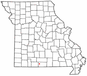
Thornfield is an unincorporated community in Ozark County, Missouri, United States. It is located 15 miles (24 km) northwest of Gainesville, on Route 95 at the Little North Fork of the White River on the edge of the Mark Twain National Forest between Wasola to the northeast and Longrun to the southwest. Hammond, the site of the historic Hammond Mill, lies on the Little North Fork 2.5 miles (4.0 km) southeast of Thornfield. Thornfield has a post office with ZIP code 65762.

Sycamore is an unincorporated community in eastern Ozark County in the Ozarks of southern Missouri, United States. It is located on Route 181, approximately fourteen miles northeast of Gainesville. The old townsite is located on a ridge on the west side of Bryant Creek, a major tributary of the North Fork River. The old Hodgson Mill and spring lie on Bryant Creek 0.8 mi (1.3 km) to the northeast. The mill was nominated to the National Register of Historic Places as Aid-Hodgson Mill in 2001.
Souder is an unincorporated community on Spring Creek in northern Ozark County, Missouri, United States. It is thirteen miles north of Gainesville and is located on county road 142, north of Route 95.
Romance is an unincorporated community in Ozark County, Missouri, United States. It is located approximately nine miles north of Gainesville. Romance is located in a valley at the confluence of two smaller streams with Ludecker Creek. It lies on state route Y, 2 miles (3.2 km) east of Missouri Route 5 and 2.3 miles (3.7 km) north of Willhoit. The Romance fire tower sits atop a knob at 1,490 feet (450 m), about 2.5 miles east.

Rockbridge is an unincorporated community in northern Ozark County, Missouri, United States. It is the site of an old mill on spring fed Spring Creek, a tributary of Bryant Creek, which still houses the post office. It lies twelve miles north of Gainesville on Missouri Route N, approximately one and one-half miles north of Route 95. The narrow valley floor is only about 650 feet (200 m) wide and at an elevation of 770 feet (230 m) and the Ozark ridges on either side are 200 to 250 feet higher.

Longrun is an unincorporated community in western Ozark County, Missouri, United States. It is located on Route 95, approximately 5.7 miles (9.2 km) northwest of Theodosia and 5.4 miles (8.7 km) southwest of Thornfield. Longrun's post office closed and mail delivery is now served by Theodosia.

Brixey is an unincorporated community in northern Ozark County, Missouri, United States. It is located 1.6 miles (2.6 km) south of Route 95 on Route N or approximately 10 miles (16 km) north of Gainesville.
Foil is an unincorporated community in northern Ozark County, Missouri, United States. It is located approximately sixteen miles south of Ava on county roads 953 and 955. Wasola is about four miles northeast on Missouri Route 5 and Thornfield approximately three miles southwest on Missouri Route JJ. The community is on the banks of Little Creek, a tributary of Little North Fork White River.
Elijah is an unincorporated community in eastern Ozark County, Missouri, United States. It is located approximately twenty-two miles west of West Plains on Missouri Supplemental Route V, one mile south of U.S. Route 160. The community is located on North Bridges Creek, with Spoon Spring within the village.
Mammoth is an unincorporated community in Ozark County, Missouri, United States. Mammoth is located along Missouri Route T, 5 miles (8.0 km) south-southeast of Gainesville. Mammoth is situated on the confluence of the Possum Walk Creek flowing into Lick Creek. The mouth of Little Creek is located 1-mile (1.6 km) northwest of Mammoth on Lick Creek.
Winnipeg is an unincorporated community in eastern Laclede County, in the Ozarks of south central Missouri. The community is located above Nelson Creek, approximately three miles northeast of Missouri Route 32. Falcon and Nebo are to the west and southwest respectively. Missouri Route 17 and the southwestern corner of Fort Leonard Wood are about two miles to the east.
Proctor is an unincorporated community in southwest Morgan County, in the U.S. state of Missouri.
Fay is an unincorporated community in southeastern Ozark County, in the Ozarks of south-central Missouri, United States. The community is located along Missouri Route J, approximately 2.5 miles south of U.S. Route 160. The Fay Cemetery lies just west of Route J and north of the Lick Creek - Sweeten Creek junction.
Locust is an unincorporated community in Ozark County, Missouri, United States. The community is located on South Fork Bratten Spring Creek, approximately one mile east of a northeast arm of Bull Shoals Lake. Access is via a county road south from U.S. Route 160, southwest of Gainesville.
Luna is an extinct town in Ozark County, in the U.S. state of Missouri. The GNIS classifies it as a populated place. The community is on a ridge between Bryant Creek to the east and Pine Creek to the west and is located on Missouri Route FF. Zanoni, on Missouri Route 181, lies approximately two miles to the northwest. The community church is one and one-half miles west on Caney Creek and Missouri Route AA. The Pine Creek confluence with Bryant Creek is one and one-quarter miles to the south, at the north end of Norfork Lake.
Prestonia is an unincorporated community in Ozark County, Missouri, United States. The Prestonia site lies on a ridge above East Pidgeon Creek and is southwest of Howards Ridge. The Missouri-Arkansas border is approximately one mile to the south and Norfork Lake is about four miles to the east. Access is from Missouri Route J via county road J529.
Thuroy is an unincorporated community in Ozark County, Missouri, United States. The village was located on a northward-flowing tributary to Barren Creek, approximately one-half mile from the Missouri-Arkansas border and Missouri State Highway 101. Bakersfield is about four miles to the northeast. Barren Creek flows into Norfork Lake in Arkansas, approximately four miles to the southwest.
Quaker is an unincorporated community in southwestern Washington County, in the U.S. state of Missouri. Quaker is located on Missouri Route C, between Courtois to the southwest and Delbridge to the northeast. The area is within the Mark Twain National Forest and the Hazel Creek Recreation Area, along with a section of the Ozark Trail lie approximately four miles to the north.

