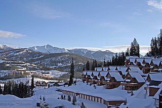
Trego, Montana

Last updated

Trego, Montana
USA Montana location map.svg
Red pog.svg
Trego
Usa edcp location map.svg
Red pog.svg
Trego
Coordinates: 48°42′19″N114°52′10″W / 48.70528°N 114.86944°W / 48.70528; -114.86944
Country United States
State Montana
County Lincoln
Area
[1]
  Total54.83 sq mi (142.01 km2)
  Land53.90 sq mi (139.61 km2)
  Water0.93 sq mi (2.40 km2)
Elevation
[2]
3,117 ft (950 m)
Population
 (2020)
  Total515
  Density9.55/sq mi (3.69/km2)
Time zone UTC-7 (Mountain (MST))
  Summer (DST) UTC-6 (MDT)
ZIP code
59934
Area code 406
GNIS feature ID792364 [2]
FIPS code 30-74725

Trego is an unincorporated community, and census-designated place (CDP), in Lincoln County, Montana, United States. As of the 2020 US Census, Trego has a population of 515. [3] Trego is located 1.5 miles west of US Highway 93 and serves as the gateway community to the Tobacco Valley when traveling from Flathead County heading north.

Contents

Geography

Trego is in northeastern Lincoln County and occupies a large portion of the valley of Fortine Creek and surrounding countryside. U.S. Route 93 runs along the northeast edge of the CDP, approximately 2.5 miles (4.0 km) northeast of the original railroad-station community of Trego, while the CDP extends southwest from the rail station up Fortine Creek for 10 miles (16 km). US 93 leads northwest 16 miles (26 km) to Eureka and southeast 35 miles (56 km) to Whitefish.

Trego is located about 25 miles south of the Roosville Border Crossing with British Columbia, Canada, 16 miles south of Eureka, Montana, 5 miles south of Fortine, Montana, and 7 miles north of Stryker, Montana.

According to the U.S. Census Bureau, the Trego CDP has a total area of 52.1 square miles (135.0 km2), of which 51.2 square miles (132.6 km2) are land and 0.9 square miles (2.4 km2), or 1.78%, are water. [4]

The Trego area is characterized by dense coniferous forests, open meadowlands, and abundance of small creeks and lakes. The landscape is dominated by the Whitefish Range, which lies just east of Highway 93, punctuated by Stryker Peak and Mount Marston.

Dickey Lake is the largest lake in Trego, followed by Murphy Lake, both of which offer recreational activities including boat ramps, campgrounds, hiking trails, and swimming beaches. Fortine Creek, the largest in Trego, offers recreation opportunities with public access.

Climate

The climate in Trego, MT is generally mild and temperate, with cold winters and warm summers. Temperatures range from an average high of 85 degrees Fahrenheit in the summer to an average low of 12 degrees Fahrenheit in the winter. During the spring and fall months, temperatures can range between 35 and 70 degrees Fahrenheit. Precipitation levels are fairly consistent throughout the year, with most months receiving around 2-3 inches of rain per month. Snowfall can range from a few inches to several feet, depending on the season. Overall, Trego experiences a pleasant climate year round that is ideal for outdoor activities like hiking and camping.

Trego, Montana gets 17 inches of rain, on average, per year. The US average is 38 inches of rain per year.

Trego averages 56 inches of snow per year. The US average is 28 inches of snow per year. [5]

History

The Fortin Family [6]

The Fortin's are the most notable family in Trego's history, being the first homesteaders to the region. In 1894, Octave Fortin and his family settled on 160 acres of meadowland just east of where "Trego" would eventually stand. This homestead would eventually become to be known as the OF Ranch (what today is known as Blarney Ranch). Octave's brother, Phillip Fortin, also homesteaded in the region, about four miles north of Octave's claim (what today is known as the Dunlap Hay Ranch).

The Fort Steele/Kalispell Trail bordered the Fortin Ranch along the eastern boundary, and remnants of this original Native American/horse/wagon trail are still visible on the ranch, as are the remnants of the original buildings the Fortin's constructed. Today, much of the trail was filled over and paved for modern day "Ant Flat Road."

Octave Fortin, and wife Lena, had five sons, Edward and Walter Ritter (Lena's sons from a previous marriage where their father, William Ritter, died), as well as Oscar, Philip, and Henry. The family primarily raised cattle on the ranch, but also produced other goods such as butter, milk, hay and grains.

Fortin to Fortine [6]

The town of Fortine, Fortine Creek, and Fortine Creek Road are named in honor of the Fortin Family, however there is discussion on how the "E" became affixed to the name Fortin, and has remained to this day. As told directly by Henry Fortin in his memoir, "The OF Ranch," he states, 'the true version of it was when some of the (Great Northern) railroad engineers asked Father (Octave) how he pronounced his name. He naturally pronounced it the French way, For - Tan. Since it was very difficult for Father to write, and even more difficult for him to spell his name, they asked him if it wasn't spelled Fortine. Being a little embarrassed and not wishing to discuss it further, Father replied, 'Oui Oui,' meaning, 'Yes Yes' in English, and so the name Fortine came into existence.' [6]

The Great Northern Railway "Town Swap"

When the Great Northern Railway came through this region in the early 1900s, and was completed in 1904, many of the rail stops and sidings were named, two of which were Trego and Fortine. There are many local rumors about how Trego should be Fortine and Fortine should be Trego, meaning the town names were swapped. This is attributed to an error by the Great Northern Railway. The error was acknowledged in an August 6, 1904 article of the Tobacco Plains Journal (now the Tobacco Valley News), stating, 'Harrisburg will disappear and Fortine will take its place, and Fortine is down as Trego.' [7] The confusion arises from an unnamed railroad engineer who mounted the sign "Trego" on what was supposed to be the Fortine station/siding, and mounted the "Fortine" sign on what was supposed to be the Trego station/siding. Once the mistake had been realized, the Great Northern Railway had already printed all of their maps, publications, and informational flyers detailing their new rail line from Kalispell/Whitefish to Eureka, so instead of re-printing everything and the great expense involved, they opted to just leave the names, which has remained to this day.

The Fortin Family Legacy on the Region

In 1905, Octave Fortin was one of the three founding members of Trego School District #53, which is still operating as a K-8 public school for the families of Trego.

On May 13, 1925, Octave was issued the first ever US Forest Service Grazing Permit for the Blackfeet National Forest, now known as the Kootenai National Forest, creating a legacy for area ranches that still is active to this day in Lincoln County, with 13 currently active US Forest Service grazing permit allotments for cattle. [8]

The town of Fortine, Fortine Creek, and Fortine Creek Road are all named in honor of Octave and his family. Also, what is now known as Marl Lake, just west of Fortine, was originally named Fortine Lake. [6]

Ant Flat Ranger Station

Little was known about Montana’s vast, unmapped wilderness when presidential proclamations set aside U.S. forest reserves during the 1890s. In 1904, this site became one of the region’s first year-round ranger stations. Ample water, land suitable for pasture and domestic gardens, proximity to heavy timberlands, and access to the Great Northern Railway made Ant Flat an ideal location.

President Theodore Roosevelt appointed his friend Fred Herrig, a decorated Rough Rider, its first ranger. The primitive facility grew and by the end of Herrig’s tenure in 1920, this strategically positioned district within the Blackfeet Forest Reserve was top-rated for fire detection, prevention, and control. Although no original log buildings remain at Ant Flat, lilac bushes Herrig planted mark the site of the first primitive headquarters.

The remaining buildings of the historic complex date to post 1920 when the Forest Service began to serve a wider traveling public. As use of national forests increased, the appearance of official facilities became more important and the Forest Service sought to harmonize its buildings with the environment. Ant Flat Station reflects these trends. The six-stall log barn (1921-1925) recalls the earlier construction phases and the importance of pack animals. The less “rustic” Craftsman style office/warehouse (1927), gas and oil storage building (1932), and garage and mechanic shop (1934) are a more formal expression of the Forest Service ethic. Ant Flat became a seasonal work center in 1963 but its presence chronicles the evolution of the Forest Service from its beginning through the formative 1920s and 1930s. [9]

Trego Community Hall

The Trego Community Hall, now known as the Trego, Fortine, Stryker (TFS) Community Hall was established in 1947 by a group of volunteers on land donated by the Opelt Family.

The Community Hall features tall ceilings, which were designed so it could host basketball games and the stage was built so music could be shared for dances and parties. During later years of expansion, a kitchen and front hallway were added, as well as running water and additional lighting, to allow the hall to continue to be a modern gathering place for the Trego community and the neighboring communities of Fortine and Stryker. [10]

The Community Hall hosts annual events such as the Easter Egg Hunt, the Bike-a-Thon, Trego Heritage Days, a Halloween Party, and the Trego Christmas Bazaar. [10]

Dickey Lake Bible Camp

In 1946, Pastors Arvid Erickson, Harold Erickson, Johnny Tieszen, Everett Hansen and local families from Trego, Fortine, Evergreen, and Ronan, Montana, joined with missionaries Ms. Anna Sontra and Ms. Belle Thompson of the CM&A working with the Flathead Indian Reservation, the local Ross McKenzie family, The Bible Club Ministry in Kalispell and other ministry minded families, to create a camp where they would minister to youth and adults. The setting was a parcel of land on the northwest shores of Dickey Lake in Trego, Montana, which is still in operation to this day. [11]

Arts and Culture

Each year, Trego plays host to several local events which celebrate the unique history and culture of the region, including the Backwoods Accordion Festival and the Trego Car Show held annually in July, as well as Trego Heritage Days, held annually in September.

Trego currently has one location listed on the National Register of Historic Places, the Ant Flat Ranger Station, which was officially designated in 1996. [12] Ant Flat Ranger Station is open to the public year-round and is located halfway between Fortine Creek Road and Highway 93 on Ant Flat Road.

Also at the Ant Flat Ranger Station is Ant Flat Nature Trail #348, which leads to a viewing platform allowing visitors to see a marshland ecosystem. This is a loop trail that is designed for wheelchair access to the platform, then foot travel for the remainder of the 1-mile, self-guided nature trail. Restrooms and picnicking areas are provided. [13]

Government Services

Trego has a United States Post Office, as well as the Trego, Fortine, Stryker Volunteer Fire Department, both of which are located adjacent to each other on Fortine Creek Road.

Education

Trego School District #53 offers K-8 education for local children. [14]

Related Research Articles

<span class="mw-page-title-main">Trinity County, California</span> County in California, United States

Trinity County is a county located in the northwestern portion of the U.S. state of California. Trinity County is rugged, mountainous, heavily forested, and lies along the Trinity River within the Salmon and Klamath Mountains. It is also one of three counties in California with no incorporated cities.

<span class="mw-page-title-main">Lincoln County, Montana</span> County in Montana, United States

Lincoln County is a county located in the U.S. state of Montana. As of the 2020 census, the population was 19,677. Its county seat is Libby. The county was founded in 1909 and named for President Abraham Lincoln. The county lies on Montana's north border and thus shares the US-Canadian border with the Canadian province of British Columbia.

<span class="mw-page-title-main">Lake Montezuma, Arizona</span> CDP in Yavapai County, Arizona

Lake Montezuma is a census-designated place (CDP) in Yavapai County in the U.S. state of Arizona. The population was 5,111 at the 2020 census. The CDP includes the communities of Rimrock and McGuireville. Located along Interstate 17, it is 20 miles (32 km) south of Sedona and 8 miles (13 km) north of Camp Verde in central Arizona's Verde Valley.

<span class="mw-page-title-main">Groveland-Big Oak Flat, California</span> Unincorporated community in California, United States

Groveland-Big Oak Flat is an unincorporated community and former census-designated place (CDP) in Tuolumne County, California, United States. The population was 3,388 at the 2000 census. This CDP included the communities of Groveland, Big Oak Flat and Pine Mountain Lake (PML).

<span class="mw-page-title-main">Bigfork, Montana</span> Unincorporated community in Montana, United States

Bigfork is a census-designated place (CDP) in Flathead County, Montana, United States. It is within Montana's Rocky Mountains. The population was 5,118 at the 2020 census, up from 4,270 in 2010.

<span class="mw-page-title-main">Whitehall, Montana</span> Town in Montana, United States

Whitehall is a town in Jefferson County, Montana, United States. The population was 1,006 at the 2020 census. It is part of the Helena Micropolitan Statistical Area.

<span class="mw-page-title-main">Fortine, Montana</span> Census-designated place in Montana, United States

Fortine is a census-designated place (CDP) in Lincoln County, Montana, United States. The population was 206 at the 2021 census.

<span class="mw-page-title-main">Lockwood, Montana</span> CDP in Montana, United States

Lockwood is a census-designated place (CDP) in Yellowstone County, Montana, United States. It is not an organized city or town. The population was 7,195 at the 2020 census.The population was 7,222 at the 2020 census. Lockwood is a suburb of Billings and is the second largest community in the Billings Metropolitan Statistical Area. Annexation of Lockwood to Billings has been studied; however, the June 2009 Billings City Council Annexation Plan states that the city has no plans to annex Lockwood in the foreseeable future. Lockwood is the site of a major Exxon refinery.

<span class="mw-page-title-main">Big Sky, Montana</span> Census-designated place in Montana, United States

Big Sky is an unincorporated census-designated place (CDP) in Gallatin and Madison counties in southwestern Montana, United States. As of the 2010 census it had a population of 2,308. It is 45 miles (72 km) southwest of Bozeman. This unincorporated community straddles both counties, is not considered a town, and does not have a town government. The primary industry of the area is tourism.

<span class="mw-page-title-main">Cinco Ranch, Texas</span> Census-designated place in Texas, United States

Cinco Ranch is a census-designated place and master-planned community located in the extraterritorial jurisdiction of the city of Houston within Fort Bend and Harris counties in the U.S. state of Texas. According to the United States Census Bureau, the CDP has a total area of 4.9 square miles (12.8 km2).The population was 16,899 at the 2020 census. It lies approximately 25 miles (40 km) west of the Harris County seat of Houston and 10 miles (16 km) north of the Fort Bend County seat of Richmond. Cinco Ranch is considered to be part of the Greater Katy area and is roughly 10 miles southeast of the city of Katy.

<span class="mw-page-title-main">Kootenai National Forest</span> National forest in Montana and Idaho, United States

The Kootenai National Forest is a national forest located in the far northwestern section of Montana and the northeasternmost lands in the Idaho panhandle in the United States, along the Canada–US border. Of the 2.2 million acres (8,900 km2) administered by the forest, less than 3 percent is located in the state of Idaho. Forest headquarters are located in Libby, Montana. There are local ranger district offices in Eureka, Fortine, Libby, Trout Creek, and Troy, Montana. About 53 percent of the 94,272-acre (381.51 km2) Cabinet Mountains Wilderness is located within the forest, with the balance lying in neighboring Kaniksu National Forest.

<span class="mw-page-title-main">Idaho Panhandle National Forests</span> National forests in Idaho, United States

The Idaho Panhandle National Forests are a jointly administered set of three national forests located mostly in the U.S. state of Idaho. In 1973, major portions of the Kaniksu, Coeur d'Alene, and St. Joe National Forests were combined to be administratively managed as the Idaho Panhandle National Forests (IPNF). The IPNF consists of more than 2.5 million acres (10,000 km2) of public lands in the panhandle of north Idaho, with small areas extending into eastern Washington (4.7%) and western Montana (1.2%). The northernmost portion of the IPNF share a boundary with Canada. The Forest Supervisor's office is located in Coeur d'Alene, Idaho with district office's in Bonners Ferry, Sandpoint, Priest River, Fernan and Smelterville, and St. Maries and Avery.

<span class="mw-page-title-main">Northern Transcon</span> Railroad route in the United States

The Northern Transcon, a route operated by the BNSF Railway, traverses the most northerly route of any railroad in the western United States. This route was originally part of the Chicago, Burlington and Quincy Railroad, Northern Pacific Railway, Great Northern Railway and Spokane, Portland and Seattle Railway systems, merged into the Burlington Northern Railroad system in 1970.

<span class="mw-page-title-main">Glenwood, New Mexico</span> Census-designated place in New Mexico, United States

Glenwood is a census-designated place in Catron County, New Mexico, United States. As of the 2010 census it had a population of 143. The area was founded in 1878 as Bush Ranch. Located near the San Francisco River, Glenwood is 61 miles (98 km) northwest of Silver City on U.S. Route 180, and is 38 miles (61 km) south of Reserve.

Babb is a small unincorporated farming and ranching community in Glacier County, Montana, United States, on the Blackfeet Indian Reservation. The community experiences a large influx of tourists in the summer months as it is the gateway to the Many Glacier area of Glacier National Park. For statistical purposes, the United States Census Bureau has defined Babb as a census-designated place (CDP). It had a population of 174 at the 2010 census.

<span class="mw-page-title-main">Stryker, Montana</span> Census-designated place in Montana, United States

Stryker is an unincorporated community and census-designated place (CDP) in Lincoln County, Montana, United States. As of the 2010 census it had a population of 26. Stryker has the 59933 ZIP code.

<span class="mw-page-title-main">Eagles Nest Wilderness</span> U.S. Wilderness Area in Colorado

The Eagles Nest Wilderness is a U.S. Wilderness Area located in the Gore Range near Vail, Copper Mountain, Frisco, Silverthorne, and Heeney, in Summit and Eagle Counties, Colorado. Eagles Nest Wilderness falls within the jurisdiction of Dillon Ranger District and Holy Cross Ranger District, White River National Forest. The 135,114-acre (546.79 km2) wilderness with 180 miles (290 km) of trails was established in 1976. In 2010, additional lands were proposed for wilderness protection under the Hidden Gems proposal, affecting Elliot Ridge, Tenmile, and Lower Piney areas of Summit and Eagle Counties.

<span class="mw-page-title-main">Ant Flat Ranger Station</span> United States historic place

The Ant Flat Ranger Station is a site on the National Register of Historic Places located 2 miles south of Fortine, Montana in Kootenai National Forest. It was added to the Register on December 30, 1996.

<span class="mw-page-title-main">Haigler Creek, Arizona</span> CDP in Gila County, Arizona

Haigler Creek is an unincorporated community and census-designated place (CDP) in northern Gila County, Arizona, United States. It lies at an elevation of 5,240 feet and is surrounded by the Tonto National Forest. As of the 2020 census, Haigler Creek had a population of 39 people.

References

  1. "ArcGIS REST Services Directory". United States Census Bureau. Retrieved September 5, 2022.
  2. 1 2 U.S. Geological Survey Geographic Names Information System: Trego, Montana
  3. "Total Population: 2020 Census DEC Summary File 1 (P1), Trego CDP, Montana". data.census.gov. U.S. Census Bureau. Retrieved February 12, 2024.
  4. "U.S. Gazetteer Files: 2019: Places: Montana". U.S. Census Bureau Geography Division. Retrieved April 29, 2020.
  5. Places, Best. "Best Places Trego, Montana Climate". Best Places. Retrieved February 14, 2024.
  6. 1 2 3 4 Fortin, Henry (1960). The OF Ranch. Trego, Mont.: Henry Fortin.
  7. Tobacco Plains Journal (August 6, 1904). "Tobacco Plains Journal".
  8. Sykes, Willie (May 13, 2022). "Livestock on National Forest System Lands". USFS. Retrieved February 14, 2024.
  9. Montana National Register Sign Program (February 14, 2024). "Ant Flat Ranger Station". Historic MT. Retrieved February 14, 2024.
  10. 1 2 "TFS Community Hall". February 13, 2024.
  11. "Dickey Lake Bible Camp History". Dickey Lake Bible Camp. February 16, 2024. Retrieved February 16, 2024.
  12. "Ant Flat Ranger Station". National Archives Catalog. December 30, 1996. Retrieved February 14, 2024.
  13. "Ant Flat Historic Site/Nature Trail 348". Visit MT. February 14, 2024. Retrieved February 14, 2024.
  14. "Trego School District 53". Trego School District 53. February 14, 2024. Retrieved February 14, 2024.