
Lincoln County is a county located in the U.S. state of Montana. As of the 2020 census, the population was 19,677. Its county seat is Libby. The county was founded in 1909 and named for President Abraham Lincoln. The county lies on Montana's north border and thus shares the US-Canadian border with the Canadian province of British Columbia.

Augusta is an unincorporated community and census-designated place (CDP) in Lewis and Clark County, Montana, United States. The population was 309 at the 2010 census and rose to 316 in the 2020 census. The most accepted version in the naming of this town is after Augusta Hogan, thought to be the first child born in this town, the daughter of J. D. Hogan, an early rancher.

Helena Valley Northeast is a census-designated place (CDP) in Lewis and Clark County, Montana, United States. The population was 2,995 at the 2010 census. It is part of the Helena Micropolitan Statistical Area.

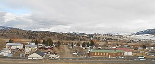
Fortine is a census-designated place (CDP) in Lincoln County, Montana, United States. The population was 206 at the 2021 census.

Lowesville is a census-designated place (CDP) in Lincoln County, North Carolina, United States. The population was 2,945 at the 2010 census, up from 1,440 in 2000.

Westport is an unincorporated community and census-designated place (CDP) located in Lincoln County, North Carolina, United States. The population of the CDP was 4,026 at the 2010 census, up from 2,006 at the 2000 census. The community's name comes from its location on the west side of Lake Norman.
Walton is an unincorporated community and census-designated place in Lancaster County, Nebraska, United States. Walton had a population of 306 as of the 2010 census. The headquarters of the Cornhusker Council of the Boy Scouts of America are located in Walton.
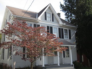
Falmouth is an unincorporated community and census-designated place (CDP) in Conoy Township, Lancaster County, Pennsylvania, United States. As of the 2010 census the population was 420, but the 2020 census shows that the population has decreased to 397.
Shindler is an unincorporated community and census-designated place (CDP) in Lincoln County, South Dakota, United States. The population was 607 at the 2020 census.

Stryker is an unincorporated community and census-designated place (CDP) in Lincoln County, Montana, United States. As of the 2010 census it had a population of 26. Stryker has the 59933 ZIP code.
Trego is an unincorporated community, and census-designated place (CDP), in Lincoln County, Montana, United States. As of the 2010 census it had a population of 541. Trego is located 1.5 miles west of Highway 93 and serves as the gateway community to the Tobacco Valley.
Craig is an unincorporated community and census-designated place (CDP) in Lewis and Clark County, Montana, United States. As of the 2010 census, the population was 43. Craig is located along Interstate 15 on the west side of the Missouri River, 43 miles (69 km) north of Helena, the state capital, and 47 miles (76 km) southwest of Great Falls.
Geyser is a small, unincorporated rural village in Judith Basin County, Montana, United States, southeast of Great Falls along U.S. Route 87.
Swan Lake is a census-designated place and unincorporated community in Lake County, Montana, United States. Its population was 113 as of the 2010 census.
Happys Inn is a census-designated place (CDP) in Lincoln County, Montana, United States. The population was 164 at the 2010 census.
Pioneer Junction is a census-designated place (CDP) in Lincoln County, Montana, United States. The population was 959 at the 2010 census.
Sylvanite is a census-designated place (CDP) in Lincoln County, Montana, United States. The population was 103 at the 2010 census.
West Kootenai is a census-designated place (CDP) in Lincoln County, Montana, United States. The population was 365 at the 2010 census.
Rader Creek is a census-designated place (CDP) in Jefferson County, Montana, United States. The population was 363 at the 2010 census.
South Hills is a census-designated place (CDP) in Jefferson County, Montana, United States. The population was 517 at the 2010 census.


