
Staffordshire is a landlocked ceremonial county in the West Midlands of England. It borders Cheshire to the north-west, Derbyshire and Leicestershire to the east, Warwickshire to the south-east, the West Midlands county and Worcestershire to the south, and Shropshire to the west. The largest settlement is the city of Stoke-on-Trent; the county town is Stafford.

Stoke-upon-Trent, also called Stoke, is one of the six towns that along with Hanley, Burslem, Fenton, Longton and Tunstall form the city of Stoke-on-Trent, in Staffordshire, England.
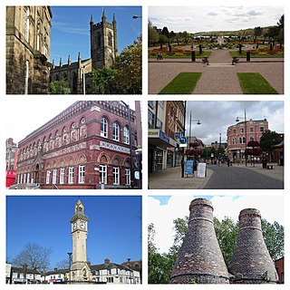
Stoke-on-Trent is a city and unitary authority area in Staffordshire, England, with an area of 36 square miles (93 km2). In 2021, the city had an estimated population of 258,400. It is the largest settlement in Staffordshire and is surrounded by the towns of Newcastle-under-Lyme, Alsager, Kidsgrove and Biddulph, which form a conurbation around the city.
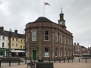
Newcastle-under-Lyme is a market town and the administrative centre of the Borough of Newcastle-under-Lyme in Staffordshire, England. It is adjacent to the city of Stoke-on-Trent. In 2021 the population was 75,082.

Kidsgrove is a town in the borough of Newcastle-under-Lyme, Staffordshire, England, on the Cheshire border. It is part of the Potteries Urban Area, along with Stoke-on-Trent and Newcastle-under-Lyme. It has a population of 26,276. Most of the town is in the Kidsgrove ward, whilst the western part is in Ravenscliffe.

Bramhall is an area in the Metropolitan Borough of Stockport, Greater Manchester, England. Historically in Cheshire, it had a population of 17,436 at the 2011 Census.

Burslem is one of the six towns that along with Hanley, Tunstall, Fenton, Longton and Stoke-upon-Trent form part of the city of Stoke-on-Trent in Staffordshire, England. It is often referred to as the "mother town" of Stoke on Trent.

Barlaston is a village and civil parish in the borough of Stafford in the county of Staffordshire, England. It is roughly halfway between the city of Stoke-on-Trent and the small town of Stone. According to the 2001 census the population of the parish was 2,659, rising at the 2011 Census to 2,858.

Smallthorne is an area in the city of Stoke-on-Trent in Staffordshire, England. It is in the north-east of the city, near Burslem. Smallthorne borders Bradeley and Chell in the north, Norton-in-the-Moors in the east, Sneyd Green in the south, and Burslem in the west.
Sneyd Green is an area in the city of Stoke-on-Trent, Staffordshire, England, in the north-east of the city, 1.5 miles (2.4 km) from Hanley. Sneyd Green borders Smallthorne in the north, Milton in the east, Birches Head in the south, and Cobridge in the west.

Clayton is a suburb and a ward in the Newcastle-under-Lyme district, in the county of Staffordshire, England.

Penkhull is a district of the city of Stoke-on-Trent, Staffordshire, England, part of Penkhull and Stoke electoral ward, and Stoke Central parliamentary constituency.

Cliff Vale is a district of the city of Stoke-on-Trent, and lies to the immediate south of Etruria and just east of Basford and Hartshill. Cliffe Vale is in the valley of the Fowlea Brook, now better known as Etruria Valley. There are industrial and employment uses along the A500, and new residential developments along the Trent and Mersey Canal. The Shelton New Road (B5045) passes through from east to west. The area is sometimes called Cliff Vale by the city council, and is part of the Hartshill electoral ward.
Blurton is a district in the south of Stoke-on-Trent, in the English county of Staffordshire. Hollybush, Old Blurton, Blurton Farm and Newstead are the names of the areas in which make up the town known as Blurton.
Norton le Moors is in the north-east of the city of Stoke-On-Trent, Staffordshire, England, mostly within the city boundary, with the rest in the Staffordshire Moorlands district.

Stoke Row is a village and civil parish in the Chiltern Hills, about 5 miles (8 km) west of Henley-on-Thames in South Oxfordshire and about 9 miles (14 km) north of Reading. The 2011 Census recorded the parish population as 651.

Goldenhill is an area on the northern edge of Stoke-on-Trent, in the Stoke-on-Trent district, in the ceremonial county of Staffordshire, England. It is centred along the High Street, part of the A50 road that runs from south-east to north-west. It is about 1 mile (1.6 km) north of Tunstall and 1.5 miles (2.4 km) south-east of Kidsgrove.

Chell is a suburb of the city of Stoke-on-Trent in the ceremonial county of Staffordshire, England, that can be subdivided into Little Chell, Great Chell and Chell Heath. It lies on the northern edge of the city, approximately 1-mile (1.6 km) from Tunstall, 2 miles (3.2 km) from Burslem and 3 miles (4.8 km) from the county border with Cheshire. Chell borders Pitts Hill to the west, Tunstall to the south west, Stanfield and Bradeley to the south, with the outlying villages of Packmoor and Brindley Ford to the north and Ball Green to the east. Since 2011 the area has been divided into the electoral wards of Bradeley & Chell Heath, Great Chell & Packmoor and Little Chell & Stanfield.

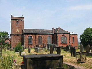
The church of St James-the-Less is in Uttoxeter Road, Longton, Staffordshire, Stoke-on-Trent, England.

