Series of walls surrounding the city of Genoa, Italy
Porta Soprana is the best-known gate of the ancient walls of Genoa. After major restorations carried out between the 19th and 20th centuries, it has regained the appearance it supposedly had at the time of the construction of the so-called Barbarossa walls (1150 ca.).
The walls of Genoa (mura di Genova in Italian, miage de Zena in Ligurian) constitute in their whole the several circles of walls that protected and defended the city of Genoa, former capital of the homonymous republic. To this day, large portions of these walls remain, and Genoa has more and longer walls than any other city in Italy.
In Roman times the original centre of Genoa, on the Sarzano hill, may have been defended by a wall, but there is no archaeological or documentary evidence of its existence.
The first known city walls were built in the 9th century, when thanks to Berengar II of Italy, the city gained wide autonomy, with subsequent economic development and a population increase. The first walls, which included Sarzano hill, had three gates: the Serravalle gate, at the north side of the church of San Lorenzo, another on the hill of Saint Andrew, near the site of the future Porta Soprana, and another one at the end of “Via Canneto il curto”, near the church of San Peter.
The settlement enclosed by the walls and the coastline occupied about twenty-two hectares. Some small settlements (housing mainly workmen and artisans), which had grown around churches, monasteries, and feudal palaces, remained outside the walls.
In 1155, this defensive wall was extended to the northwest to include the new settlements outside the walls. The walls culminated on the top of St. Andrew hill, with Porta Soprana.
The new walls greatly expanded the area contained within, compared to the previous one, including an area of 55 hectares.
The construction of the walls dragged until 1163; in that year, the international political situation and particularly relations with emperor Frederick Barbarossa led to an acceleration of work, as attested to by Caffaro, and the work was completed in 53 days thanks to the effort of the entire population.
The three main gates had a monumental look, with high semicircular towers. Two of them survive to this day: “Porta Soprana” and “Porta dei Vacca”; the third one, Porta Aurea ("Golden Gate"), already partially demolished in the 18th century, was completely demolished in the second half of the 20th century. In the 13th century, the Old Pier peninsula, at the southern limit of the port, was also included inside the walls, thus completing the fortifications on the sea side of the city.
The 14th century expansion
Map of the city walls in the 14th century
In the 14th century, urban expansion of the city, caused by the increase in commercial activity, led to a new extension of walls to encompass the new quarters which stood to the west and east of the original city centre.
Between 1320 and 1327, the east side of the walls was extended to include Carignano Hill, passing where now are the esplanade of Acquasola and the Monumental Bridge. This wall section had two gates: Porta dell'Acquasola and Porta degli Archi. Hence, the ancient walls, still visible, continue with the names of Mura of Santa Chiara, Mura del Prato, and Mura delle Cappuccine, ending with a cliff overlooking the sea.
From 1347 and 1350, another extension was built toward the west, from the fort of Castelletto to the new St. Thomas Gate, near the present Principe railway station. This stretch of walls included a series of towers and gates which no longer exist (Carbonara, Pietraminuta, St. George, the above-mentioned St. Thomas Gate, and another tower in the place where today stands Castello d'Albertis). After this enlargement, the city wall ran for 4,550 meters, containing an area of 155 hectares.
The walls in the 16th century
In the 16th century, the walls were no longer able to withstand an attack by modern firearms, so they were modified to create new Star forts.
Map of the 16th-century walls with the new curtains and gates along the port area
In 1528, Andrea Doria placed the Republic of Genoa under the protection of the Spaniards. Fearing the possibility of new attacks by the French army, he promoted the modernization of the city walls, projected by Giovanni Maria Olgiati[it] and carried out in the third decade of the 16th century. The “Barbarossa walls” and their 14th-century extensions were modernized by replacing the old square towers with triangular bastions and building new curtains with a counterscarp profile.
A set of walls was also built along the sea, including the entire shoreline between the St. Thomas Gate and the Molo Vecchio (Old Pier). In this stretch of wall, new gates were created, one for each pier of the port. At the end of Molo Vecchio in the second half of the century, Galeazzo Alessi designed Porta Siberia, an example of Renaissance military architecture. From here, the walls are linked to those already existing on the sea side of Sarzano and Carignano hills, and they reach the mouth of Bisagno stream. Of the three main gates of the 16th-century walls, Porta Siberia and the Porta degli Archi (moved from the original location for the opening of Via XX Settembre) still stand today, while the St. Thomas Gate was demolished to build the Principe railway station.
The Mura Nuove (New Walls)
Map of Genoa with the New Walls
The “Mura Nuove” (New Walls) are the last and most imposing walls built along the ridge of the hills encircling downtown Genoa, and were built in the first half of the 17th century.
The view of Genoa from the sea is characterized by the line of New Walls with their fortifications, on the ridge of the hills, above the hilly quarters which grew after World War II; coming from the north, by train or car, the first visible structure is the mass of Fort Diamante, high on the mount on the left bank of the Val Polcevera, and the Fort Fratello Minore. Shortly after, on the ridge in the distance is Fort Begato, included in the line of bastions that rise up to the top of Mount Peralto, where sits Fort Sperone with its high walls.
The “New Walls”, the last and largest city walls, were built starting in 1626, after the repeated attempts of Charles Emmanuel I of Savoy to invade Genoa had convinced the government of the need for new and more powerful defensive walls.
Although this defensive wall had already been suggested in 1568, the government of Genoa began the work in 1626, following the failed attack on 10 May 1625 of a French-Piedmontese army at the Pertuso Pass (where, in memory of the event, was later built the Shrine of Nostra Signora della Vittoria, meaning "Our Lady of Victory").
In less than four years, between 1629 and 1633, an army of diggers, bricklayers, and stonemasons (eight hundred, according to some sources, even three thousand according to others), divided into twenty-eight teams, raised curtains and bastions along the two ridges overlooking the valleys of Polcevera and Bisagno.
The “New Walls” extended for almost twenty kilometers, of which seven were along the coastline. Their construction caused the incorporation of the quarter of San Teodoro within the walls. The walls, seen from above, have a triangular shape, the vertices being Mount Peralto, the lighthouse, and the mouth of the Bisagno stream.
Fortifications beginning from the Lighthouse of Genoa climb Granarolo Hill then reach mount Peralto, where the curtains overlooking Val Polcevera and those overlooking Val Bisagno meet; then they descend the plain along the final stretch of the Bisagno, protected by powerful bastions known as “Fronti Basse”. The waterfront was completed to defend the coastline from the lighthouse up to the western limit of the old walls (St. Thomas Gate).
This structure was built on the hills even on steep slopes, in areas still sparsely populated today. This has contributed to their preservation, while the sections closest to the city were mostly demolished for the construction of new quarters and other infrastructure.
The length of the “New Walls” reached 19,560 meters, enclosing an area of 903 hectares (nearly five times the 197 hectares included in the ”old walls” until the 16th century).[2]
The Eastern ridge
The Eastern ridge
From Fort Sperone, after a short stretch towards the southeast (Peralto Walls), the walls meet Fort Castellaccio and then different section of walls, named “Chiappe”, “Sant'Erasmo”, “San Bernardino”, and “Zerbino”, ending above Brignole railway station. The section of walls which used to stand here, named "Walls of Montesano", were demolished in the 19th century to allow construction of the railway station.
The city's urban expansion eastward in the last decades of the 19th century caused the demolition of one of the most powerful and evocative parts of the New Walls, the so-called “Fronti Basse”, a huge rampart that ran straight, with two large bastions in the plain on the right bank of the Bisagno. This large structure linked the New Walls with the “Sixteenth century walls” from the place where now stands the railway station, up to the “Walls of Prato”.
In the "Fronti Basse" there were two gates, the monumental Porta Pila (by Bartolomeo Bianco), at the end of Via Giulia (due to the completion of Via XX Settembre the gate was moved behind Brignole station), and "Porta Romana", at the end of Via San Vincenzo, where the ancient road to the east quarters began.
The Western ridge
The Western ridge
From the top of Mount Peralto, where Fort Sperone sits, walls come down towards the southwest in a straight line to Fort Begato, then continue to fall along the panoramic road which runs along the curtain walk, taking first the name "Walls of Granarolo" near the gate of the same name, then “Walls of Monte Moro”. After Fort Tenaglia, the walls continue as "Walls of Porta Murata" to reach the “Angeli Gate” and the “Walls of Angeli”, where nowadays they stop abruptly due to the excavation, in the 1930s, of San Benigno Hill, an imposing rocky ridge where formerly stood the church and monastery of San Benigno, later turned into barracks. The “walls of San Benigno” ran along the ridge of this hill and went to the lighthouse of Lanterna and the Lanterna Gate.
View of Genoa with San Benigno hill, its walls and barracks in an image from the 19th century
The waterfront
“Porta Nuova”, the 19th-century gate near the Lanterna
With the 17th-century expansion, the walls along the coast were reinforced with new bastions and extended beyond St. Thomas Gate to Capo Faro, where they met those descending along the western ridge. Due to port expansion, most of the walls along the sea were demolished; only a short stretch survives, recently enhanced with a walk from the ferry terminal to the lighthouse. Close by the lighthouse there was the monumental Lantern Gate, projected by Antonio Ponsonelli, built in 1633, and demolished in 1830 following the construction of a new gate a short distance away, “Porta Nuova” (New Gate), which was better suited to increased traffic.
The fortresses
During the 18th century and the first half of the 19th, along the perimeter of the walls were built some fortifications, including Castellaccio, Sperone (on the top of Mount Peralto), Begato, and Tenaglia. Other forts were built in different periods on the hills outside the city walls and along the ridge on the left bank of Val Bisagno. Most of the Genoese fortifications (a total of 16) are still visible and some of them also visited.
In the second half of the 18th century, immediately after the Austrian siege of 1747, the fortifications were expanded with the construction of four fortresses external to the walls: Diamante, Quezzi, Richelieu, and Santa Tecla, designed by French military engineers Jacques De Sicre and Pierre De Cotte.
During the siege of Genoa of April 1800, these forts were the site of many harsh battles between French and Austrian armies.
After the annexation of the Napoleonic Ligurian Republic to the Kingdom of Sardinia, decided by the Congress of Vienna in 1814, the Savoy government (1815–1840) built a series of forts, towers, and coastal batteries, making Genoa the best equipped fortress in the Mediterranean. The designer of this last phase of construction of the Genoese fortifications was major Giulio D'Andreis.
Forts along the perimeter of the New Walls include:
Fort San Giuliano (now headquarters of the Provincial Command of the Carabinieri)
Fort San Martino
Fort Santa Tecla
Fort Quezzi
Fort Richelieu
Fort Monteratti
Fort Sperone
19th-century towers
In 1820, the Engineering Military Corps of the Kingdom of Sardinia started to build a set of towers, external to the walls, similar to Martello towers. A few years later, due to cost and low usefulness, their construction was stopped. Only three of them were completed: Torre Quezzi, Torre San Bernardino, and Torre Zerbino (the last one no longer existing). Others still exist in the condition in which they were left when the work was stopped, missing the second floor and the roof.
Granarolo tower
New Walls today
The new walls and forts, once the purposes for which they were planned were gone, were decommissioned from military property in 1914. After this date, some of these structures were used as warehouses, jails for prisoners of war during World War I, anti-aircraft emplacements, or houses for evacuees during World War II. Others were given to private ownership or left abandoned. Nowadays, although they are public property, their condition is not uniform: the main fortresses have recently been restored and may be visited on request, others, even if in a state of decay, are freely visited, and some of them host television or cellphone towers.
The only fort still used by a military institution is Fort San Giuliano, which overlooks Corso Italia, in the quarter of Albaro, now headquarters of the Provincial Command of the Carabinieri.
The "New Walls" and the forts are now included in the "Parco Urbano delle Mura" (City Park of Walls), having a surface of 876 hectares, which is the largest green "lung" of Genoa, and provides the possibility of different excursions of historic and wildlife interest.[3]
Related Research Articles
A defensive wall is a fortification usually used to protect a city, town or other settlement from potential aggressors. The walls can range from simple palisades or earthworks to extensive military fortifications with towers, bastions and gates for access to the city. From ancient to modern times, they were used to enclose settlements. Generally, these are referred to as city walls or town walls, although there were also walls, such as the Great Wall of China, Walls of Benin, Hadrian's Wall, Anastasian Wall, and the Atlantic Wall, which extended far beyond the borders of a city and were used to enclose regions or mark territorial boundaries. In mountainous terrain, defensive walls such as letzis were used in combination with castles to seal valleys from potential attack. Beyond their defensive utility, many walls also had important symbolic functions – representing the status and independence of the communities they embraced.
City Gate is a gate located at the entrance of Valletta, Malta. The present gate, which is the fifth one to have stood on the site, was built between 2011 and 2014 to designs of the Italian architect Renzo Piano.
Albaro is an affluent residential neighbourhood of the Italian city of Genoa, located 3 kilometres (1.9 mi) east of the city centre. It was formerly an independent comune, named San Francesco d'Albaro, included in the city of Genoa in 1873. At present, together with the neighbourhoods of Foce and San Martino d'Albaro is part of the Genoa's city VIII Municipio.
The Cottonera Lines, also known as the Valperga Lines, are a line of fortifications in Cospicua and Birgu, Malta. They were built in the 17th and 18th centuries to form the outer defences of the Three Cities of Birgu, Senglea and Cospicua. They surrounded an earlier line of fortifications, known as the Santa Margherita Lines.
The Walls of Padua are a complex of defensive works around the Italian city of Padua, designed to defend it from hostile attack. It was built in 4 phases.
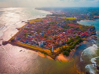
Galle Fort, in the Bay of Galle on the southwest coast of Sri Lanka, was built first in 1588 by the Portuguese, then extensively fortified by the Dutch during the 17th century from 1649 onwards. It is a historical, archaeological and architectural heritage monument, which even after more than 432 years maintains a polished appearance, due to extensive reconstruction work done by Archaeological Department of Sri Lanka.
The Venetian Walls are a series of defensive walls which surround Nicosia the capital city of Cyprus. The first city walls were built in the Middle Ages, but they were completely rebuilt in the mid-16th century by the Republic of Venice. The walls are still largely intact, and are among the best preserved Renaissance fortifications in the Eastern Mediterranean. They are a major tourist attraction.
The Janiculum walls are a stretch of defensive walls erected in 1643 by Pope Urban VIII as a completion of the Leonine wall and for a better protection of the area of Rome rising on the right bank of the Tiber.
The Santa Margherita Lines, also known as the Firenzuola Lines, are a line of fortifications in Cospicua, Malta. They were built in the 17th and 18th centuries to protect the land front defences of the cities of Birgu and Senglea. A second line of fortifications, known as the Cottonera Lines, was later built around the Santa Margherita Lines, while the city of Cospicua was founded in the 18th century within the Santa Margherita and Cottonera Lines.
The fortifications of Valletta are a series of defensive walls and other fortifications which surround Valletta, the capital city of Malta. The first fortification to be built was Fort Saint Elmo in 1552, but the fortifications of the city proper began to be built in 1566 when it was founded by Grand Master Jean de Valette. Modifications were made throughout the following centuries, with the last major addition being Fort Lascaris which was completed in 1856. Most of the fortifications remain largely intact today.
The fortifications of Birgu are a series of defensive walls and other fortifications which surround the city of Birgu, Malta. The first fortification to be built was Fort Saint Angelo in the Middle Ages, and the majority of the fortifications were built between the 16th and 18th centuries by the Order of Saint John. Most of the fortifications remain largely intact today.
The fortifications of Senglea are a series of defensive walls and other fortifications which surround the city of Senglea, Malta. The first fortification to be built was Fort Saint Michael in 1552, and the majority of the fortifications were built over the next decade when it was founded by Grand Master Claude de la Sengle. Modifications continued until the 18th century, but large parts of the fortifications were demolished between the 19th and 20th centuries. Today, all that remain of Senglea's fortifications are the seaward bastions and part of the land front.
The Real Cittadella was a fort in Messina, Sicily. The Cittadella was built between 1680 and 1686 by the Spanish Empire, and it was considered to be one of the most important fortifications in the Mediterranean. Most of the fort was demolished in the 20th century, but some parts can still be seen.
Forte del Santissimo Salvatore, also known as Castello del Santissimo Salvatore, is a fort in Messina, Sicily. It was built in the mid-16th century, and it is still military property. Some of its walls were demolished after the earthquake of 1908, but the rest of the fort is still intact.
The fortifications of Chania are a series of defensive walls and other fortifications which surround the city of Chania in Crete, Greece. The inner city walls were first built in antiquity, and were rebuilt by the Byzantine Empire. The outer walls were built in the 16th century by the Republic of Venice. Some of the fortifications were demolished in the 20th century, but parts of both the Byzantine and Venetian walls remain intact.
The term Great Genoa refers to the present area of the municipality of Genoa, in the north west of Italy. Great Genoa extends for over 30 km along the coast of Ligurian Sea from Nervi to Voltri, and up the Polcevera valley of the Polcevera river and the Bisagno river valley of the Bisagno river.
Prè is a neighbourhood in the old town of the Italian city of Genoa. It was one of the six sestieri of ancient Genoa. At present it is part of the Genoa's city I Municipio. Located close to the old harbour, it is likely the best-known neighbourhood of the old town of Genoa.
Forte Sperone is a fortification included in the "New Walls" built to defend the Italian city of Genoa, located on top of Mount Peralto. The union of two walls, one on the side of Val Polcevera and the other on the side of Val Bisagno, gives the fort the appearance of the bow of a ship, from which its name derives. Due to its dominant position, it was one of the most important structures of the fortifications of Genoa.
The Walls of Grosseto, known also as Medicean Walls, are a series of defensive brick walls surrounding the city of Grosseto in southern Tuscany, Italy.
References
↑ Bartolomeo Bianco projected in Genoa some of Via Balbi palaces and worked with De Mari also to the walls of Vado Ligure.
↑ Riccardo Dellepiane, Mura e fortificazioni di Genova, Nuova Editrice Genovese, Genoa, 1984 (reprinted in 2008, ISBN978-88-88963-22-8), page 65
This page is based on this Wikipedia article Text is available under the CC BY-SA 4.0 license; additional terms may apply. Images, videos and audio are available under their respective licenses.