Ward, New York

Last updated

Ward, New York
USA New York location map.svg
Red pog.svg
Ward
Location within the state of New York
Coordinates: 42°13′30″N77°54′5″W / 42.22500°N 77.90139°W / 42.22500; -77.90139
Country United States
State New York
County Allegany
Government
  Type Town council
   Town supervisor James Lucey (D)
  Town council
Members' list
Area
[1]
  Total29.19 sq mi (75.61 km2)
  Land29.18 sq mi (75.56 km2)
  Water0.02 sq mi (0.04 km2)
Elevation
2,211 ft (674 m)
Population
 (2020) [2]
  Total331 Decrease2.svg
  Estimate 
(2021) [2]
329
  Density12.17/sq mi (4.70/km2)
Time zone UTC-5 (Eastern (EST))
  Summer (DST) UTC-4 (EDT)
FIPS code 36-003-78201
GNIS feature ID0979596 [3]

Ward is a town in Allegany County, New York, United States. The population was 331 at the 2020 census. [2] The town was named after Hamilton Ward.

Contents

The town is in the southeast quadrant of the county, north of the village of Wellsville.

History

The first settler arrived around 1817. The town of Ward was created in 1856 from parts of the towns of Alfred and Amity.

The only significant community, Phillips Creek, was first settled between 1830 and 1835.

In the summer of 1838, a violent windstorm caused destruction of property and loss of life.

Geography

According to the United States Census Bureau, the town has a total area of 29.2 square miles (76 km2), of which 29.2 square miles (76 km2) is land and 0.03% is water.

NY 244 is a major east–west highway through the north part of the town.

Demographics

Historical population
CensusPop.Note
1860 877
1870 745−15.1%
1880 620−16.8%
1890 567−8.5%
1900 547−3.5%
1910 496−9.3%
1920 400−19.4%
1930 299−25.2%
1940 250−16.4%
1950 239−4.4%
1960 234−2.1%
1970 27115.8%
1980 36233.6%
1990 334−7.7%
2000 39016.8%
2010 368−5.6%
2020 331−10.1%
2021 (est.)329 [2] −0.6%
U.S. Decennial Census [4]

As of the census [5] of 2000, there were 390 people, 133 households, and 107 families residing in the town. The population density was 13.4 people per square mile (5.2/km2). There were 244 housing units at an average density of 8.4 per square mile (3.2/km2). The racial makeup of the town was 97.69% White, 1.03% African American and 1.28% Asian.

There were 133 households, out of which 41.4% had children under the age of 18 living with them, 70.7% were married couples living together, 6.8% had a female householder with no husband present, and 18.8% were non-families. 14.3% of all households were made up of individuals, and 6.0% had someone living alone who was 65 years of age or older. The average household size was 2.88 and the average family size was 3.19.

In the town, the population was spread out, with 30.3% under the age of 18, 6.7% from 18 to 24, 28.2% from 25 to 44, 24.9% from 45 to 64, and 10.0% who were 65 years of age or older. The median age was 36 years. For every 100 females, there were 93.1 males. For every 100 females aged 18 and over, there were 98.5 males.

The median income for a household in the town was $40,750, and the median income for a family was $41,000. Males had a median income of $30,000 versus $22,292 for females. The per capita income for the town was $15,271. About 12.9% of families and 14.9% of the population were below the poverty line, including 16.7% of those under age 18 and 2.6% of those age 65 or over.

Communities and locations in Ward

Related Research Articles

<span class="mw-page-title-main">Bear Creek, Alabama</span> Town in Alabama, United States

Bear Creek is a town in Marion County, Alabama, United States. It incorporated in 1907, although the 1910 U.S. Census records indicated 1909. At the 2020 census, the population was 1,047.

<span class="mw-page-title-main">Randolph, Kansas</span> City in Riley County, Kansas

Randolph is a city in Riley County, Kansas, United States. As of the 2020 census, the population of the city was 159.

<span class="mw-page-title-main">Wallagrass, Maine</span> Town in the state of Maine, United States

Wallagrass is a town in Aroostook County, Maine, United States. The population was 519 at the 2020 census.

<span class="mw-page-title-main">Beaver Creek, Minnesota</span> City in Minnesota, United States

Beaver Creek is a city in Rock County, Minnesota, United States. The town was platted in 1877 and named for the large number of beavers which were caught along the nearby creek throughout the late 1800s.

Ashley Township is a township in Stearns County, Minnesota, United States. The population was 262 at the 2010 census.

<span class="mw-page-title-main">Cedar Creek, Nebraska</span> Village in Nebraska, United States

Cedar Creek is a village in Cass County, Nebraska, United States. The population was 465 at the 2020 census.

<span class="mw-page-title-main">Amity, Allegany County, New York</span> Town in New York, United States

Amity is a town in Allegany County, New York, United States. The population was 2,185 at the 2020 census. The name of the town means "friendship."

<span class="mw-page-title-main">North Enid, Oklahoma</span> Town in Oklahoma, United States

North Enid is a town in Garfield County, Oklahoma, United States. The population was 860 at the 2010 census. The town is served by the Chisholm school district. North Enid was the original railroad town site in the Enid–Pond Creek Railroad War.

<span class="mw-page-title-main">Gibson Township, Cameron County, Pennsylvania</span> Township in Pennsylvania, United States

Gibson Township is a township in Cameron County, Pennsylvania, United States. The population was 178 at the 2020 census, up from 164 in 2010, which in turn was a decline from the figure of 222 in 2000.

<span class="mw-page-title-main">Beech Creek Township, Pennsylvania</span> Township in Pennsylvania, United States

Beech Creek Township is a township in Clinton County, Pennsylvania, United States. The population was 966 at the 2020 census.

<span class="mw-page-title-main">Rich Creek, Virginia</span> Town in Virginia, United States

Rich Creek is a town in Giles County, Virginia, United States. The population was 774 as per the 2010 census, up from 665 as per the 2000 census. It is part of the Blacksburg–Christiansburg Metropolitan Statistical Area.

<span class="mw-page-title-main">Mill Creek, West Virginia</span> Town in West Virginia, United States

Mill Creek is a town in Randolph County, West Virginia, United States, along the Tygart Valley River. The population was 563 at the 2020 census.

<span class="mw-page-title-main">Reedy, West Virginia</span> Town in West Virginia, United States

Reedy is a town in Roane County, West Virginia, United States. The population was 152 at the 2020 census.

<span class="mw-page-title-main">Flemington, West Virginia</span> Town in West Virginia, United States

Flemington is a town in Taylor County, West Virginia, United States. The population was 311 at the 2020 census. Flemington was incorporated in 1922 by the West Virginia Circuit Court, and named for James Fleming, an early settler in the area originally from Hampshire County.

<span class="mw-page-title-main">New Martinsville, West Virginia</span> City in West Virginia, United States

New Martinsville is a city in and the county seat of Wetzel County, West Virginia, United States, along the Ohio River. The population was 5,186 at the 2020 census.

Sioux Creek is a town in Barron County in the U.S. state of Wisconsin. The population was 655 at the 2010 census.

<span class="mw-page-title-main">Sand Creek, Wisconsin</span> Town in Wisconsin, United States

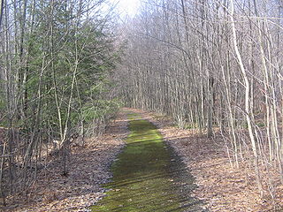
Sand Creek is a town in Dunn County, Wisconsin, United States. The population was 586 at the 2000 census. The unincorporated community of Sand Creek lies within the town, on the Red Cedar River.

<span class="mw-page-title-main">Plymouth, Juneau County, Wisconsin</span> Town in Wisconsin, United States

Plymouth is a town in Juneau County, Wisconsin, United States. The population was 639 at the 2000 census.

<span class="mw-page-title-main">Bergen, Marathon County, Wisconsin</span> Town in Wisconsin, United States

Bergen is a town in Marathon County, Wisconsin, United States. It is part of the Wausau, Wisconsin Metropolitan Statistical Area. The population was 740 at the 2020 census. The unincorporated community of Moon is located partially in the town.

<span class="mw-page-title-main">Rose, Wisconsin</span> Town in Wisconsin, United States

Rose is a town in Waushara County, Wisconsin, United States. The population was 595 at the 2000 census. The unincorporated community of Heffron is located partially in the town.

References

  1. "2016 U.S. Gazetteer Files". United States Census Bureau. Retrieved July 4, 2017.
  2. 1 2 3 4 Bureau, US Census. "City and Town Population Totals: 2020—2021". Census.gov. US Census Bureau. Retrieved October 3, 2022.
  3. "US Board on Geographic Names". United States Geological Survey. October 25, 2007. Retrieved January 31, 2008.
  4. "Census of Population and Housing". Census.gov. Retrieved June 4, 2015.
  5. "U.S. Census website". United States Census Bureau . Retrieved January 31, 2008.