Wellington Parish, New Brunswick

Last updated

Wellington
St-Edouard-de-Kent NB.JPG
Saint-Édouard-de-Kent
Kent County NB - Wellington Parish.PNG
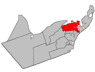
Location within Kent County, New Brunswick.
Coordinates: 46°31′30″N64°44′42″W / 46.525°N 64.745°W / 46.525; -64.745
Country Flag of Canada (Pantone).svg  Canada
Province Flag of New Brunswick.svg  New Brunswick
County Kent County
Erected1814
Area
[1]
  Land184.80 km2 (71.35 sq mi)
Population
 (2021) [1]
  Total3,292
  Density17.8/km2 (46/sq mi)
  Change 2016-2021
Increase2.svg 6.9%
  Dwellings
1,747
Time zone UTC-4 (AST)
  Summer (DST) UTC-3 (ADT)
Figures do not include portion within the town of Bouctouche, the Buctouche 16 Indian reserve, and the rural community of Cocagne

Wellington is a geographic parish in Kent County, New Brunswick, Canada. [4]

Contents

For governance purposes it is divided between the towns of Champdoré and Grand-Bouctouche, the village of Five Rivers, [lower-alpha 1] and the incorporated rural community of Beausoleil, [5] all of which are members of the Kent Regional Service Commission, [6] and the Buctouche 16 Indian reserve, which is not.

Prior to the 2023 governance reform, the parish was divided between the town of Bouctouche, [7] the Indian reserve, the incorporated rural community of Cocagne, and the local service districts of Grand Saint-Antoine, Sainte-Anne-de-Kent and the parish of Wellington, which included areas with enhanced services named Bouctouche Cove, Desroches, Dixon Point-Route 134, Wellington - Dixon Point-Route 134, and Saint-Grégoire. [8] Bouctouche and Sainte-Anne-de-Kent became part of Grand-Bouctouche, Grand Saint-Antoine part of Champdoré, Cocagne part of Beaulsoleil, and the LSD of the parish of Wellington was split between all four new municipalities.

Origin of name

The parish was named for the Marquess of Wellington, [lower-alpha 2] British commander in the Peninsular War. [9]

History

Wellington was erected in 1814 as part of Northumberland County from Newcastle Parish. [10] It included modern Dundas and Sainte-Marie Parishes plus most of Saint-Paul Parish.

In 1827 Dundas was erected as its own parish, [11] with the Mahalawodiac River forming the boundary between the two.

In 1828 the boundary with Dundas was altered, moved south to run along grant lines south of Després Road in the east and then straight west. [12]

In 1862 the boundary with Dundas was altered to its modern course. [13]

In 1867 Sainte-Marie was erected from the western part of Wellington, including modern Saint-Paul. [14]

In 1871 the Renauds Mills area was returned from Sainte-Marie. [15]

Boundaries

Wellington Parish is bounded: [2] [16] [17]

Communities

Communities at least partly within the parish. [16] [17] [20] bold indicates an incorporated municipality or Indian reserve

Bodies of water

Bodies of water [lower-alpha 5] at least partly within the parish. [16] [17] [20]

Other notable places

Parks, historic sites, and other noteworthy places at least partly within the parish. [16] [17] [20]

Demographics

Parish population total does not include Bouctouche, Buctouche 16, and portion within Cocagne (after 2011)

See also

Notes

  1. Maps still visible as thumbnails show the current and previous governance boundaries. [5]
  2. Wellington was raised to Duke two months after the parish was erected.
  3. By the magnet of 1850, [18] when declination in the area was between 21º and 22º west of north. [19]
  4. By the magnet of 1862, [13] when declination in the area was between 21º and 22º west of north. [19]
  5. Not including brooks, ponds or coves.

Related Research Articles

<span class="mw-page-title-main">Saumarez Parish, New Brunswick</span> Parish in New Brunswick, Canada

Saumarez is a geographic parish in Gloucester County, New Brunswick, Canada.

<span class="mw-page-title-main">Moncton Parish, New Brunswick</span> Parish in New Brunswick, Canada

Moncton is a geographic parish in Westmorland County, New Brunswick, Canada.

<span class="mw-page-title-main">Dundas Parish, New Brunswick</span> Parish in Canada

Dundas is a geographic parish in Kent County, New Brunswick, Canada.

<span class="mw-page-title-main">Richibucto Parish, New Brunswick</span> Parish in New Brunswick, Canada

Richibucto is a geographic parish in Kent County, New Brunswick, Canada.

<span class="mw-page-title-main">Queensbury Parish, New Brunswick</span> Parish in New Brunswick, Canada

Queensbury is a geographic parish in York County, New Brunswick, Canada.

<span class="mw-page-title-main">Hardwicke Parish, New Brunswick</span> Parish in New Brunswick, Canada

Hardwicke is a geographic parish in Northumberland County, New Brunswick, Canada.

<span class="mw-page-title-main">Caraquet Parish, New Brunswick</span> Parish in New Brunswick, Canada

Caraquet is a geographic parish in Gloucester County, New Brunswick, Canada.

<span class="mw-page-title-main">Madawaska Parish, New Brunswick</span> Parish in New Brunswick, Canada

Madawaska is a geographic parish in Madawaska County, New Brunswick, Canada.

<span class="mw-page-title-main">Saint-Basile Parish, New Brunswick</span> Parish in New Brunswick, Canada

Saint-Basile is a geographic parish in Madawaska County, New Brunswick, Canada.

<span class="mw-page-title-main">Sainte-Anne Parish, New Brunswick</span> Parish in New Brunswick, Canada

Sainte-Anne is a geographic parish in Madawaska County, New Brunswick, Canada.

<span class="mw-page-title-main">Saint-Léonard Parish, New Brunswick</span> Parish in New Brunswick, Canada

Saint-Léonard is a geographic parish in Madawaska County, New Brunswick, Canada.

<span class="mw-page-title-main">Glenelg Parish, New Brunswick</span> Parish in New Brunswick, Canada

Glenelg is a geographic parish in Northumberland County, New Brunswick, Canada.

<span class="mw-page-title-main">Carleton Parish, New Brunswick</span> Parish in New Brunswick, Canada

Carleton is a geographic parish in Kent County, New Brunswick, Canada.

<span class="mw-page-title-main">Saint-Louis Parish, New Brunswick</span> Parish in New Brunswick, Canada

Saint-Louis is a geographic parish in Kent County, New Brunswick, Canada.

<span class="mw-page-title-main">Sainte-Marie Parish, New Brunswick</span> Parish in New Brunswick, Canada

Saint-Marie, is a geographic parish in Kent County, New Brunswick, Canada.

<span class="mw-page-title-main">Saint-Paul Parish, New Brunswick</span> Parish in New Brunswick, Canada

Saint-Paul is a geographic parish in Kent County, New Brunswick, Canada.

<span class="mw-page-title-main">Saint Marys Parish, New Brunswick</span> Parish in New Brunswick, Canada

Saint Marys is a geographic parish in York County, New Brunswick, Canada.

<span class="mw-page-title-main">Shediac Parish, New Brunswick</span> Parish in New Brunswick, Canada

Shediac is a geographic parish in Westmorland County, New Brunswick, Canada.

<span class="mw-page-title-main">Upham Parish, New Brunswick</span> Parish in New Brunswick, Canada

Upham is a geographic parish in Kings County, New Brunswick, Canada.

<span class="mw-page-title-main">Hampton Parish, New Brunswick</span> Parish in New Brunswick, Canada

Hampton is a geographic parish in Kings County, New Brunswick, Canada.

References

  1. 1 2 "Census Profile". Statistics Canada. 26 October 2022. Retrieved 30 October 2022.
  2. 1 2 "Chapter T-3 Territorial Division Act". Government of New Brunswick. Retrieved 26 February 2023.
  3. "Chapter I-13 Interpretation Act". Government of New Brunswick. Retrieved 26 February 2023.
  4. The Territorial Division Act [2] divides the province into 152 parishes, the cities of Saint John and Fredericton, and one town of Grand Falls. The Interpretation Act [3] clarifies that parishes include any local government within their borders.
  5. 1 2 "Kent Regional Service Commission: RSC 6". Government of New Brunswick. Retrieved 26 February 2023.
  6. "Regions Regulation – Regional Service Delivery Act". Government of New Brunswick. 21 July 2022. Retrieved 26 February 2023.
  7. "Municipalities Order - Municipalities Act". Governmentof New Brunswick. 25 June 2021. Retrieved 26 February 2023.
  8. "Local Service Districts Regulation - Municipalities Act". Government of New Brunswick. 25 June 2021. Retrieved 26 February 2023.
  9. Ganong, William F. (1896). A Monograph of the Place-Nomenclature of the Province of New Brunswick. Royal Society of Canada. p. 279. Retrieved 17 March 2021.
  10. "54 Geo. III c. 17 An Act in further addition to an Act, intituled 'An Act for the better ascertaining and confirming the boundaries of the several Counties, within this Province, and for subdividing them into Towns or Parishes.'". Acts of the General Assembly of His Majesty's Province of New-Brunswick; Passed in the Year 1814. Saint John, New Brunswick: Government of New Brunswick. 1814. pp. 16–18. Retrieved 27 March 2021.
  11. "7 Geo. IV c. 31 An Act for the division of the County of Northumberland into three Counties, and to provide for the Government and Representation of the two new Counties.". Acts of the General Assembly of His Majesty's Province of New-Brunswick, Passed in the Year 1827. Fredericton: Government of New Brunswick. 1827. pp. 97–103. Retrieved 27 March 2021.
  12. "9 Geo. IV c. 11 An Act to alter the division line between the Parishes of Dundas and Wellington in the County of Kent.". Acts of the General Assembly of His Majesty's Province of New-Brunswick, Passed in the Year 1828. Fredericton: Government of New Brunswick. 1828. p. 17. Retrieved 27 March 2021.
  13. 1 2 "25 Vic. c. 47 An Act to alter the Division Line of the Parishes of Dundas and Wellington, in the County of Kent.". Acts of the General Assembly of Her Majesty's Province of New Brunswick, Passed in March and April 1862. Fredericton: Government of New Brunswick. 1862. pp. 117–118. Retrieved 27 March 2021.
  14. "30 Vic. c. 32 An Act to erect a part of the Parish of Wellington, in the County of Kent, into a separate Town or Parish.". Acts of the General Assembly of Her Majesty's Province of New Brunswick, Passed in the Month of June 1867. Fredericton: Government of New Brunswick. 1867. pp. 56–58. Retrieved 27 March 2021.
  15. "34 Vic. c. 14 An Act in amendment of the Act 30th Victoria, Chapter 32, intituled 'An Act to erect part of the Parish of Wellington, in the County of Kent, into a separate Town or Parish.'". Acts of the General Assembly of Her Majesty's Province of New Brunswick. Passed in the Month of May 1871. Fredericton: Government of New Brunswick. 1871. pp. 98–99. Available as a free ebook from Google Books.
  16. 1 2 3 4 "No. 89". Provincial Archives of New Brunswick. Department of Natural Resources and Energy Development. Retrieved 11 June 2021. Remainder of parish on maps 90, 99, and 100 at same site.
  17. 1 2 3 4 "269" (PDF). Transportation and Infrastructure. Government of New Brunswick. Retrieved 11 June 2021. Remainder of parish on mapbooks 270, 285, 286, and 302 at same site.
  18. "13 Vic. c. 51 An Act to consolidate all the Laws now in force for the division of the Province into Counties, Towns and Parishes.". Acts of the General Assembly of Her Mjaesty's Province of New Brunswick, Passed in the Year 1850. Fredericton: Government of New Brunswick. 1850. pp. 142–152, 145–149. Retrieved 27 March 2021. Book was poorly proofread, resulting in title typo and reuse of page numbers 145–152.
  19. 1 2 "Historical Magnetic Declination". National Oceanic and Atmospheric Administration. Retrieved 2 March 2021.
  20. 1 2 3 "Search the Canadian Geographical Names Database (CGNDB)". Government of Canada. Retrieved 6 July 2021.
  21. Statistics Canada: 1996, 2001, 2006 census
  22. 2011 Statistics Canada Census Profile: Wellington Parish, New Brunswick
  23. 1 2 "Census Profile, 2016 Census Wellington, Parish [Census subdivision], New Brunswick". Statistics Canada. 8 February 2017. Retrieved 14 September 2019.

46°31′30″N64°44′42″W / 46.52500°N 64.74500°W / 46.52500; -64.74500 (Wellington Parish, New Brunswick)