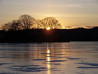
History
Wenham Lake lies in the traditional lands of the Agawam people. The Agwam people recognised tribal ownership of the eastern part of what is now Essex County, Massachusetts. Those lands were ceded to the English in a quitclaim deed made by Chief Masconomet to John Winthrop the Younger. The deed was part of an amalgamation arrangement between remaining Agawam (whose numbers had markedly declined in the 1600s due to disease) and the English colonists of Charlestown, Massachusetts. [1]
Wenham Lake is first found under the name "Great Pond", in the records of Salem, Massachusetts.The lake was the site of the murder of John Hoddy by John Williams. Hoddy's dog detained Williams until his arrest. [2]
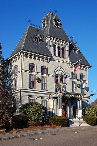
In 1638, Hugh Peters, the Puritan minister of the First Church of Salem, delivered a sermon to a small group of settlers on the shore of Wenham Lake. His sermon turned upon "Enon, near Salem, because there was much water there", a biblical reference to John 3:23. A small settlement nearby was thus named "Enon". The site of the sermon is marked by a stone with an engraved plaque. Enon was officially recognized by the General Court of Massachusetts on November 5, 1639. On May 10, 1643, Enon was incorporated and renamed Wenham. The lake was then named Wenham Lake.
In 1846, Benjamin Barker wrote Mornilva, or the outlaw of the forest: a romance of Lake Wenham. He described the lake's "clear, calm and placid waters, the beautiful and picturesque hills upon its borders, the beautiful evergreen of its dusky pine woods, and above all, the blue canopy of heaven, which overshadows it." [3]
In 1877, the Quaker poet John Greenleaf Whittier wrote "The Witch of Wenham" which was set on the shores of Wenham Lake. [4]
In the early 1900s, the ornithologist and hunter John Charles Phillips published, "Wenham Great Pond" [5] recounting his time over ten years at Wenham Lake. [6]

Beverly is a city in Essex County, Massachusetts, and a suburb of Boston. The population was 42,670 at the time of the 2020 United States Census. A resort, residential, and manufacturing community on the Massachusetts North Shore, Beverly includes Ryal Side, North Beverly, Montserrat, Beverly Farms and Prides Crossing. Beverly is a rival of Marblehead for the title of being the "birthplace of the U.S. Navy"

Hamilton is a town in the eastern central portion of Essex County in eastern Massachusetts, United States. At the 2020 census, it had a population of 7,561. Currently the town has no manufacturing industry and no industrially-zoned land.
Manchester-by-the-Sea is a coastal town on Cape Ann, in Essex County, Massachusetts, United States. The town is known for scenic beaches and vista points. According to the 2020 population census, the population is 5,395.

Middleton is a town in Essex County, Massachusetts, United States. The population was 9,779 at the 2020 census.

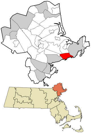
Wenham is a town in Essex County, Massachusetts. The population was 4,979 at the time of the 2020 census.
Topsfield is a town in Essex County, Massachusetts, United States. The population was 6,569 at the 2020 census. Topsfield is located in the North Shore region of Massachusetts. Part of the town comprises the census-designated place of Topsfield.

The Wenham Lake Ice Company, operating out of Wenham Lake in Wenham, Massachusetts, United States, harvested ice and exported it all around the world before the advent of factory-made ice. Wenham-lake ice was awarded a royal warrant from Queen Victoria.

Fresh Pond is a reservoir and park in Cambridge, Massachusetts. Prior to the Pond's use exclusively as a reservoir, its ice had been harvested by Boston's "Ice King", Frederic Tudor, and others, for shipment to North American cities and to tropical areas around the world. Fresh Pond is bordered by Fresh Pond Parkway, Huron Avenue, Grove Street, Blanchard Road, and Concord Avenue.
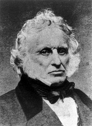
Frederic Tudor was an American businessman and merchant. Known as Boston's "Ice King", he was the founder of the Tudor Ice Company and a pioneer of the international ice trade in the early 19th century. He made a fortune shipping ice cut from New England ponds to ports in the Caribbean, Europe, and as far away as India and Hong Kong.

Alewife Brook Reservation is a Massachusetts state park and urban wild located in Cambridge, Arlington, and Somerville. The park is managed by the state Department of Conservation and Recreation and was established in 1900. It is named for Alewife Brook, which was also historically known as Menotomy River, a tributary of the Mystic River.
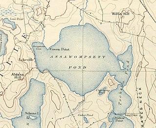
Assawompset Pond is a reservoir/pond within the towns of Lakeville and Middleboro, in southeastern Massachusetts. It shares its waters with Long Pond and is openly connected with Pocksha Pond. These lakes provide a source of drinking water to the city of New Bedford, the largest city in southeastern Massachusetts. At almost four square miles (10 km2), it is the largest natural lake in Massachusetts.

Massachusetts's 6th congressional district is located in northeastern Massachusetts. It contains most of Essex County, including the North Shore and Cape Ann, as well as part of Middlesex County. It is represented by Seth Moulton, who has represented the district since January 2015. The shape of the district went through minor changes effective from the elections of 2012 after Massachusetts congressional redistricting to reflect the 2010 census. The towns of Tewksbury and Billerica were added, along with a small portion of the town of Andover.
Spy Pond, also known as Spie Pond in the 17th and 18th centuries, is a 103-acre (0.42 km2) kettle hole pond located near the heart of Arlington, Massachusetts, adjacent to the Minuteman Bikeway.
Ipswich River is a small river in northeastern Massachusetts, United States. It held significant importance in early colonial migrations inland from the ocean port of Ipswich. The river provided safe harborage at offshore Plum Island Sound to early Massachusetts subsistence farmers, who were also fishermen. A part of the river forms town boundaries and divides Essex County, Massachusetts on the coast from the more inland Middlesex County. It is 35 miles (56 km) long, and its watershed is approximately 155 square miles (401 km2), with an estimated population in the area of 160,000 people.

The Salem Beverly Waterway Canal, sometimes called the Grand Wenham Canal, is an aqueduct canal in Topsfield and Wenham, Massachusetts. It was never used to transport anything but water and recreational canoeists.

Route 97 is a south–north highway in Essex County in northeastern Massachusetts, United States. It connects the cities of Beverly and Haverhill before continuing into Salem, New Hampshire as New Hampshire Route 97.
The Agawam River is a 10.7-mile-long (17.2 km) stream in southeastern Massachusetts, USA, that is part of the Wareham River estuary watershed. The Agawam River is named in honor of the peaceful Native Americans that helped the Massachusetts Bay Colony establish its first Connecticut River Valley settlement at Springfield, Massachusetts in 1636, and helped it to flourish while many of the Connecticut Colony settlements south of Springfield were attacked or destroyed by more war-like Native American tribes.
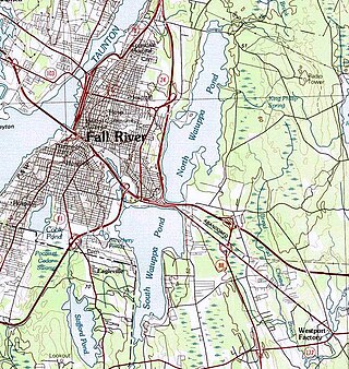
The Watuppa Ponds are two large, naturally occurring, spring-fed, glacially formed ponds located in Fall River and Westport, Massachusetts. Watuppa is a native word meaning "place of boats". The two ponds were originally one body of water, connected by a narrow rocky straight called "The Narrows" located on a thin strip of land between the two ponds which forms part boundary of between Fall River and Westport. The border between Fall River and Westport is also divided between the two ponds. Together, the ponds have an overall north–south length of about 7.5 miles, and have an average east–west width of about a mile. The ponds are drained by the Quequechan River, and flows in a westerly direction through the center of Fall River from South Watuppa Pond to Mount Hope Bay.
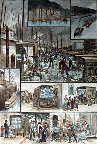
The ice trade, also known as the frozen water trade, was a 19th-century and early-20th-century industry, centering on the east coast of the United States and Norway, involving the large-scale harvesting, transport and sale of natural ice, and later the making and sale of artificial ice, for domestic consumption and commercial purposes. Ice was cut from the surface of ponds and streams, then stored in ice houses, before being sent on by ship, barge or railroad to its final destination around the world. Networks of ice wagons were typically used to distribute the product to the final domestic and smaller commercial customers. The ice trade revolutionised the U.S. meat, vegetable and fruit industries, enabled significant growth in the fishing industry, and encouraged the introduction of a range of new drinks and foods. It only flourished in the time between the development of reliable transportation and the development of widespread mechanical refrigeration.


