
Pettigrew State Park is a North Carolina State Park in Tyrrell and Washington Counties, North Carolina in the United States. It covers 5,951 acres (24.08 km2) around the shore lines of Lake Phelps and the Scuppernong River. The park's developed facilities are south of U.S. Route 64 near Roper and Creswell, North Carolina. Pettigrew State Park is open for year-round recreation, including hiking, camping, fishing, boating and picnicking.

Lake Attitash is a lake located on the border of Merrimac, Massachusetts and Amesbury, Massachusetts, and constitutes at least a portion of Amesbury's water supply.
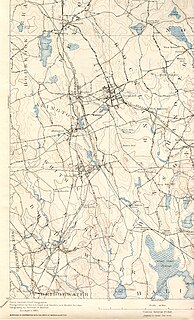
The Satucket River is 5.5-mile-long (8.9 km) river in southeastern Massachusetts within the Taunton River Watershed. It flows generally west from Robbins Pond in East Bridgewater, and into the Matfield River.
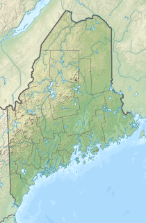
Trickey Pond is a water body in the U.S. state of Maine. Its maximum depth is 55 feet (17 m). The lack of serious pollution in the area contributes to the pond's remarkably good water clarity. At most points in the pond, the entire depth can be seen.

Dug Pond is a small body of water in Natick, Massachusetts. Most notably it is home to Memorial Beach, one of few swimming beaches in Natick, and its eastern shore is the site of Natick High School.

Ashuelot Pond is a 368-acre (149 ha) water body located in Sullivan County in western New Hampshire, United States, in the town of Washington. It is situated along the upper reaches of the Ashuelot River, a tributary of the Connecticut River.

Goose Pond is a 625-acre (2.5 km2) water body located in Grafton County in western New Hampshire, United States, in the towns of Canaan and Hanover. It is considered a great pond by the state of New Hampshire. The lake has 6.3 miles (10.1 km) of shoreline, and is approximately 3 miles (5 km) long by 0.5 miles (0.8 km) wide. All but the northernmost end of the pond is in the town of Canaan. The average depth of the pond is approximately 10 feet (3.0 m), with the deepest part approximately 35 feet (11 m). The lake is part of the Mascoma River watershed, flowing to the Connecticut River.

Lake Lashaway is a 293-acre (1.19 km2) pond located near the East Brookfield and North Brookfield, Massachusetts town line. The Lake Lashaway Community Association’s website is www.LakeLashaway.org. The town line cuts the lake approximately in half. The lake lies just to the north of state Route 9 as it passes through East Brookfield.

Quaboag Pond is a 537-acre (2.17 km2) pond located near the East Brookfield and Brookfield, Massachusetts. The pond lies about two miles (3 km) south of state Route 9 as it passes through East Brookfield. Quaboag Pond was once named Podunk Pond.

Browning Pond is located in Oakham and Spencer, Massachusetts. This 89-acre (360,000 m2) great pond forms the headwaters of the Seven Mile River. It is part of the Chicopee River Watershed.

Billington Sea is a 269-acre (1.09 km2) warm water pond located in Plymouth, Massachusetts. Morton Park lies on the pond's northern shore. The pond is fed by groundwater and cranberry bog outlets. The average depth is seven feet and the maximum depth is 11 feet (3.4 m). The pond provides the headwaters to Town Brook. Seymour Island is located in the center of the pond. Billington Sea was named after its discoverer, Francis Billington, one of the passengers on the Mayflower.

Tispaquin Pond is a 194-acre (0.79 km2) warm water pond in Middleborough, Massachusetts. The pond is in the Taunton River Watershed. The average depth of the pond is seven feet, and the maximum depth is eight feet. Transparency of the water is six feet. Shorts Brook and Woods Brook provide the inflow for the pond. The outflow is Fall Brook, a tributary of the Nemasket River. Camp Avoda and Camp Yomechas are located on the pond. Access to the southern shore of the pond is via Eldon Street off Rocky Gutter Street. An unpaved launch area is suitable for car top boats and canoes. It is a popular spot for recreational fishing, particularly for yellow perch and largemouth bass.

The Watuppa Ponds are two large, naturally occurring, spring-fed, glacially formed ponds located in Fall River and Westport, Massachusetts. Watuppa is a native word meaning "place of boats". The two ponds were originally one body of water, connected by a narrow rocky straight called "The Narrows" located on a thin strip of land between the two ponds which forms part boundary of between Fall River and Westport. The border between Fall River and Westport is also divided between the two ponds. Together, the ponds have an overall north-south length of about 7.5 miles, and have an average east-west width of about a mile. The ponds are drained by the Quequechan River, and flows in a westerly direction through the center of Fall River from South Watuppa Pond to Mount Hope Bay.

Walker Pond is a body of water in Sturbridge, Massachusetts, situated off Route 49 on the way to Wells State Park.
Winnacunnet is a word derived from one of the Algonquian languages and may mean "beautiful place in the pines". Other sources suggest a meaning of "place of pines" or "beautiful long place."
Mashapaug Lake is a 297-acre (1.20 km2) lake surrounded by Bigelow Hollow State Park and Nipmuck State Forest in the town of Union in northeastern Connecticut. The lake has a maximum depth of 39.5 feet, and an average depth of 15 feet. Its normal surface elevation is 706 feet. The lake is very popular with fishermen and boaters from the area, and can also be used for swimming.
Lake Garfield is a 275-acre (111 ha) lake located about 0.5 miles (0.80 km) north of the center of Monterey, off Route 23 in Berkshire County, Massachusetts.
Crescent Lake receives drainage from Coffee Pond and Dumpling Pond in northern Casco, Maine, and extends south into Raymond. The south end of the lake overflows through Tenny River to Panther Pond 1 mile (1.6 km) south. The town of Raymond maintains a boat ramp on Maine State Route 85 at the south end of Crescent Lake. Smallmouth bass, largemouth bass, chain pickerel, and white perch thrive in the lake. Dissolved oxygen deficiency below the 11-metre (36 ft) summer thermocline limits suitability for cold-water fish; but the lake supports populations of cusk and rainbow smelt.
China Lake is a pond in Kennebec County, Maine. Located northeast of the state capital of Augusta, China Lake is situated in the towns of China and Vassalboro. China Lake has two large basins connected by a narrow neck. The elongated eastern basin with an average depth of less than 30 feet (9.1 m) is entirely within the town of China, and has an irregular shoreline heavily developed with residences and seasonal cottages. The more nearly circular western basin extending into East Vassalboro is as deep as 85 feet (26 m), and shoreline development around the western basin has been discouraged to allow use as a water supply for Waterville and Winslow. The western basin overflows into Outlet Stream in the town of Vassalboro. Outlet Stream flows 7 miles (11 km) north to discharge into the Sebasticook River in Winslow 1 mile (1.6 km) upstream of the Kennebec River.

Heart Pond is a great pond located in the southwestern corner of Chelmsford, Massachusetts. The pond borders the town of Westford, Massachusetts. The pond has a surface area of 91 acres and a maximum depth of 20 ft. The pond is a warm water fishery and is a popular fishing spot in the town containing, Largemouth bass, Black Bullhead, Chain Pickerel, White and Yellow perch as well as Sunfish.


