
Adams County is a county in the U.S. state of Iowa. As of the 2020 census, the population was 3,704, making it Iowa's least-populous county. Its county seat is Corning.
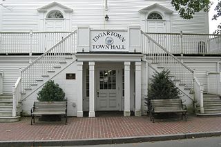
Dukes County is a county located in the U.S. state of Massachusetts. As of the 2020 census, the population was 20,600, making it the second-least populous county in Massachusetts. Its county seat is Edgartown.

Braxton County is a county in the central part of the U.S. state of West Virginia. As of the 2020 census, the population was 12,447. The county seat is Sutton. The county was formed in 1836 from parts of Lewis, Kanawha, and Nicholas counties and named for Carter Braxton, a Virginia statesman and signer of the Declaration of Independence.
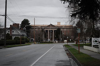
Skagit County is a county in the U.S. state of Washington. As of the 2020 census, the population was 129,523. The county seat and largest city is Mount Vernon. The county was formed in 1883 from Whatcom County and is named for the Skagit Indian tribe, which has been indigenous to the area prior to European-American settlement.
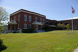
San Juan County is a county located in the Salish Sea in the far northwestern corner of the U.S. state of Washington. As of the 2020 census, its population was 17,788. The county seat and only incorporated town is Friday Harbor, located on San Juan Island. The county was formed on October 31, 1873, from Whatcom County and is named for the San Juan Islands, which are in turn named for Juan Vicente de Güemes, 2nd Count of Revillagigedo, the Viceroy of New Spain.

Monroe County is a county located on the eastern border of the U.S. state of Ohio, across the Ohio River from West Virginia. As of the 2020 census, the population was 13,385, making it the second-least populous county in Ohio. Its county seat is Woodsfield. The county was created in 1813 and later organized in 1815.

San Miguel County is a county in the U.S. state of New Mexico. As of the 2020 census, the population was 27,201. Its county seat is Las Vegas.

Attu Station is a census-designated place (CDP) located on Attu Island in the Aleutians West Census Area in the U.S. state of Alaska. The population was 21 at the 2010 census, consisting entirely of coast guard personnel who resided and worked at Casco Cove Coast Guard Station, but left the island when the station was closed in August 2010, leaving it uninhabited. LORAN Station Attu had provided a navigational signal for mariners of the North Pacific since the 1970s.

East Farmingdale is a hamlet and a census-designated place (CDP) in Suffolk County, on Long Island, in New York. The population of the CDP was 6,484 at the 2010 census. Located in the Town of Babylon, the residents are served by the Farmingdale Post Office.

The United States has a racially and ethnically diverse population. At the federal level, race and ethnicity have been categorized separately. The most recent United States census recognized five racial categories, as well as people who belong to two or more of the racial categories. The United States also recognizes the broader notion of ethnicity. The 2000 census and 2010 American Community Survey inquired about the "ancestry" of residents, while the 2020 census allowed people to enter their "origins". The Census Bureau also classified respondents as either Hispanic or Latino, identifying as an ethnicity, which comprises the minority group in the nation.

Canas is one of the 31 barrios in the municipality of Ponce, Puerto Rico. Along with Anón, Coto Laurel, Guaraguao, Quebrada Limón, Real, San Patricio, and Marueño, and the coastal barrio of Capitanejo, Canas is one of the municipality's nine bordering barrios. It borders the municipality of Peñuelas. Along with Playa, Bucana, Vayas and Capitanejo, Canas is also one of Ponce's five coastal barrios. It was founded in 1831.

Magueyes is one of the 31 barrios of the municipality of Ponce, Puerto Rico. Together with Cerrillos, Machuelo Arriba, Maragüez, Montes Llanos, Portugués, Sabanetas, and Tibes, Magueyes is one of the municipality's eight interior barrios. The name of this barrio is of native Indian origin. It was created in 1831.

Maragüez is one of the 31 barrios of the municipality of Ponce, Puerto Rico. Along with Magueyes, Tibes, Portugués, Montes Llanos, Machuelo Arriba, Sabanetas, and Cerrillos, Maragüez is one of the municipality's eight rural interior barrios. The name of this barrio is of native Indian origin. It was created in 1878.

Marueño is one of the 31 barrios of the municipality of Ponce, Puerto Rico. Along with Anón, Coto Laurel, Guaraguao, Quebrada Limón, Real, and San Patricio, and the coastal barrios of Canas and Capitanejo, Marueño is one of the municipality's nine bordering barrios. Marueño borders the municipality of Peñuelas. The name of this barrio is of native Indian origin. It was created in 1831.

Sabanetas is one of the 31 barrios of the municipality of Ponce, Puerto Rico. Along with Magueyes, Tibes, Portugués, Montes Llanos, Machuelo Arriba, Maragüez, and Cerrillos, Sabanetas is one of the municipality's eight rural interior barrios. The name of this barrio is of native Indian origin. It was founded in 1831.
Tutu, also known as Estate Tutu is one of the seven administrative subdistricts on Saint Thomas island in the United States Virgin Islands. It is located in eastern St. Thomas and is mostly made up of the second-largest town in the U.S.V.I., Anna's Retreat in the Tutu Valley, sometimes nicknamed Tutu. According to the U.S. Census Bureau in 2010 the population was 6,867, which is down from 8,197 in 2000 and further down from 9,100 in the U.S. Census of 1990. Tutu is known as a densely populated residential area and is second only to the territorial capital of Charlotte Amalie in terms of highest population density on the island of Saint Thomas. It is home to approximately 20 percent of the island population and has a total area of 1.5 square miles. There have been numerous excavations in an area known as the Tutu Archaeological Village Site, which has discovered numerous artifacts from the native Arawak people who inhabited the area in the pre-Columbian era.
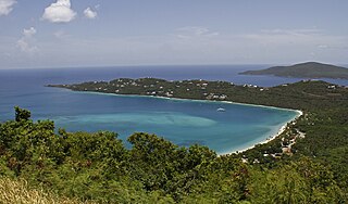
Northside with its population of 10,049 as of the 2010 United States Census is the second-most populous administrative census subdistrict (CSD) on Saint Thomas, only less populated than the Charlotte Amalie subregion with the islands’ territorial capital of more than 18,000 people. Northside is sometimes called Nordside in Virgin Islands Creole, which is the Danish translation for north side. Northside is home to communities such as Neltjeberg, Zambee, Resolution, Ensomned, Barrett, Solberg, Lerkenlund, Misgen, Mafolie, Louisenhoj, Estate Thomas, Mandal, Enighed, Canaan, and Peterborg. By area, the Northside subdistrict is the largest administrative census sub-district on the Saint Thomas island.
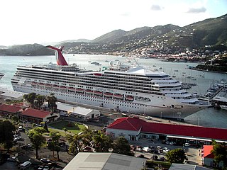
Southside is a census subdistrict (CSD) on Saint Thomas in the United States Virgin Islands. The CSD is bordering Charlotte Amalie from Havensight in the west, Nordside- and the Tutu subdistricts to the north, and the East End subdistrict to the east. The 2010 U.S. Census showed a population of 5,411 people, which is a decrease of 56 people as compared to the 2000 U.S. Census of 5,467. Some of the communities here includes Havensight, Bellevue, Raphune, Hoffman, Bolongo and Bovoni.
Anna's Hope Village is an administrative sub-district of St. Croix, U.S. Virgin Islands.
