Willoughby, Lincolnshire

Last updated

Willoughby
Church of St Helena, Willoughby, Lincs - geograph.org.uk - 49744.jpg
St Helena's Church, Willoughby
Lincolnshire UK location map.svg
Red pog.svg
Willoughby
Location within Lincolnshire
Population400 
OS grid reference TF476719
  London 125 mi (201 km)  S
Civil parish
District
Shire county
Region
Country England
Sovereign state United Kingdom
Post town ALFORD
Postcode district LN13
Police Lincolnshire
Fire Lincolnshire
Ambulance East Midlands
List of places
UK
England
Lincolnshire
53°13′26″N0°12′36″E / 53.224°N 0.210°E / 53.224; 0.210

Willoughby is a village in the district of East Lindsey, Lincolnshire, England. It is situated three miles (five kilometres) south from the market town of Alford, and on the edge of the Lincolnshire Wolds, an Area of Outstanding Natural Beauty.

Contents

History

The name 'Willoughby' derives from the Old Norse wilig-by meaning 'willow tree farm/settlement'. [1]

To the rear of Tavern Way is a field containing a scheduled ancient monument, a medieval earthwork of an unknown date.[ citation needed ]

The most notable person to have come from Willoughby is John Smith, one of the leaders of the Virginia Colony in North America. He was born and raised in the village, and christened at St Helena's church in 1580. [2] When Smith was 16 years old his father George Smith died and was buried at the same church on 3 April 1596. [3] Smith was connected to the Native American girl Pocahontas, daughter of the chief of the Powhatan confederacy tribes. Smith met her when settling Jamestown in the 17th century. There have been many fictional representations of their encounter and surrounding events, including Disney's animated musical film Pocahontas and its sequel. The cottage where Smith lived still exists and is in one of the village lanes. On the anniversary of the founding of the Jamestown settlement hundreds of Americans come to the village to see where Smith lived.[ citation needed ]

Geography

The village is close to the coast, with Skegness 12 miles (19 kilometres) away and Chapel St Leonards seven miles (eleven kilometres) away. The village is within the civil parish of Willoughby with Sloothby, which includes the hamlets of Sloothby and Hasthorpe.

Willoughby has two main farms. One is on the Clover Industrial Estate and the other is on Hanby Lane opposite the petrol station. Both farms have wide field access and pasture sheep in the summer.[ citation needed ]

Population

All together, the 2011 Census counted 592 residents of the Willoughby with Sloothby parish. [4] The population was gender balanced, with 50.3% male and 49.7% female. [5] Most residents were white (98.6%) [6] who declared as Christian (71.1%). [7]

Residents of Willoughby with Sloothby live primarily in small, aging households. Of the 252 households, 20.6% were a single person, 52.8% were two people, 12.3% were three people, and 14.3% comprised four or more people. [8] Most families had no dependent children (76.6%), [9] and 64.3% of households were headed by a person aged 55 or over. [10]

Architecture

Residential

Although several new houses have been built in the village, such as those on Tavern Way and John Smith Close, the village has seen little growth. Newer houses have been built to the west of the village on the old grounds of the tavern. Older houses are to the east of the village near the church.

The most recent development[ when? ] is a group of new bungalows on Station Road.[ citation needed ]

There is a large manor house at the eastern edge of the village toward Bonthorpe. The older main building was recently renovated. In the 1980s, a new hall and extension was constructed and in the 1990s and 2000s further improvements were carried out.[ citation needed ]

Another large house in the grounds of the church is the rectory on Station Road. [11]

Commercial

At present there is only one shop/petrol station selling convenience goods and a former blacksmith's shop which sells and repairs gardening equipment. A mobile fish and chip shop visits the village weekly. The public house is called The Willoughby Arms. [12] The village used to be larger, with more services that included a butcher, a post office and a dairy shop. Changing demographics and the loss of the railway line and station caused the decline of these businesses.[ citation needed ]

Facilities

Education

The village has a small primary school, St Helena's Church of England Primary School. The school, which opened in 1948,[ citation needed ] serves students from preschool to Year 6 (ages 4 through 11). [13] As of July 2011 the school had 106 pupils. [14]

Transportation

In 1848, the village was connected to the rest of the county by the East Lincolnshire Railway, a line from Peterborough to Grimsby. Willoughby railway station was also the point where the Mablethorpe line began. Since the rail line closed in 1970, villagers have had to depend on motor-vehicle travel.[ according to whom? ] The original platform, former line and station houses still exist.[ citation needed ]

There are a few daily buses operated by the Lincolnshire bus company, Translinc, and Stagecoach in Lincolnshire. Three school bus services run through the week to Alford.

There are three main roads through the village – Church Road, Station Road and Hanby Lane.

Community and events

The village community life revolves around the church. Some residents attend Sunday service[ according to whom? ] and many use it for weddings, funerals and baptisms. St Helena's Church is one of many in the parish. The rural parish stretches as far as Chapel St Leonards.[ citation needed ]

The Village Hall and Green sponsors numerous events throughout the year including a garden competition run by the Willoughby Garden Club, the annual Summer Fair and a Christmas dinner. The Hall is also used for private events. The Bowls Club meets weekly and players are free to use the green near the Village Hall whenever they please.[ citation needed ]

The playing field hosts the annual School Sports Day and many other functions. Many locals use the recently installed play equipment. Near the playing field are allotments.[ citation needed ]

Related Research Articles

<span class="mw-page-title-main">Saltfleet</span> Coastal village in the East Lindsey district of Lincolnshire, England

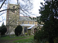
Saltfleet is a coastal village in the East Lindsey district of Lincolnshire, England. It is approximately 8 miles (13 km) north of Mablethorpe and 11 miles (18 km) east of Louth.

<span class="mw-page-title-main">Alford, Lincolnshire</span> Town in East Lindsey district of Lincolnshire, England

Alford is a town in the East Lindsey district of Lincolnshire, England, at the foot of the Lincolnshire Wolds, which form an Area of Outstanding Natural Beauty. The population was recorded as 3,459 in the 2011 Census and estimated at 3,789 in 2019. It lies between the towns of Mablethorpe, Louth, Spilsby, and Skegness and acts as a local retail centre.

<span class="mw-page-title-main">Ancaster, Lincolnshire</span> Village in the South Kesteven district of Lincolnshire, England

Ancaster is a village and civil parish in the South Kesteven district of Lincolnshire, England, on the site of a Roman town. The population of the civil parish was 1,317 at the 2001 census increasing to 1,647 at the 2011 census. The civil parish includes the settlements of Sudbrook and West Willoughby.

<span class="mw-page-title-main">Bembridge</span> Human settlement in England

Bembridge is a village and civil parish located on the easternmost point of the Isle of Wight. It had a population of 3,848 according to the 2001 census of the United Kingdom, leading to the implausible claim by some residents that Bembridge is the largest village in England. Bembridge is home to many of the Island's wealthiest residents. The population had reduced to 3,688 at the 2011 Census.

<span class="mw-page-title-main">Linton, Cambridgeshire</span> Human settlement in England

Linton is a village and civil parish in Cambridgeshire, England, on the border with Essex. The village is approximately 8 miles (13 km) southeast from the city and county town of Cambridge. The A1307 passes through the village.

Aby is a village in the East Lindsey district of Lincolnshire, England. It is approximately 30 miles (48 km) east from the city and county town of Lincoln and 8 miles (13 km) south-east from Louth. Aby is part of the civil parish of Aby with Greenfield.

<span class="mw-page-title-main">Louth and Horncastle (UK Parliament constituency)</span> Parliamentary constituency in the United Kingdom, 1997 onwards

Louth and Horncastle is a constituency in Lincolnshire represented in the House of Commons of the UK Parliament since 2015 by Victoria Atkins, a Conservative.

<span class="mw-page-title-main">Swineshead, Lincolnshire</span> Village and civil parish in Lincolnshire, England

Swineshead is a village and civil parish in the Borough of Boston in Lincolnshire, England. It is 7 miles (11 km) west of the town of Boston. The population of the civil parish including Baythorpe was 2,810 at the 2011 census. The parish includes the areas of Swineshead Bridge and North End to the north, Fenhouses and Blackjack to the east, and Drayton to the south.

<span class="mw-page-title-main">Humberston</span> Village and civil parish south of Cleethorpes in North East Lincolnshire, England

Humberston is a village and civil parish south of Cleethorpes in North East Lincolnshire, England.

<span class="mw-page-title-main">Allington, Lincolnshire</span> Village in the South Kesteven district of Lincolnshire, England

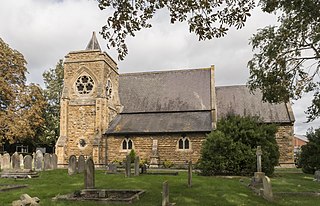
Allington is a village and civil parish in the South Kesteven district of Lincolnshire, England, 3 miles (5 km) north-west of Grantham. The 2001 census gave a parish population of 728 in 329 households. The population increased to 897 in 422 households in the 2011 census.

<span class="mw-page-title-main">North Hykeham</span> Town in North Kesteven, Lincolnshire, England

North Hykeham is a town and civil parish in the North Kesteven district, in the county of Lincolnshire, England. It forms part of the Lincoln Urban Area. The population of the town at the 2011 census was 13,884.

<span class="mw-page-title-main">Bilsby</span> Village in East Lindsey district, Lincolnshire, England

Bilsby is a village and civil parish in the East Lindsey district of Lincolnshire, England. It lies on the main A1111 road between Alford and Sutton-on-Sea, 1 mile (1.6 km) east of Alford. Thurlby and Asserby are hamlets within Bilsby parish. The censuses showed a parish population of 538 in 2001 and 487 in 2011, with an estimate of 489 in 2019.

<span class="mw-page-title-main">Sutton-on-Sea</span> Town in the East Lindsey district, Lincolnshire, England

Sutton-on-Sea is a seaside town in the East Lindsey district of Lincolnshire, England, beside a long sandy beach along the Lincolnshire Coast and north sea. The town is part of the civil parish of Mablethorpe and Sutton. The southern part of the town is known as Sandilands and nearby is also Trusthorpe.

<span class="mw-page-title-main">Irby in the Marsh</span> Village and civil parish in Lincolnshire, England

Irby in the Marsh is a village and civil parish in the East Lindsey district of Lincolnshire, England. It is situated on the B1195 road, geographically 4.5 miles (7 km) east from Spilsby and 6 miles (10 km) west from Skegness.

<span class="mw-page-title-main">Friskney</span> Village and civil parish within the East Lindsey district of Lincolnshire, England

Friskney is a village and civil parish within the East Lindsey district of Lincolnshire, England.

<span class="mw-page-title-main">Silk Willoughby</span> Village and civil parish in the North Kesteven district of Lincolnshire, England

Silk Willoughby is a village and civil parish in the North Kesteven district of Lincolnshire, England. The population of the civil parish at the 2011 census was 299. It is situated 2 miles (3 km) south from Sleaford.

<span class="mw-page-title-main">Welton le Marsh</span> Village and civil parish in the East Lindsey district of Lincolnshire, England

Welton le Marsh is a village and civil parish in the East Lindsey district of Lincolnshire, England. It is situated approximately 6 miles (10 km) north-east from the town of Spilsby and approximately 5 miles (8.0 km) south from the town of Alford. The hamlet of Boothby lies within the parish, about 1 mile (1.6 km) east of Welton le Marsh village.

<span class="mw-page-title-main">Great Carlton</span> Village and civil parish in the East Lindsey district of Lincolnshire, England

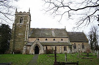
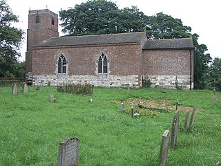
Great Carlton is a village and civil parish in the East Lindsey district of Lincolnshire, England. The population of the civil parish at the 2011 census was 136. It is situated 5 miles (8.0 km) southeast from the market town of Louth, Lincolnshire.

<span class="mw-page-title-main">Hilldale, Lancashire</span> Human settlement in England

Hilldale is civil parish in the West Lancashire district of Lancashire, England, containing the village of Hill Dale and the neighbouring hamlet of Andertons Mill. Formerly part of Wrightington, Hilldale became a separate civil parish in 1999. As of 2011, Hilldale has a population of 581.

<span class="mw-page-title-main">Willoughby with Sloothby</span> Human settlement in England

Willoughby with Sloothby is a civil parish in the East Lindsey district of Lincolnshire in the East Midlands of England. The parish includes the settlements of Willoughby and Sloothby as well as the hamlets and villages of Bonthorpe, Mawthorpe, Hasthorpe and Habertoft. The parish covers quite a large area of East Lindsey with the towns of Alford, Mablethorpe, Spilsby, Skegness and Burgh le Marsh situated near the parish. The parish's nearest railway station is Skegness. The village of Willoughby was served by a station on the former East Lincolnshire Railway and Mablethorpe Loop Line. However, it closed in 1970 and so did the lines. The station master's house and a section of platform and goods shed survive near the site.

References

  1. "Key to English Place-names". kepn.nottingham.ac.uk.
  2. McCartney, Martha (16 May 2013). "John Smith (bap. 1580–1631)". Encyclopedia Virginia. Virginia Foundation for the Humanities.
  3. Barbour, Philip L: The Three Worlds of Captain John Smith, p. 9. Houghton Mifflin Company Boston, 1964.
  4. "Residence Type, 2011 (QS101EW)". Office for National Statistics. March 2011.
  5. "Sex, 2011 (QS104EW)". Office for National Statistics. March 2011.
  6. "Ethnic Group, 2011 (QS201EW)". Office for National Statistics. March 2011.
  7. "Religion, 2011 (QS208EW)". Office for National Statistics. March 2011.
  8. "Household Size, 2011 (QS406EW)". Office for National Statistics. March 2011.
  9. "Families with Dependent Children, 2011 (QS118EW)". Office for National Statistics. March 2011.
  10. "Household Lifestage, 2011 (QS111EW)". Office for National Statistics. March 2011.
  11. Wold & Marsh (PDF), July–August 2013
  12. "Willoughby Arms: Church Lane, Willoughby, Alford, Lincolnshire, LN13 9SU". George Bateman and Son Ltd. Retrieved 16 September 2013.
  13. "School Brochure: "Together, We Strive for Excellence"" (PDF). St Helena's Church of England Primary School. Retrieved 16 September 2013.
  14. "National Society Statutory Inspection of Anglican Schools Report" (PDF). Diocese of Lincoln, Board of Education. Retrieved 15 February 2013.