Related Research Articles

Cherokee County, Alabama is a county located in the northeastern part of the U.S. state of Alabama. As of the 2020 census, the population was 24,971. Its county seat is Centre. The county is named for the Cherokee tribe.

DeKalb County is a county located in the northeastern part of the U.S. state of Alabama. As of the 2020 census, the population was 71,608. Its county seat is Fort Payne, and it is named after Major General Baron Johan DeKalb. DeKalb County is part of the Huntsville-Decatur-Albertville, AL Combined Statistical Area.
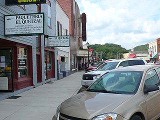
Collinsville is a town in DeKalb and Cherokee counties in the U.S. state of Alabama. It was incorporated in 1887. As of the 2010 census, the population was 1,983.
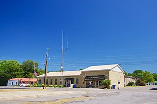
Crossville is a town in DeKalb County, Alabama, United States. At the 2010 census the population was 1,862, up from 1,431 in 2000. Crossville is located atop Sand Mountain, a southern extension of the Cumberland Plateau.
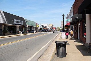
Fort Payne is a city in and county seat of DeKalb County, in northeastern Alabama, United States. At the 2020 census, the population was 14,877.

Attalla is a city in Etowah County, Alabama, United States. As of the 2010 census, the population was 6,048.

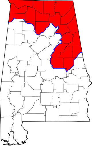
North Alabama is a region of the U.S. state of Alabama. Several geographic definitions for the area exist, with all descriptions including the nine counties of Alabama's Tennessee Valley region. The North Alabama Industrial Development Association also lists Cherokee, Cullman, Franklin, and Winston counties in the region. The Alabama Mountain Lakes Tourist Association expands the definition further to include Blount, Etowah, and Marion counties.

State Route 176 was created in September 1980 along previous County/Secondary State Roads 81 and 89 in DeKalb County and part of County/Secondary State Road 89 in Cherokee County. Part of the route took over what had been State Route 275 and forms the northern end of the Little River Canyon Rim Parkway: a scenic, but severely substandard highway following the northern rim of the limestone canyon for 22 miles (35 km).

Sand Mountain is a sandstone plateau in northeastern Alabama and northwestern Georgia and southeastern Tennessee where the plateau is known as Raccoon Mountain and Elder Mountain. It is part of the southern tip of the Appalachian mountain chain and it is the largest plateau in the chain. Geologically a continuation of Walden Ridge, Sand Mountain is part of the Cumberland Plateau, separated from the main portion of the plateau by the Tennessee River and Sequatchie Valley. The average elevation on Sand Mountain is around 1,500 feet (460 m) above sea level, compared to about 650 feet (200 m) in the surrounding area. This elevation leads to its having the coolest climate in the state of Alabama. The largest city on Sand Mountain is Albertville, in Marshall County. As of the 2020 census, the population of the city was 22,386.
Area codes 256 and 938 are telephone area codes in the North American Numbering Plan (NANP) for North Alabama, as well as some eastern portions of the state. The two area codes form an overlay plan for the same numbering plan area. Area code 256 was created in 1998, and 938 was added in 2010.

The Cherokee–American wars, also known as the Chickamauga Wars, were a series of raids, campaigns, ambushes, minor skirmishes, and several full-scale frontier battles in the Old Southwest from 1776 to 1794 between the Cherokee and American settlers on the frontier. Most of the events took place in the Upper South region. While the fighting stretched across the entire period, there were extended periods with little or no action.

The Great Indian Warpath (GIW)—also known as the Great Indian War and Trading Path, or the Seneca Trail—was that part of the network of trails in eastern North America developed and used by Native Americans which ran through the Great Appalachian Valley. The system of footpaths extended from what is now upper New York to deep within Alabama. Various Native peoples traded and made war along the trails, including the Catawba, numerous Algonquian tribes, the Cherokee, and the Iroquois Confederacy. The British traders' name for the route was derived from combining its name among the northeastern Algonquian tribes, Mishimayagat or "Great Trail", with that of the Shawnee and Delaware, Athawominee or "Path where they go armed".
Fort Cass was a fort located on the Hiwassee River in present-day Charleston, Tennessee, that served as the military operational headquarters for the entire Cherokee removal, an forced migration of the Cherokee known as the Trail of Tears from their ancestral homelands in the Southeast to Indian Territory in present-day Oklahoma. Fort Cass housed a garrison of United States troops who watched over the largest concentration of internment camps where Cherokee were kept during the summer of 1838 before starting the main trek west to Indian Territory, and served as one of three emigration deports where the Cherokee began their journey west, the others of which were located at Ross's Landing in Chattanooga and Gunter's Landing near Guntersville, Alabama.
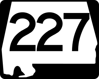
State Route 227 is a 39-mile-long (63 km) route that serves as a connection between the Etowah–DeKalb county line south of Crossville with U.S. Route 431 (US 431) at Guntersville in Marshall County.
The Battle of Taliwa was fought in Ball Ground, Georgia, in 1755. The battle was part of a larger campaign of the Cherokee against the Muscogee Creek people, where a contingent of 500 Cherokee warriors led by war chief Oconostota defeated the Muscogee Creek people and pushed them south from their northern Georgia homelands, allowing the Cherokee to begin settling in the region.
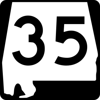
State Route 35 (SR 35) is a 68.291-mile-long (109.904 km) state highway in the northeastern part of the U.S. state of Alabama. The southern terminus of the highway is at its intersection with SR 9 in rural Cherokee County northeast of Cedar Bluff and near the Georgia state line. The northern terminus of the highway is at Woodville in Jackson County where it has a second intersection with U.S. Route 72 (US 72).
David Brown was a Cherokee clergyman and translator who worked in Mississippi as a missionary to the Cherokee. As a youth, he was educated in schools for Native Americans in Tennessee and Connecticut. He also attended Andover Theological Seminary in Massachusetts before returning to the South.
Manitou Cave is a cave in Alabama, near the town of Fort Payne, in the side of Lookout Mountain. In the early 1800s, the Fort Payne area was a Cherokee settlement named Willstown. This was the home of Sequoyah during his time of creating the Cherokee syllabary. Later, Sequoyah's son wrote on the walls of Manitou Cave using this syllabary, documenting ceremonial events and other culturally significant information and history. In the 1830s, Cherokee people were forcibly relocated from this area along the Trail of Tears, leaving the cave empty for some time. During the Civil War, the cave was a source of saltpeter for the Confederate Army. The mineral was mined by laborers to provide the essential ingredient for black powder. The cave was also designated fallout shelter during the Cold War.

The historic Cherokee settlements were Cherokee settlements established in Southeastern North America up to the removals of the early 19th century. Several settlements had existed prior to and were initially contacted by explorers and colonists of the colonial powers as they made inroads into frontier areas. Others were established later.
Fort Likens was a temporary stockade fort built in 1838 in present-day Cherokee County, Alabama. The fort was used to house soldiers who participated in the Cherokee removal.
References
- The journal of Major John Norton; Klink, Karl, and James Talman, ed.; Toronto Champlain Society; 1970.
- McLoughlin, William G. Cherokee Renascence in the New Republic. (Princeton: Princeton University Press, 1992).
- Mooney, James. Myths of the Cherokee and Sacred Formulas of the Cherokee. (Nashville: Charles and Randy Elder-Booksellers, 1982).
- Wilkins, Thurman. Cherokee Tragedy: The Ridge Family and the Decimation of a People. (New York: Macmillan Company, 1970).