Wilson, Texas

Last updated

Wilson, Texas
Wilson Texas 2010.jpg
The Green Building in downtown Wilson
Relief map of Texas.png
Red pog.svg
Wilson
Location in Texas
Usa edcp relief location map.png
Red pog.svg
Wilson
Location in the United States
Coordinates: 33°19′01″N101°43′27″W / 33.31694°N 101.72417°W / 33.31694; -101.72417 [1]
CountryFlag of the United States.svg  United States
StateFlag of Texas.svg  Texas
County Lynn
Region Llano Estacado
Established1912
Founded byWilliam Dickson Green
Area
[2]
  Total0.65 sq mi (1.67 km2)
  Land0.64 sq mi (1.67 km2)
Elevation
[1]
3,120 ft (950 m)
Population
 (2010) [3]
  Total489
  Estimate 
(2019) [4]
490
  Density758.6/sq mi (292.89/km2)
Time zone UTC-6 (CST)
ZIP code
79381
Area code 806
FIPS code 48-79612
Website Handbook of Texas
Grain silos on the south side of Wilson Wilson Texas Grain Silos.jpg
Grain silos on the south side of Wilson

Wilson is a small rural city in the northeastern quadrant of Lynn County, Texas, United States. As of the 2010 census, the population was 489. [3]

Contents

History

The town of Wilson was established in 1912 by William Dickson Green of Shiner, Texas, and Lonnie Lumsden. [5] Early settlers included German and Polish emigrant farmers who acquired property on former Wilson County School lands located in Lynn County, hence the city's name. [6] [7]

Wilson was founded in anticipation that the Panhandle and Santa Fe Railway would lay tracks through the area. [5] The Panhandle and Santa Fe Railway Company was one of the two major operating subsidiaries of the Atchison, Topeka and Santa Fe Railway Company (Santa Fe) in Texas, with lines crossing the Texas Panhandle and South Plains regions, as well as a line across the Trans-Pecos to Presidio. A branch line between Slaton Junction and Lamesa was constructed in 1911, and this line would pass directly through Wilson. [8]

In 1917, William Green built the "Green Building" that housed a mercantile store that quickly became the center of activity in this small town. [5] The couple most involved in operating the store were Mr. and Mrs. J.T. Williams, who managed the store from 1916 to 1936, when Mr. Williams died. [5] Mrs. Williams continued to manage the store for another few years until the early 1940s. In 1963, the citizens of Wilson celebrated the renovation of the Green Building, and today, the refurbished building serves as the city hall and historical museum, and continues to be a community gathering spot. [5]

Geography

Wilson rests upon the level High Plains of the Llano Estacado in West Texas. It is situated at the intersection of Farm to Market Road 400 and Farm to Market Road 211. Farm to Market Road 400 runs parallel to the tracks of the former Panhandle and Santa Fe Railway. This branch line was abandoned in 1999 and Wilson no longer has access to rail transport.

It is located at 33°19′01″N101°43′27″W / 33.31694°N 101.72417°W / 33.31694; -101.72417 (33.3170352, –101.7240454). [1] Wilson is 11 miles (18 km) northeast of Tahoka, the Lynn county seat.

According to the United States Census Bureau, the city has a total area of 0.6 square miles (1.6 km2), all land. [2]

Demographics

Historical population
CensusPop.Note
1960 403
1970 4337.4%
1980 57833.5%
1990 568−1.7%
2000 532−6.3%
2010 489−8.1%
2019 (est.)490 [4] 0.2%
U.S. Decennial Census [9]

As of the 2010 census, [10] 489 people resided in Wilson, down from 532 people in 2000. According to the 2000 census, 182 households and 139 families resided in the city. The population density was 816.8 inhabitants per square mile (315.4/km2). The 194 housing units averaged 297.8/sq mi (115.2/km2). The racial makeup of the city was 72.56% White, 0.94% African American, 22.18% from other races, and 4.32% from two or more races. Hispanics or Latinos of any race were 55.45% of the population.

Of the 182 households, 39.6% had children under the age of 18 living with them, 62.1% were married couples living together, 9.9% had a female householder with no husband present, and 23.1% were not families; 19.8% of all households were made up of individuals, and 8.2% had someone living alone who was 65 years of age or older. The average household size was 2.92 and the average family size was 3.41.

In the city, the population was distributed as 32.1% under the age of 18, 10.3% from 18 to 24, 23.1% from 25 to 44, 23.5% from 45 to 64, and 10.9% who were 65 years of age or older. The median age was 32 years. For every 100 females, there were 103.8 males. For every 100 females age 18 and over, there were 102.8 males.

The median income for a household in the city was $28,333, and for a family was $32,000. Males had a median income of $26,944 versus $18,438 for females. The per capita income for the city was $12,654. About 15.0% of families and 26.1% of the population were below the poverty line, including 36.6% of those under age 18 and 23.4% of those age 65 or over.

Notable people

See also

Related Research Articles

<span class="mw-page-title-main">Crosby County, Texas</span> County in Texas, United States

Crosby County is a county located in the U.S. state of Texas. As of the 2020 census, its population was 5,133. The county seat is Crosbyton. The county was founded in 1876 and later organized in 1886. Both the county and its seat are named for Stephen Crosby, a land commissioner in Texas.

<span class="mw-page-title-main">Carson County, Texas</span> County in Texas, United States

Carson County is a county located in the U.S. state of Texas. As of the 2020 census, its population was 5,807. The county seat is Panhandle. The county was founded in 1876 and later organized in 1888. It is named for Samuel Price Carson, the first secretary of state of the Republic of Texas.

<span class="mw-page-title-main">Briscoe County, Texas</span> County in Texas, United States

Briscoe County is a county located in the U.S. state of Texas. As of the 2020 census, the population was 1,435. Its county seat is Silverton. The county was created in 1876 and later organized in 1892. It is named for Andrew Briscoe, a soldier during the Texas Revolution.

<span class="mw-page-title-main">Nazareth, Texas</span> City in Texas, United States

Nazareth is a city in Castro County, Texas, United States. The population was 311 at the 2010 census, down from 356 at the 2000 census.

<span class="mw-page-title-main">Ralls, Texas</span> City in Texas, United States

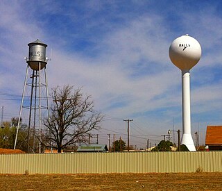
Ralls is a city in Crosby County, Texas, United States. It was named after John Robinson Ralls, who, with the help of W.E. McLaughlin, laid out the townsite in July 1911. As of the 2010 census, it had a population of 1,944, down from 2,252 at the 2000 census. Ralls is surrounded by productive farmlands that primarily produce cotton and grains, with lesser amounts of soybean, sunflower seed, and vegetables.

<span class="mw-page-title-main">Floydada, Texas</span> City in Texas, United States

Floydada is a city in and the county seat of Floyd County, Texas, United States. This rural community lies on the high plains of the Llano Estacado in West Texas and is sometimes referred to as the Pumpkin Capital of Texas. The population was 3,038 at the 2010 census, down from 3,676 at the 2000 census.

<span class="mw-page-title-main">Anton, Texas</span> City in Texas, United States

Anton is a city in Hockley County, Texas, United States. The population was 1,126 at the 2010 census.

<span class="mw-page-title-main">Smyer, Texas</span> Town in Texas, United States

Smyer is a town in Hockley County, Texas, United States. The nickname it is known for is "The Pit Stop Town", since the town is between two major urban areas. The population was 474 at the 2010 census. in 2023, the population declined to 433.

<span class="mw-page-title-main">Amherst, Texas</span> City in Texas, United States

Amherst is a city in Lamb County, Texas, United States. The population was 721 at the 2010 census.

<span class="mw-page-title-main">Sudan, Texas</span> City in Texas, United States

Sudan is a city in Lamb County in Texas, United States. Its population was 958 at the 2010 census.

New Deal is a U.S. town in Lubbock County, Texas. The population was 794 at the 2010 census. It is part of the Lubbock Metropolitan Statistical Area and the Llano Estacado region.

<span class="mw-page-title-main">Shallowater, Texas</span> Community in Texas, United States

Shallowater is a city in Lubbock County, Texas, United States. Shallowater is on U.S. Route 84 and the Burlington Northern Santa Fe line, 12 miles (19 km) northwest of Lubbock. Its population was 2,484 at the 2010 census. It is part of the Lubbock metropolitan statistical area.

<span class="mw-page-title-main">Wolfforth, Texas</span> City in Texas, United States

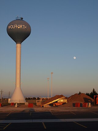
Wolfforth is a town located in Lubbock County, Texas, United States. It is a southwestern suburb of Lubbock. The population was 3,670 at the 2010 census.

<span class="mw-page-title-main">New Home, Texas</span> City in Texas, United States

New Home is a small city in Lynn County, Texas, United States. The population was 334 at the 2010 census.

<span class="mw-page-title-main">Bovina, Texas</span> City in Texas, United States

Bovina is a city in Parmer County, Texas, United States. The population was 1,868 at the 2010 census.

<span class="mw-page-title-main">O'Donnell, Texas</span> City in Texas, United States

O'Donnell is a West Texas city that lies primarily in Lynn County, with a small portion extending south into Dawson County, Texas, United States. Its population was 831 at the 2010 census, down from 1,011 at the 2000 census. The Lynn county portion of O'Donnell is part of the Lubbock Metropolitan area.

<span class="mw-page-title-main">Abernathy, Texas</span> City in Texas, United States

Abernathy is a city in Hale and Lubbock counties in the U.S. state of Texas. The population was 2,805 at the 2010 census.

<span class="mw-page-title-main">Llano Estacado</span> Southwestern United States in New Mexico and Texas

The Llano Estacado, sometimes translated into English as the Staked Plains, is a region in the Southwestern United States that encompasses parts of eastern New Mexico and northwestern Texas. One of the largest mesas or tablelands on the North American continent, the elevation rises from 3,000 feet (900 m) in the southeast to over 5,000 feet (1,500 m) in the northwest, sloping almost uniformly at about 10 feet per mile (2 m/km).

<span class="mw-page-title-main">West Texas</span> Region in Texas, United States

West Texas is a loosely defined region in the U.S. state of Texas, generally encompassing the arid and semiarid lands west of a line drawn between the cities of Wichita Falls, Abilene, and Del Rio.

<span class="mw-page-title-main">Panhandle and Santa Fe Railway</span>

The Panhandle and Santa Fe Railway (P&SF) was a railroad company that was a subsidiary of the Atchison, Topeka and Santa Fe Railway (AT&SF), operating primarily in the Texas Panhandle.

References

  1. 1 2 3 "Wilson". Geographic Names Information System . United States Geological Survey, United States Department of the Interior.
  2. 1 2 "2019 U.S. Gazetteer Files". United States Census Bureau. Retrieved August 7, 2020.
  3. 1 2 "Total Population: 2010 Census DEC Summary File 1 (P1), Wilson city, Texas". data.census.gov. U.S. Census Bureau. Retrieved January 27, 2021.
  4. 1 2 "Population and Housing Unit Estimates". United States Census Bureau. May 24, 2020. Retrieved May 27, 2020.
  5. 1 2 3 4 5 Schwertner, Bonnie S. (July 14, 2016). "Wilson News". The Slatonite. Ken Richardson. p. 4.
  6. "Wilson, TX (Lynn County)". The Handbook of Texas online. Retrieved July 15, 2016.
  7. Schwertner, Bonnie S. (July 21, 2016). "Wilson News". The Slatonite. Ken Richardson. p. 4.
  8. H. Allen Anderson. "Pecos and Northern Texas Railway". Handbook of Texas Online. Retrieved March 12, 2013.
  9. "Census of Population and Housing". Census.gov. Retrieved June 4, 2015.
  10. "U.S. Census website". United States Census Bureau . Retrieved January 31, 2008.
  11. "Ray Westbrook, Jerry Coleman continuing marathon radio career: Coleman's mark on local radio has endured for half a century, May 6, 2012". Lubbock Avalanche Journal . Retrieved November 1, 2013.