The Arctic Archipelago, also known as the Canadian Arctic Archipelago, is a group of islands north of the Canadian mainland.

The Hardangerfjord is the fourth longest fjord in the world, and the second longest fjord in Norway. It is located in Hordaland county in the Hardanger region. The fjord stretches 179 kilometres (111 mi) from the Atlantic Ocean into the mountainous interior of Norway along the Hardangervidda plateau. The innermost point of the fjord reaches the town of Odda.
Grenland is a traditional district in the county of Telemark, in the south of Norway. Located in the southeastern part of the county, Grenland is composed of the municipalities Skien, Porsgrunn, Bamble, and Siljan. Sometimes the municipalities Kragerø and Drangedal are considered being part of the area. The region encompasses 1,794 km² and has 122,978 inhabitants (2004), which translates as 12% of the area and 64% of the population of Telemark.

The Nærøyfjord is a fjord in the municipality of Aurland in Sogn og Fjordane, Norway. The narrow fjord is a branch of the large Sognefjord, and it is featured on the "Norway in a Nutshell" daytrips for tourists. The 18-kilometre (11 mi) long fjord is only 500 metres (1,600 ft) wide in some parts.

Wijdefjord is the longest fjord in Norway's Svalbard archipelago. Wijdefjord is located in the northern portion of the island of Spitsbergen, which lies in the Arctic Ocean about midway between Norway and the North Pole, and is the largest island in the archipelago. The fjord is 108 km (67 mi) long. Opening on Spitsbergen's north coast, it runs roughly southwards into the interior, separating Andrée Land in the west from Margaretas Land in the east. The southern half of the fjord is part of Indre Wijdefjorden National Park.

Van Mijenfjorden is the third-longest fjord in Norway's Svalbard archipelago. It lies in the southern portion of Spitsbergen island, south of Nordenskiöld Land and north of Nathorst Land. The fjord is 83 km (52 mi) long, being separated from Bellsund further out by Akseløya and Mariaholmen. The settlement of Sveagruva lies on the fjord's north bank.

Wahlenbergfjorden, sometimes known in English as Waalenburg Bay, is a fjord on the southwest coast of the Arctic island of Nordaustlandet, in Norway's Svalbard archipelago. At 46 kilometres (29 mi) in length, and 15 km (9.3 mi) wide, it is the fifth longest fjord in the archipelago, and the longest on the island. The fjord lies between Gustav V Land and Gustav Adolf Land, at geographical co-ordinates 79°40′N20°00′E. Its mouth faces Spitsbergen across Hinlopen Strait, the strait separating the two islands.

Hall Basin is an Arctic waterway between Hall Land in Greenland to the west and Canada's northernmost island to the east, Ellesmere Island.

Kongsfjorden is an inlet on the west coast of Spitsbergen, an island which is part of the Svalbard archipelago in the Arctic Ocean. The inlet is 26 km (16 mi) long and ranges in width from 6 to 14 km. Two glaciers, Kronebreen and Kongsvegen, head the fjord.

The Atlantic Ocean Tunnel is an undersea tunnel that is part of Norwegian County Road 64 which connects Kristiansund Municipality to Averøy Municipality in Møre og Romsdal county, Norway. The eastern end of the tunnel is on Kirkelandet island in the town of Kristiansund and the western end of the tunnel is on the island of Averøya, just west of the village of Sveggen. The 5,727-metre (18,789 ft) long tunnel runs beneath the Bremsnesfjorden, reaching a depth of 250 metres (820 ft), making it one of the deepest undersea tunnels in the world. Construction began in 2006, and the tunnel opened on 19 December 2009, later than initially estimated. Breakthrough was in March 2009. Problems with water leaks caused delays and cost overruns.

Recherche Fjord is a small fjord on the south side of Bellsund, Spitsbergen. The glacier Recherchebreen debouches into the fjord from south, and Renardbreen from west.

Adventfjorden is a 7 km long and 4 km wide bay on the southern side of Isfjorden, on the west coast of Spitsbergen. The name is a corruption of Adventure Bay, which was probably named after the Hull whaleship Adventure, which resorted to Isfjorden in 1656. The fjord was originally known as Klass Billen Bay. At the head of Adventfjorden is Adventdalen.

Ekmanfjorden is an 18 km (11 mi) long fjord branching north from inner Isfjorden. It is separated by Nordfjorden to the south by Sveaneset in the west and Kapp Wærn in the east. It lies within Nordre Isfjorden National Park.

Raudfjorden is a 20 km long and 5 km wide fjord on the northwestern coast of Spitsbergen. It has two southern branches, Klinckowströmfjorden and Ayerfjorden, split by the peninsula Buchananhalvøya. The fjord is situated on the divide between Albert I Land and Haakon VII Land.
Odense Fjord is a 13 km long fjord on the northern part of the Danish island of Funen.

Oscar II Land is the land area between Isfjorden and Kongsfjorden on Spitsbergen, Svalbard. The 30 km (19 mi) long glacier Sveabreen divides Oscar II Land from James I Land.

Duvefjorden is a fjord at the northern side of Nordaustlandet, Svalbard. The fjord has a length of about 35 kilometres (22 mi) and a width of 12 to 13 km. Former names of the fjord include Baye du Pigeon, Dove Bay, Tauben Bai and Duiven-baai.

Brennevinsfjorden is a fjord in Gustav V Land at Nordaustlandet, Svalbard. The fjord has a length of about eleven nautical miles, and runs in between Depotodden and Kapp Hansteen.

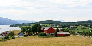
Skålvik Fjord is an arm of Vinje Fjord in the municipality of Halsa in Møre og Romsdal County, Norway, in the traditional Nordmøre district. Skålvik Fjord extends 9.5 kilometers (5.9 mi) southwards to Betna. Geologically, the same channel of the fjord extends north of Vinje Fjord and continues as the Sålå Strait (Sålåsundet) in the Municipality of Aure.


