
Săpânța is a commune in Maramureș County in northern Romania, 15 kilometers northwest of Sighet and just south of the Tisza River. It is composed of a single village, Săpânța.
Hatvan is a town in Heves county, Hungary. Hatvan is the Hungarian word for "sixty". Hatvan is located at around 47°40′5″N19°40′11″E.
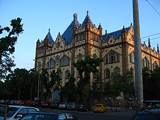
The Geological Museum of Budapest is the main museum of geology in Hungary. It is located on the Stefánia út in the western part of Pest.

Felsőlajos is a village in Bács-Kiskun county, in the Southern Great Plain region of Hungary.

Csegöld is a village in Szabolcs-Szatmár-Bereg county, in the Northern Great Plain region of eastern Hungary.

The Danube Promenade is located on the Pest side of Budapest, Hungary. On the bank of the Danube, this promenade extends from the Széchenyi Chain Bridge to the Erzsébet Bridge.

The Shoes on the Danube Bank is a memorial in Budapest, Hungary. Conceived by film director Can Togay, he created it on the east bank of the Danube River with sculptor Gyula Pauer to honour the Jews who were killed by fascist Arrow Cross militiamen in Budapest during World War II. They were ordered to take off their shoes, and were shot at the edge of the water so that their bodies fell into the river and were carried away. It represents their shoes left behind on the bank.
Gönyű is a village in Győr-Moson-Sopron county, Hungary.

Ecséd is a small village in Heves County, Hungary.
Bag, Hungary is a village in Pest county, Hungary.
Csemő is a village in Pest county, Hungary.
Kóka is a village in Pest county, Hungary. Olympian János Dosztály was born here.
Kisoroszi is a village on Szentendre Island in Pest county, Budapest metropolitan area, Hungary. It has a population of 892 (2007).

Pilisborosjenő is a village in Pest county, Budapest metropolitan area, Hungary. It has a population of 3,373 (2012).
Szada is a village in Pest county, Budapest metropolitan area, Hungary.

Szentlőrinckáta is a village in Pest county, Hungary.
Sződ is a village in Pest county, Hungary.
Tápiógyörgye is a village in Pest county, Hungary.
Tápiószentmárton is a village in Pest county, Hungary.
Tatárszentgyörgy is a village in Pest county, Hungary.


