
Viola is a village in Mercer County, Illinois, United States. The population was 955 at the 2010 census, a decline of one person from 956 in 2000.
Barh Azoum is one of three departments in Salamat, a region of Chad. Its capital is Am Timan.
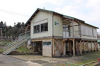
Tsurugata Station is a JR East railway station located in Noshiro, Akita Prefecture, Japan.
Khovd is a sum (district) of the Uvs aimag (province) in Mongolia. It is located in the south-west of the aimag, at the border to the Bayan-Ölgii Aimag. It is situated in the Achit Lake depression, sum center is 28 km SE from the lake at the Khovd River left bank. Eastern part of the sum is situated in Kharkhiraa-Türgen mountains.

Baalbek District is an administrative district in the Baalbek-Hermel Governorate of the Republic of Lebanon, having the city Baalbek as its capital. It is by far the largest district in the country comprising a total of 2,319 km2 (895 sq mi).

Urasar is a town in Armenia's Lori Province.

Kənzə is a village in the Ismailli Rayon of Azerbaijan. The village forms part of the municipality of Qoşakənd. According to Azerbaijan's State Statistics Committee, only three people lived in the village as of 2014.

Güneypəyə is a village in the Kalbajar Rayon of Azerbaijan.
Dąbrówka is a village in the administrative district of Gmina Sulmierzyce, within Pajęczno County, Łódź Voivodeship, in central Poland.

Bednary is a village in the administrative district of Gmina Pobiedziska, within Poznań County, Greater Poland Voivodeship, in west-central Poland. It lies approximately 6 kilometres (4 mi) north-west of Pobiedziska and 24 km (15 mi) north-east of the regional capital Poznań.
Głodowo is a village in Gmina Miastko, Bytów County, Pomeranian Voivodeship, in northern Poland. It lies approximately 23 kilometres (14 mi) south-west of Bytów and 100 km (62 mi) south-west of Gdańsk.
Ustarbowo is a village in the administrative district of Gmina Wejherowo, within Wejherowo County, Pomeranian Voivodeship, in northern Poland. It lies approximately 7 kilometres (4 mi) south-west of Wejherowo and 35 km (22 mi) north-west of the regional capital Gdańsk.
Tammiku (Kose) is a village in Kose Parish, Harju County in northern Estonia.
Santuario di San Camillo de Lellis is a church in Milan, Italy.

Vnukovo District is an administrative district (raion) of Western Administrative Okrug, and one of the 125 raions of Moscow, Russia. Most of the district is occupied by Vnukovo International Airport, a small adjacent residential area, and a separate residential micro-district. The area of the district is 16.912 square kilometers (6.530 sq mi). Population: 20,100.
Favaro Veneto is an urban part of the comune (city) of Venice, in the Province of Venice, Veneto, northeastern Italy.
Qarqa is a village in Abarghan Rural District, in the Central District of Sarab County, East Azerbaijan Province, Iran. At the 2006 census, its population was 398, in 73 families.
Peshtani is a village in Municipality of Prilep, Republic of Macedonia.
Fifteen is an unincorporated community in Washington County, in the U.S. state of Ohio.

La Ribera de Salamanca commonly referred to as "Las Arribes" is a subcomarca in the comarca of Vitigudino in the province of Salamanca, Castile and León. It contains seven municipalities: Aldeadávila, Masueco, Mieza, Pereña, Saucelle, Villarino de los Aires and Vilvestre.


