Walewice is a village in the administrative district of Gmina Bielawy, within Łowicz County, Łódź Voivodeship, in central Poland, on the Bzura River. It lies approximately 19 kilometres (12 mi) west of Łowicz and 39 km (24 mi) north of the regional capital Łódź.

Zamch is a village in the administrative district of Gmina Obsza, within Biłgoraj County, Lublin Voivodeship, in eastern Poland. It lies approximately 4 kilometres (2 mi) east of Obsza, 34 km (21 mi) south-east of Biłgoraj, and 109 km (68 mi) south of the regional capital Lublin.

Huta is a settlement in the administrative district of Gmina Suwałki, within Suwałki County, Podlaskie Voivodeship, in north-eastern Poland. It lies approximately 7 kilometres (4 mi) east of Suwałki and 110 km (68 mi) north of the regional capital Białystok.

Dalików is a village in Poddębice County, Łódź Voivodeship, in central Poland. It is the seat of the gmina called Gmina Dalików. It lies approximately 10 kilometres (6 mi) east of Poddębice and 28 km (17 mi) north-west of the regional capital Łódź.

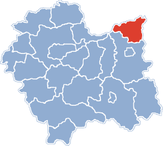
Luszowice is a village in the administrative district of Gmina Radgoszcz, within Dąbrowa County, Lesser Poland Voivodeship, in southern Poland.

Kalina Mała is a village in the administrative district of Gmina Miechów, within Miechów County, Lesser Poland Voivodeship, in southern Poland. It lies approximately 6 kilometres (4 mi) east of Miechów and 36 km (22 mi) north of the regional capital Kraków.

Grotniki Małe is a village in the administrative district of Gmina Nowy Korczyn, within Busko County, Świętokrzyskie Voivodeship, in south-central Poland. It lies approximately 3 kilometres (2 mi) north-east of Nowy Korczyn, 20 km (12 mi) south-east of Busko-Zdrój, and 66 km (41 mi) south of the regional capital Kielce.

Bocheniec is a village in the administrative district of Gmina Małogoszcz, within Jędrzejów County, Świętokrzyskie Voivodeship, in south-central Poland. It lies approximately 4 kilometres (2 mi) south-east of Małogoszcz, 19 km (12 mi) north of Jędrzejów, and 24 km (15 mi) south-west of the regional capital Kielce.

Podłozy is a settlement in the administrative district of Gmina Wielkie Oczy, within Lubaczów County, Subcarpathian Voivodeship, in south-eastern Poland, close to the border with Ukraine. It lies approximately 5 kilometres (3 mi) west of Wielkie Oczy, 18 km (11 mi) south of Lubaczów, and 79 km (49 mi) east of the regional capital Rzeszów.

Gliny Małe is a village in the administrative district of Gmina Borowa, within Mielec County, Subcarpathian Voivodeship, in south-eastern Poland. It lies approximately 5 kilometres (3 mi) north-west of Borowa, 17 km (11 mi) north-west of Mielec, and 65 km (40 mi) north-west of the regional capital Rzeszów.
Budy Mdzewskie is a village in the administrative district of Gmina Strzegowo, within Mława County, Masovian Voivodeship, in east-central Poland.
Zalesie is a village in the administrative district of Gmina Szydłowo, within Mława County, Masovian Voivodeship, in east-central Poland.

Mościbrody is a village in the administrative district of Gmina Wiśniew, within Siedlce County, Masovian Voivodeship, in east-central Poland. It lies approximately 4 kilometres (2 mi) north of Wiśniew, 8 km (5 mi) south of Siedlce, and 91 km (57 mi) east of Warsaw.

Mościbrody-Kolonia is a village in the administrative district of Gmina Wiśniew, within Siedlce County, Masovian Voivodeship, in east-central Poland. It lies approximately 4 kilometres (2 mi) north of Wiśniew, 8 km (5 mi) south of Siedlce, and 91 km (57 mi) east of Warsaw.
Czartówek is a village in the administrative district of Gmina Skulsk, within Konin County, Greater Poland Voivodeship, in west-central Poland.
Jerzmanice is a village in the administrative district of Gmina Rzepin, within Słubice County, Lubusz Voivodeship, in western Poland.

Jędrzejów is a village in the administrative district of Gmina Grodków, within Brzeg County, Opole Voivodeship, in south-western Poland. It lies approximately 5 kilometres (3 mi) south-west of Grodków, 26 km (16 mi) south-west of Brzeg, and 44 km (27 mi) west of the regional capital Opole.

Imieni is a settlement in the administrative district of Gmina Studzienice, within Bytów County, Pomeranian Voivodeship, in northern Poland. It lies approximately 10 kilometres (6 mi) east of Studzienice, 15 km (9 mi) east of Bytów, and 67 km (42 mi) south-west of the regional capital Gdańsk.
Markowo is a village in the administrative district of Gmina Dubeninki, within Gołdap County, Warmian-Masurian Voivodeship, in northern Poland, close to the border with the Kaliningrad Oblast of Russia.

Otręby is a village in the administrative district of Gmina Nowogard, within Goleniów County, West Pomeranian Voivodeship, in north-western Poland. It lies approximately 4 kilometres (2 mi) north of Nowogard, 25 km (16 mi) north-east of Goleniów, and 47 km (29 mi) north-east of the regional capital Szczecin.


