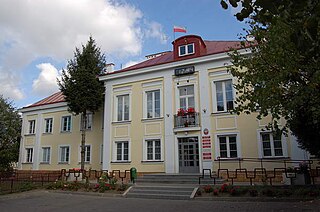
Raczyce is a village in the administrative district of Gmina Ziębice, within Ząbkowice Śląskie County, Lower Silesian Voivodeship, in south-western Poland. Prior to 1945 it was in Germany. It lies approximately 8 kilometres (5 mi) north of Ziębice, 19 km (12 mi) north-east of Ząbkowice Śląskie, and 52 km (32 mi) south of the regional capital Wrocław.

Wymysłów is a village in the administrative district of Gmina Karczmiska, within Opole Lubelskie County, Lublin Voivodeship, in eastern Poland. It lies approximately 5 kilometres (3 mi) north-east of Karczmiska, 13 km (8 mi) north-east of Opole Lubelskie, and 37 km (23 mi) west of the regional capital Lublin.

Gruszów Wielki is a village in the administrative district of Gmina Dąbrowa Tarnowska, within Dąbrowa County, Lesser Poland Voivodeship, in southern Poland. It lies approximately 7 kilometres (4 mi) north-east of Dąbrowa Tarnowska and 81 km (50 mi) east of the regional capital Kraków.

Skrzynka is a village in the administrative district of Gmina Szczucin, within Dąbrowa County, Lesser Poland Voivodeship, in southern Poland. It lies approximately 4 kilometres (2 mi) south of Szczucin, 13 km (8 mi) north-east of Dąbrowa Tarnowska, and 83 km (52 mi) east of the regional capital Kraków.

Głowaczowa is a village in the administrative district of Gmina Czarna, within Dębica County, Subcarpathian Voivodeship, in south-eastern Poland. It lies approximately 6 kilometres (4 mi) east of Czarna, 8 km (5 mi) west of Dębica, and 50 km (31 mi) west of the regional capital Rzeszów.

Niwka is a village in the administrative district of Gmina Radłów, within Tarnów County, Lesser Poland Voivodeship, in southern Poland. It lies approximately 4 kilometres (2 mi) south of Radłów, 11 km (7 mi) west of Tarnów, and 66 km (41 mi) east of the regional capital Kraków.

Pawłówka is a village in the administrative district of Gmina Chynów, within Grójec County, Masovian Voivodeship, in east-central Poland. It lies approximately 4 kilometres (2 mi) south-west of Chynów, 13 km (8 mi) east of Grójec, and 38 km (24 mi) south of Warsaw.

Stefanków is a village in the administrative district of Gmina Jasieniec, within Grójec County, Masovian Voivodeship, in east-central Poland. It lies approximately 9 kilometres (6 mi) east of Jasieniec, 13 km (8 mi) east of Grójec, and 41 km (25 mi) south of Warsaw.

Zakrzewo is a village in the administrative district of Gmina Karniewo, within Maków County, Masovian Voivodeship, in east-central Poland. It lies approximately 8 kilometres (5 mi) north-east of Karniewo, 4 km (2 mi) north-west of Maków Mazowiecki, and 75 km (47 mi) north of Warsaw.

Dzielnik is a village in the administrative district of Gmina Siennica, within Mińsk County, Masovian Voivodeship, in east-central Poland. It lies approximately 7 kilometres (4 mi) south-east of Siennica, 18 km (11 mi) south-east of Mińsk Mazowiecki, and 52 km (32 mi) east of Warsaw.

Kawęczynek is a village in the administrative district of Gmina Konstancin-Jeziorna, within Piaseczno County, Masovian Voivodeship, in east-central Poland. It lies approximately 5 kilometres (3 mi) south-east of Konstancin-Jeziorna, 10 km (6 mi) east of Piaseczno, and 22 km (14 mi) south-east of Warsaw.

Przedbórz is a village in the administrative district of Gmina Staroźreby, within Płock County, Masovian Voivodeship, in east-central Poland. It lies approximately 5 kilometres (3 mi) east of Staroźreby, 27 km (17 mi) north-east of Płock, and 81 km (50 mi) north-west of Warsaw.

Miękiny is a village in the administrative district of Gmina Iłów, within Sochaczew County, Masovian Voivodeship, in east-central Poland. It lies approximately 2 kilometres (1 mi) north-east of Iłów, 19 km (12 mi) north-west of Sochaczew, and 67 km (42 mi) west of Warsaw.

Swoboda is a village in the administrative district of Gmina Szamocin, within Chodzież County, Greater Poland Voivodeship, in west-central Poland. It lies approximately 9 kilometres (6 mi) east of Szamocin, 25 km (16 mi) east of Chodzież, and 76 km (47 mi) north of the regional capital Poznań.

Pleśno is a village in the administrative district of Gmina Bisztynek, within Bartoszyce County, Warmian-Masurian Voivodeship, in northern Poland. It lies approximately 12 kilometres (7 mi) north-east of Bisztynek, 23 km (14 mi) south-east of Bartoszyce, and 52 km (32 mi) north-east of the regional capital Olsztyn.

Czarnowiec is a village in the administrative district of Gmina Reszel, within Kętrzyn County, Warmian-Masurian Voivodeship, in northern Poland. It lies approximately 3 kilometres (2 mi) west of Reszel, 19 km (12 mi) west of Kętrzyn, and 50 km (31 mi) north-east of the regional capital Olsztyn.

Dłużec is a village in the administrative district of Gmina Piecki, within Mrągowo County, Warmian-Masurian Voivodeship, in northern Poland. It lies approximately 7 kilometres (4 mi) west of Piecki, 12 km (7 mi) south of Mrągowo, and 50 km (31 mi) east of the regional capital Olsztyn.

Zalesie is a village in the administrative district of Gmina Świętajno, within Olecko County, Warmian-Masurian Voivodeship, in northern Poland. It lies approximately 7 kilometres (4 mi) north-west of Świętajno, 17 km (11 mi) west of Olecko, and 119 km (74 mi) east of the regional capital Olsztyn.

Sadowo is a village in the administrative district of Gmina Biskupiec, within Olsztyn County, Warmian-Masurian Voivodeship, in northern Poland. It lies approximately 7 kilometres (4 mi) east of Biskupiec and 37 km (23 mi) east of the regional capital Olsztyn.

Małdaniec is a village in the administrative district of Gmina Szczytno, within Szczytno County, Warmian-Masurian Voivodeship, in northern Poland. It lies approximately 10 kilometres (6 mi) south-east of Szczytno and 50 km (31 mi) south-east of the regional capital Olsztyn.


