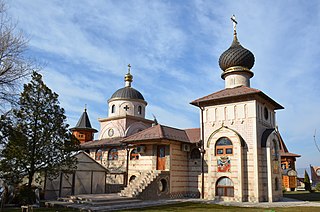
Kabadüz is a town and district of Ordu Province in the Black Sea region of Turkey. According to the 2000 census, population of the district is 11,049 of which 4,018 live in the town of Kabadüz. The district covers an area of 352 km2 (136 sq mi), and the town lies at an elevation of 545 m (1,788 ft).
Mozang Chungi or Mozang is an area in Lahore, Pakistan. Nearby areas are Jail Road, Choubarji, Shama and famous Anarkali Bazar. It is located at 31°32'55N 74°18'54E. The area came under attention after the controversial Raymond Allen Davis incident took place here.

Middlebranch is an unincorporated community in northeastern Plain Township, Stark County, Ohio, United States. Although it is unincorporated, it has a post office, with the ZIP code of 44652. The community is part of the Canton–Massillon Metropolitan Statistical Area. The area is mostly residential, with notable amounts of land being used for farming as well. Trains from the Wheeling and Lake Erie Railway often run through the area carrying loads of scrap metal bound for other Ohio cities.

Kichik Kovlyar is a village in the Sabirabad Rayon of Azerbaijan.

Sady is a village in the administrative district of Gmina Żytno, within Radomsko County, Łódź Voivodeship, in central Poland. It lies approximately 6 kilometres (4 mi) south-east of Żytno, 26 km (16 mi) south-east of Radomsko, and 101 km (63 mi) south of the regional capital Łódź.

Nowy Kaleń is a village in the administrative district of Gmina Sadkowice, within Rawa County, Łódź Voivodeship, in central Poland. It lies approximately 4 kilometres (2 mi) south-east of Sadkowice, 22 km (14 mi) east of Rawa Mazowiecka, and 76 km (47 mi) east of the regional capital Łódź.

Kowiesy is a village in Skierniewice County, Łódź Voivodeship, in central Poland. It is the seat of the gmina called Gmina Kowiesy. It lies approximately 21 kilometres (13 mi) east of Skierniewice and 67 km (42 mi) east of the regional capital Łódź.

Marianów is a village in the administrative district of Gmina Nowy Kawęczyn, within Skierniewice County, Łódź Voivodeship, in central Poland. It lies approximately 2 kilometres (1 mi) north-west of Nowy Kawęczyn, 10 km (6 mi) south-east of Skierniewice, and 54 km (34 mi) east of the regional capital Łódź.

Rzymy-Las is a village in the administrative district of Gmina Łuków, within Łuków County, Lublin Voivodeship, in eastern Poland. It lies approximately 7 kilometres (4 mi) south-east of Łuków and 72 km (45 mi) north of the regional capital Lublin.

Fanisławice is a village in the administrative district of Gmina Łopuszno, within Kielce County, Świętokrzyskie Voivodeship, in south-central Poland. It lies approximately 8 kilometres (5 mi) south-east of Łopuszno and 22 km (14 mi) west of the regional capital Kielce.

Zalesie is a village in the administrative district of Gmina Grójec, within Grójec County, Masovian Voivodeship, in east-central Poland. It lies approximately 4 kilometres (2 mi) north-west of Grójec and 39 km (24 mi) south of Warsaw.

Czarna Rola is a village in the administrative district of Gmina Jedlińsk, within Radom County, Masovian Voivodeship, in east-central Poland. It lies approximately 5 kilometres (3 mi) north-west of Jedlińsk, 18 km (11 mi) north of Radom, and 75 km (47 mi) south of Warsaw.

Galew is a village in the administrative district of Gmina Brudzew, within Turek County, Greater Poland Voivodeship, in west-central Poland. It lies approximately 4 kilometres (2 mi) south-west of Brudzew, 7 km (4 mi) north-east of Turek, and 118 km (73 mi) east of the regional capital Poznań.
Łęg Piekarski is a village in the administrative district of Gmina Dobra, within Turek County, Greater Poland Voivodeship, in west-central Poland.

Rozwory is a village in the administrative district of Gmina Debrzno, within Człuchów County, Pomeranian Voivodeship, in northern Poland. It lies approximately 10 kilometres (6 mi) west of Debrzno, 22 km (14 mi) south-west of Człuchów, and 136 km (85 mi) south-west of the regional capital Gdańsk.

Sunset View Beach is a hamlet within Mervin Rural Municipality No. 499, Saskatchewan, Canada. In 2006 the village had a population of 43 people. It previously held the status of village until January 1, 2005. The hamlet is located 116 km north of the City of North Battleford east of highway 795.

Bela Voda is a village in the municipality of Prokuplje, Serbia. According to the 2002 census, the village has a population of 207 people.

Branka u Opavy is a village in the Moravian-Silesian Region of the Czech Republic. It has around 1,070 inhabitants and lies 4 km south of Opava. The village was first mentioned in a written document in 1257. Moravice River flows through the village.

Lianhuacun station, is a station of Shenzhen Metro Line 3. It opened on 28 June 2011.
Bilad al-Musa is a village in the sub-governorate of Bariq in the province of Asir, Saudi Arabia. It is located at an elevation of 435 meters and had a population of 5,000 in 1970. It is connected with the main road by a 3 kilometer road. The headman is Ahmed Hiyazah Fayiz Hiyazah.


