
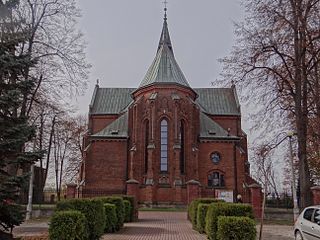
Gnojnik is a village in southern Poland, the seat of the rural gmina of Gmina Gnojnik in Brzesko County, Lesser Poland Voivodeship. It lies approximately 10 kilometres (6 mi) south of Brzesko and 52 km (32 mi) south-east of the regional capital Kraków.
Gmina Nowy Wiśnicz is an urban-rural gmina in Bochnia County, Lesser Poland Voivodeship, in southern Poland. Its seat is the town of Nowy Wiśnicz, which lies approximately 8 kilometres (5 mi) south of Bochnia and 40 km (25 mi) south-east of the regional capital Kraków.
Gmina Brzesko is an urban-rural gmina in Brzesko County, Lesser Poland Voivodeship, in southern Poland. Its seat is the town of Brzesko, which lies approximately 50 kilometres (31 mi) east of the regional capital Kraków.
Gmina Dębno is a rural gmina in Brzesko County, Lesser Poland Voivodeship, in southern Poland. Its seat is the village of Dębno, which lies approximately 8 kilometres (5 mi) east of Brzesko and 57 km (35 mi) east of the regional capital Kraków.
Jadowniki is a village in the administrative district of Gmina Brzesko, within Brzesko County, Lesser Poland Voivodeship, in southern Poland. It lies approximately 3 kilometres (2 mi) east of Brzesko and 52 km (32 mi) east of the regional capital Kraków.
Sterkowiec is a village in the administrative district of Gmina Brzesko, within Brzesko County, Lesser Poland Voivodeship, in southern Poland. It lies approximately 5 kilometres (3 mi) north-east of Brzesko and 53 km (33 mi) east of the regional capital Kraków.
Łęki is a village in the administrative district of Gmina Borzęcin, within Brzesko County, Lesser Poland Voivodeship, in southern Poland. It lies approximately 8 kilometres (5 mi) south-west of Borzęcin, 7 km (4 mi) north-east of Brzesko, and 53 km (33 mi) east of the regional capital Kraków.
Biskupice Melsztyńskie is a village in the administrative district of Gmina Czchów, within Brzesko County, Lesser Poland Voivodeship, in southern Poland. It lies approximately 4 kilometres (2 mi) north-east of Czchów, 14 km (9 mi) south-east of Brzesko, and 60 km (37 mi) east of the regional capital Kraków.
Tworkowa is a village in the administrative district of Gmina Czchów, within Brzesko County, Lesser Poland Voivodeship, in southern Poland. It lies approximately 3 kilometres (2 mi) north-west of Czchów, 12 km (7 mi) south of Brzesko, and 57 km (35 mi) south-east of the regional capital Kraków.
Jastew is a village in the administrative district of Gmina Dębno, within Brzesko County, Lesser Poland Voivodeship, in southern Poland. It lies approximately 4 kilometres (2 mi) north-west of Dębno, 4 km (2 mi) east of Brzesko, and 54 km (34 mi) east of the regional capital Kraków.
Niedźwiedza is a village in the administrative district of Gmina Dębno, within Brzesko County, Lesser Poland Voivodeship, in southern Poland. It lies approximately 8 kilometres (5 mi) south of Dębno, 12 km (7 mi) south-east of Brzesko, and 58 km (36 mi) east of the regional capital Kraków.
Perła is a village in the administrative district of Gmina Dębno, within Brzesko County, Lesser Poland Voivodeship, in southern Poland. It lies approximately 5 kilometres (3 mi) north-east of Dębno, 10 km (6 mi) east of Brzesko, and 59 km (37 mi) east of the regional capital Kraków.
Sufczyn is a village in the administrative district of Gmina Dębno, within Brzesko County, Lesser Poland Voivodeship, in southern Poland. It lies approximately 4 kilometres (2 mi) south-east of Dębno, 11 km (7 mi) east of Brzesko, and 60 km (37 mi) east of the regional capital Kraków.
Biesiadki is a village in the administrative district of Gmina Gnojnik, within Brzesko County, Lesser Poland Voivodeship, in southern Poland. It lies approximately 4 kilometres (2 mi) east of Gnojnik, 10 km (6 mi) south of Brzesko, and 55 km (34 mi) east of the regional capital Kraków.
Gosprzydowa is a village in the administrative district of Gmina Gnojnik, within Brzesko County, Lesser Poland Voivodeship, in southern Poland. It lies approximately 3 kilometres (2 mi) south-west of Gnojnik, 12 km (7 mi) south of Brzesko, and 51 km (32 mi) south-east of the regional capital Kraków.
Lewniowa is a village in the administrative district of Gmina Gnojnik, within Brzesko County, Lesser Poland Voivodeship, in southern Poland. It lies approximately 3 kilometres (2 mi) east of Gnojnik, 10 km (6 mi) south of Brzesko, and 54 km (34 mi) east of the regional capital Kraków.
Uszew is a village in the administrative district of Gmina Gnojnik, within Brzesko County, Lesser Poland Voivodeship, in southern Poland. It lies approximately 2 kilometres (1 mi) north of Gnojnik, 8 km (5 mi) south of Brzesko, and 51 km (32 mi) east of the regional capital Kraków.
Zawada Uszewska is a village in the administrative district of Gmina Gnojnik, within Brzesko County, Lesser Poland Voivodeship, in southern Poland. It lies approximately 3 kilometres (2 mi) north-east of Gnojnik, 8 km (5 mi) south of Brzesko, and 52 km (32 mi) east of the regional capital Kraków.
Rylowa is a village in the administrative district of Gmina Szczurowa, within Brzesko County, Lesser Poland Voivodeship, in southern Poland. It lies approximately 3 kilometres (2 mi) south-east of Szczurowa, 16 km (10 mi) north of Brzesko, and 53 km (33 mi) east of the regional capital Kraków.


