
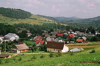
Jabłonki is a village near the Bieszczady mountains, in the administrative district of Gmina Baligród, within Lesko County, Subcarpathian Voivodeship, in south-eastern Poland. It lies approximately 10 kilometres (6 mi) south of Baligród, 24 km (15 mi) south of Lesko, and 88 km (55 mi) south of the regional capital Rzeszów. The village has a population of 110.
Baligród is a village in Lesko County, in the Subcarpathian Voivodeship (province) of south-eastern Poland. It is also the seat of the municipality (gmina) called Gmina Baligród. Location: 49°21' N 22°17' E. From 1 January 1999 until 1 January 2002 it was located in Bieszczady County.

Lake Solina is an artificial lake in the Bieszczady Mountains region, more precisely in Lesko County of the Subcarpathian Voivodship of Poland. Its coordinates are 49°22′27″N22°27′8″E.
Gmina Cisna is a rural gmina in Lesko County, Subcarpathian Voivodeship, in south-eastern Poland, on the Slovak border. Its seat is the village of Cisna, which lies approximately 30 kilometres (19 mi) south of Lesko and 95 km (59 mi) south of the regional capital Rzeszów.
Cisna-Wetlina Landscape Park is a protected area in south-eastern Poland, established in 1992, covering an area of 510.14 square kilometres (196.97 sq mi).
Tarnawa Niżna is a village in the administrative district of Gmina Lutowiska, within Bieszczady County, Subcarpathian Voivodeship, in south-eastern Poland, close to the border with Ukraine. It lies approximately 16 kilometres (10 mi) south-east of Lutowiska, 37 km (23 mi) south-east of Ustrzyki Dolne, and 116 km (72 mi) south-east of the regional capital Rzeszów.
Bystre is a village in the administrative district of Gmina Baligród, within Lesko County, Subcarpathian Voivodeship, in south-eastern Poland. It lies approximately 4 kilometres (2 mi) south of Baligród, 20 km (12 mi) south of Lesko, and 84 km (52 mi) south of the regional capital Rzeszów.
Cisowiec is a village in the administrative district of Gmina Baligród, within Lesko County, Subcarpathian Voivodeship, in south-eastern Poland. It lies approximately 4 kilometres (2 mi) north-west of Baligród, 13 km (8 mi) south-west of Lesko, and 76 km (47 mi) south of the regional capital Rzeszów.
Kiełczawa is a village in the administrative district of Gmina Baligród, within Lesko County, Subcarpathian Voivodeship, in south-eastern Poland. It lies approximately 6 kilometres (4 mi) west of Baligród, 16 km (10 mi) south-west of Lesko, and 77 km (48 mi) south of the regional capital Rzeszów.
Kołonice is a village in the administrative district of Gmina Baligród, within Lesko County, Subcarpathian Voivodeship, in south-eastern Poland. It lies approximately 10 kilometres (6 mi) south of Baligród, 24 km (15 mi) south of Lesko, and 88 km (55 mi) south of the regional capital Rzeszów.
Mchawa is a village in the administrative district of Gmina Baligród, within Lesko County, Subcarpathian Voivodeship, in south-eastern Poland. It lies approximately 4 kilometres (2 mi) north of Baligród, 13 km (8 mi) south of Lesko, and 77 km (48 mi) south of the regional capital Rzeszów.
Nowosiółki is a village in the administrative district of Gmina Baligród, within Lesko County, Subcarpathian Voivodeship, in south-eastern Poland. It lies approximately 7 kilometres (4 mi) north of Baligród, 9 km (6 mi) south of Lesko, and 73 km (45 mi) south of the regional capital Rzeszów.
Rabe is a village in the administrative district of Gmina Baligród, within Lesko County, Subcarpathian Voivodeship, in south-eastern Poland. It lies approximately 4 kilometres (2 mi) south-west of Baligród, 18 km (11 mi) south of Lesko, and 82 km (51 mi) south of the regional capital Rzeszów.
Roztoki Dolne is a village in the administrative district of Gmina Baligród, within Lesko County, Podkarpackie Voivodeship, in south-eastern Poland.
Stężnica is a village in the administrative district of Gmina Baligród, within Lesko County, Subcarpathian Voivodeship, in south-eastern Poland. It lies approximately 5 kilometres (3 mi) south-east of Baligród, 16 km (10 mi) south of Lesko, and 82 km (51 mi) south of the regional capital Rzeszów.
Zahoczewie is a village in the administrative district of Gmina Baligród, within Lesko County, Subcarpathian Voivodeship, in south-eastern Poland. It lies approximately 4 kilometres (2 mi) north of Baligród, 12 km (7 mi) south-west of Lesko, and 75 km (47 mi) south of the regional capital Rzeszów.
Żerdenka is a village in the administrative district of Gmina Baligród, within Lesko County, Subcarpathian Voivodeship, in south-eastern Poland. It lies approximately 7 kilometres (4 mi) north-east of Baligród, 9 km (6 mi) south of Lesko, and 74 km (46 mi) south of the regional capital Rzeszów.
Żernica Wyżna is a village in the administrative district of Gmina Baligród, within Lesko County, Subcarpathian Voivodeship, in south-eastern Poland. It lies approximately 4 kilometres (2 mi) north-east of Baligród, 13 km (8 mi) south of Lesko, and 78 km (48 mi) south of the regional capital Rzeszów.

The Baligród massacre occurred on Sunday, 6 August 1944 in Baligród, Lesko County, Poland. Ukrainians with the Ukrainian Insurgent Army (UPA) murdered members of the Polish population.


