This article is being considered for deletion in accordance with Wikipedia's deletion policy. |
 | |
| UTC time | 1998-05-03 23:30:21 |
|---|---|
| ISC event | 1104426 |
| USGS-ANSS | ComCat |
| Local date | May 4, 1998 |
| Local time | 08:30 |
| Magnitude | 7.5 Mw |
| Depth | 33.0 km |
| Epicenter | 22°18′N125°18′E / 22.3°N 125.3°E Coordinates: 22°18′N125°18′E / 22.3°N 125.3°E |
| Areas affected | Ryuku Islands, Taiwan |
| Tsunami | 4 cm |
The 1998 Ryukyu Islands earthquake(石垣島南方沖地震Ishigakijima nanpō-oki jishin) occurred on May 4, 1998, at 08:30 local time (UTC+9) (on May 3 at 23:30 UTC) in the Philippine Sea region with Mw 7.5 (USGS) and M7.7 (JMA). The epicenter was 260 km (162 mi) from Ishigaki Island, Japan, 400 km (249 mi) from Basco, Philippines, and 425 km (264 mi) from Hualian, Taiwan. A small local tsunami of 4 cm (2 in) was observed on Miyako. The earthquake was felt in the Ryukyu Islands and in parts of eastern Taiwan. The highest intensity was shindo 3 recorded on Yonaguni, Ishigaki, and Miyako. [1] In 1999, the former Japan Marine Science and Technology Center (海洋科学技術センター) (Japan Agency for Marine-Earth Science and Technology (JAMSTEC) (海洋研究開発機構) after 2004) conducted an investigation in the region of the source of this earthquake. [2]

The Philippine Sea is a marginal sea east and northeast of the Philippines occupying an estimated surface area of 5 million square kilometres. The Philippine Sea Plate forms the floor of the sea, which forms a portion of the western North Pacific Ocean. It is bordered by the Philippine archipelago on the southwest; Halmahera, Morotai, Palau, Yap, and Ulithi on the southeast; the Marianas, including Guam, Saipan, and Tinian, on the east; the Bonin and Iwo Jima on the northeast; the Japanese islands of Honshu, Shikoku, and Kyūshū on the north; the Ryukyu Islands on the northwest; and Taiwan in the west.
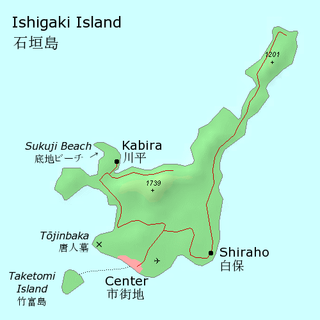
Ishigaki Island, also known as Ishigakijima, is a Japanese island west of Okinawa Hontō and the second-largest island of the Yaeyama Island group. It is within the City of Ishigaki in Okinawa Prefecture. The city functions as the business and transport center of the archipelago. The island is served by New Ishigaki Airport, the largest airport in the Yaeyamas.

Japan is an island country in East Asia. Located in the Pacific Ocean, it lies off the eastern coast of the Asian continent and stretches from the Sea of Okhotsk in the north to the East China Sea and the Philippine Sea in the south.
The source of this earthquake was a sinistral (left-lateral) strike-slip fault. It was an intra-plate earthquake inside the Philippine Sea Plate. [2] [3] Such large intra-plate earthquakes inside the Philippine Sea Plate are not very common in this region. This earthquake was the strongest intra-plate earthquake inside the Philippine Sea Plate in the Ryukyu Islands region in 100 years as it occurred. [4]
In geology, a fault is a planar fracture or discontinuity in a volume of rock, across which there has been significant displacement as a result of rock-mass movement. Large faults within the Earth's crust result from the action of plate tectonic forces, with the largest forming the boundaries between the plates, such as subduction zones or transform faults. Energy release associated with rapid movement on active faults is the cause of most earthquakes.

The Philippine Sea Plate or the Philippine Plate is a tectonic plate comprising oceanic lithosphere that lies beneath the Philippine Sea, to the east of the Philippines. Most segments of the Philippines, including northern Luzon, are part of the Philippine Mobile Belt, which is geologically and tectonically separate from the Philippine Sea Plate.