Route 35 is a state highway in the U.S. state of New Jersey, primarily traveling through the easternmost parts of Middlesex, Monmouth, and Ocean counties. It runs 58.11 mi (93.52 km) from the entrance to Island Beach State Park in Berkeley Township, Ocean County to an intersection with Route 27 in Rahway, Union County. Between Seaside Park and Mantoloking, Route 35 follows the right-of-way of the former Pennsylvania Railroad along the Jersey Shore. The route heads through Point Pleasant Beach and crosses the Manasquan River on the Brielle Bridge, meeting Route 34 and Route 70 at the former Brielle Circle in Wall Township. From there, Route 35 heads north and intersects Route 138, an extension of Interstate 195, continuing north through Monmouth County before crossing the Victory Bridge over the Raritan River into Perth Amboy, where the route continues north to Rahway.

Monmouth County is a county located in the central portion of the U.S. state of New Jersey. It is bordered to its west by Mercer and Middlesex Counties, to its south by Ocean County, to its east by the Atlantic Ocean, and to its north by the Raritan Bay. Monmouth County's geographic area comprises 30% water. The county is part of the Jersey Shore region of the state. It has also been categorized under the Central Jersey region, though it was not among the four counties explicitly listed as included in Central Jersey as part of legislation signed into law in 2023.

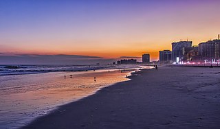
Atlantic City, sometimes referred to by its initials A.C., is a Jersey Shore seaside resort city in Atlantic County, in the U.S. state of New Jersey.

Ocean City, officially the Town of Ocean City, is an Atlantic resort town in Worcester County, Maryland, along the East Coast of the United States. The population was 6,844 at the 2020 U.S. census, although during summer weekends the city hosts between 320,000 and 345,000 vacationers and up to eight million visitors annually. During the summer, Ocean City becomes the second most populated municipality in Maryland, after Baltimore. It is part of the Salisbury metropolitan area as defined by the United States Census Bureau.

Ocean Grove is an unincorporated community and census-designated place (CDP) that is part of Neptune Township, in Monmouth County, in the U.S. state of New Jersey. It had a population of 3,057 at the 2020 United States census. It is located on the Atlantic Ocean's Jersey Shore, between Asbury Park to the north and Bradley Beach to the south. Listed on the National Register of Historic Places, Ocean Grove is noted for its abundant examples of Victorian architecture and the Great Auditorium, acclaimed as "the state’s most wondrous wooden structure, soaring and sweeping, alive with the sound of music".

Seaside Heights is a borough situated on the Jersey Shore, within Ocean County, in the U.S. state of New Jersey. As of the 2020 United States census, the borough's population was 2,440, a decrease of 447 (−15.5%) from the 2010 census count of 2,887, which in turn had reflected a decline of 268 (−8.5%) from the 3,155 counted in the 2000 census. Seaside Heights is located on the Barnegat Peninsula, a long, narrow barrier peninsula that separates the Barnegat Bay from the Atlantic Ocean. During the summer, the borough attracts a crowd largely under the age of 21, drawn to a community with boardwalk entertainment and one of the few shore communities with sizable numbers of apartments, attracting as many as 65,000 people who are often out until early morning visiting bars and restaurants.

Seaside Park is a borough in Ocean County, in the U.S. state of New Jersey. It is part of the New Brunswick–Lakewood, NJ Metropolitan Division, which is part of the New York metropolitan area. As of the 2020 United States census, the borough's population was 1,436, a decrease of 143 (−9.1%) from the 2010 census count of 1,579, which in turn had reflected decline of 684 (−30.2%) from the 2,263 counted in the 2000 census. Seaside Park is situated on the Barnegat Peninsula, a long, narrow barrier peninsula that separates Barnegat Bay from the Atlantic Ocean.

The Jersey Shore, commonly referred to locally as simply the Shore, is the coastal region of the U.S. state of New Jersey. Geographically, the term encompasses about 141 miles (227 km) of oceanfront bordering the Atlantic Ocean, from Perth Amboy in the north to Cape May Point in the south. The region includes Middlesex, Monmouth, Ocean, Atlantic, and Cape May counties, which are in the central and southern parts of the state. Located in the center of the Northeast Megalopolis, the northern half of the shore region is part of the New York metropolitan area, while the southern half of the shore region is part of the Philadelphia metropolitan area, also known as the Delaware Valley. The Jersey Shore hosts the highest concentration of oceanside boardwalks in the United States.

The 1938 New England Hurricane was one of the deadliest and most destructive tropical cyclones to strike the United States. The storm formed near the coast of Africa on September 9, becoming a Category 5 hurricane on the Saffir–Simpson hurricane scale, before making landfall as a Category 3 hurricane on Long Island on Wednesday, September 21. It is estimated that the hurricane killed 682 people, damaged or destroyed more than 57,000 homes, and caused property losses estimated at $306 million. Multiple other sources, however, mention that the 1938 hurricane might have really been a more powerful Category 4, having winds similar to Hurricanes Hugo, Harvey, Frederic and Gracie when it ran through Long Island and New England. Also, numerous others estimate the real damage between $347 million and almost $410 million. Damaged trees and buildings were still seen in the affected areas as late as 1951. It remains the most powerful and deadliest hurricane in recorded New England history, perhaps eclipsed in landfall intensity only by the Great Colonial Hurricane of 1635.

Casino Pier is an amusement park situated on a pier, in Seaside Heights, New Jersey. The pier opened in 1932 and formerly extended approximately 300 ft (91 m) into the Atlantic Ocean from the narrow strip of the Barnegat Peninsula, including approximately six blocks within Seaside Heights.

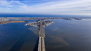
The Barnegat Peninsula, also known as the Island Beach Peninsula or Barnegat Bay Island and colloquially as "the barrier island", is a 20-mile (32 km) long, narrow barrier peninsula located on the Jersey Shore in Ocean County, New Jersey, United States, that divides the Barnegat Bay from the Atlantic Ocean. It is a vacation destination and summer colony area and is heavily dependent on tourism, real estate and fishing.

Pier Village is a Victorian-inspired mixed-use community located in Long Branch, New Jersey along the Atlantic Ocean. It opened in 2005.

The South Beach–Franklin Delano Roosevelt Boardwalk, alternately referred to as the FDR Boardwalk or the South Beach Boardwalk, is a boardwalk facing the Lower New York Bay on the East Shore of Staten Island, one of the five boroughs of New York City. The boardwalk is the main feature of a public park that stretches from Fort Wadsworth and the Verrazzano-Narrows Bridge to Miller Field, both part of the Gateway National Recreation Area. The park also contains numerous recreational facilities, including a skate park.

Hurricane Sandy was the costliest natural disaster in the history of New Jersey, with economic losses to businesses of up to $30 billion. The most intense storm of the 2012 Atlantic hurricane season, Sandy formed in the Caribbean Sea on October 22. For days ahead of its eventual landfall, the hurricane was expected to turn toward New Jersey, as anticipated by tropical cyclone forecast models and the National Hurricane Center (NHC). On October 29, Sandy lost its characteristics of a tropical cyclone and transitioned into an extratropical cyclone while approaching the New Jersey coast. About two and a half hours later, the former hurricane moved ashore New Jersey near Brigantine in Atlantic County, just north of Atlantic City, producing wind gusts as strong as 91 mph (146 km/h).

New York was severely affected by Hurricane Sandy on October 29–30, 2012, particularly New York City, its suburbs, and Long Island. Sandy's impacts included the flooding of the New York City Subway system, of many suburban communities, and of all road tunnels entering Manhattan except the Lincoln Tunnel. The New York Stock Exchange closed for two consecutive days. Numerous homes and businesses were destroyed by fire, including over 100 homes in Breezy Point, Queens. Large parts of the city and surrounding areas lost electricity for several days. Several thousand people in midtown Manhattan were evacuated for six days due to a crane collapse at Extell's One57. Bellevue Hospital Center and a few other large hospitals were closed and evacuated. Flooding at 140 West Street and another exchange disrupted voice and data communication in lower Manhattan.

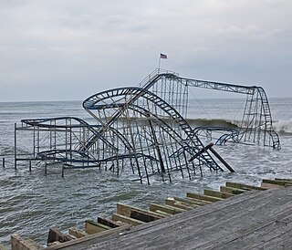
Star Jet was a steel roller coaster that operated at Casino Pier in Seaside Heights, New Jersey from 2002 until it was swept into the Atlantic Ocean by Hurricane Sandy in 2012.

Hydrus is a steel roller coaster at Casino Pier in Seaside Heights, New Jersey. Opened in 2017, it was the sixth Gerstlauer Euro-Fighter roller coaster to open in the United States and the first Euro-Fighter 320 model in the world. It replaced Star Jet, which was destroyed by Hurricane Sandy in 2012.

Jet Star, sometimes stylized as Jet-Star, was a steel roller coaster which operated between 1970 and 2000 at Casino Pier in Seaside Heights, New Jersey. It was replaced by—and sometimes confused with—Star Jet, the coaster that was swept into the Atlantic Ocean by Hurricane Sandy on October 29, 2012.

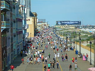
A boardwalk is a promenade along a beach or waterfront. In North America, and particularly in the United States, many waterfront commercial boardwalks have become so successful as tourist attractions that the simple wooden pathways have been replaced by esplanades made of concrete, brick or other construction, sometimes with a wooden façade on the surface. An entertainment boardwalk often contains an amusement park, casinos, or hotels on a pier-like structure. One of the earliest such boardwalks was designed in New Jersey and opened June 26, 1870, in Atlantic City, and one of the longest is Mazatlán's Malecón, at 13 miles (21 km) of oceanfront boardwalk.


