29th Street Yard (St. Louis MetroLink)

Last updated

Coordinates: 38°37′12.37″N90°07′04.32″W / 38.6201028°N 90.1178667°W / 38.6201028; -90.1178667

Geographic coordinate system Coordinate system

A geographic coordinate system is a coordinate system that enables every location on Earth to be specified by a set of numbers, letters or symbols. The coordinates are often chosen such that one of the numbers represents a vertical position and two or three of the numbers represent a horizontal position; alternatively, a geographic position may be expressed in a combined three-dimensional Cartesian vector. A common choice of coordinates is latitude, longitude and elevation. To specify a location on a plane requires a map projection.

The 29th Street Yard (also known as Jackie Joyner-Kersee Yard) is a rail yard for the St. Louis MetroLink light rail system in Greater St. Louis.

Rail yard location for storing and sorting railroad cars

A rail yard, railway yard or railroad yard is a complex series of railroad tracks for storing, sorting, or loading and unloading, railroad cars and locomotives. Railroad yards have many tracks in parallel for keeping rolling stock stored off the mainline, so that they do not obstruct the flow of traffic. Railroad cars are moved around by specially designed yard switchers, a type of locomotive. Cars in a railroad yard may be sorted by numerous categories, including railroad company, loaded or unloaded, destination, car type, or whether they need repairs. Railroad yards are normally built where there is a need to store cars while they are not being loaded or unloaded, or are waiting to be assembled into trains. Large yards may have a tower to control operations.

Light rail typically an urban form of public transport using steel-tracked fixed guideways

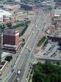
Light rail, light rail transit (LRT), or fast tram is a form of urban rail transit using rolling stock similar to a tramway, but operating at a higher capacity, and often on an exclusive right-of-way.

Greater St. Louis Metropolitan area in the United States

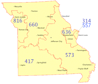
Greater St. Louis is a bi-state metropolitan area that completely surrounds and includes the independent city of St. Louis. It includes parts of both the U.S. states of Missouri and Illinois. The city core is on the Mississippi Riverfront on the border with Illinois in the geographic center of the metro area. The Mississippi River bisects the metro area in half geographically between Illinois and Missouri; however, the Missouri half is much more populous. St. Louis is the largest metro area in Missouri and the second largest in Illinois. St. Louis County is independent of the City of St. Louis and their two populations are generally tabulated separately.

The yard sits east of East St. Louis, Illinois. It is one of two MetroLink railyards that maintain the SD-400s and the SD-460s in Greater St. Louis. It opened in 2001 with the St. Clair County Extension. On October 27, 2009, Metro opened a new paint booth facility.

East St. Louis, Illinois City in Illinois, United States

East St. Louis is a city in St. Clair and Madison counties in southwestern Illinois, United States. It is located across the Mississippi River from St. Louis, Missouri, in what is defined as the Metro-East region of Southern Illinois. Once a bustling industrial center, like many cities in the Rust Belt, East St. Louis has been severely affected by loss of jobs due to industrial restructuring during the second half of the 20th century. In 1950, East St. Louis was the fourth-largest city in Illinois when its population peaked at 82,366. As of the 2010 census, the city had a population of 27,006, less than one-third of the 1950 census.


Related Research Articles

St. Clair County, Illinois County in the United States

St. Clair County is the oldest county in the U.S. state of Illinois; its western border is formed by the Mississippi River. According to the 2010 United States Census, it had a population of 270,056, making it the eighth-most populous county in Illinois and the most populous in the southern portion of the state. Its county seat is Belleville. The county was founded in 1790 by the government of the Northwest Territory, before the establishment of Illinois as a state. Cahokia Village in the county was founded in 1697 and was a French settlement and former Jesuit mission.

Madison County, Illinois County in the United States

Madison County is a county in the U.S. state of Illinois. According to the 2010 census, it had a population of 269,282. The county seat is Edwardsville, and its largest city is Granite City.

Belleville, Illinois City in Illinois, United States

Belleville is a city in St. Clair County, Illinois, coterminous with the now defunct Belleville Township. The population was 42,034 according to the Census Bureau's 2015 estimates.

Lebanon, Illinois City in Illinois, United States

Lebanon is a city in St. Clair County, Illinois, United States. The population was 5,523 at the 2010 census. Like many other places in "Little Egypt" or Southern Illinois, Lebanon was named after the Eastern Mediterranean country of the same name. It is a part of the Metro-East region of the Greater St. Louis metropolitan area.

Branch Avenue station Washington D.C. metro station

Branch Avenue is an island-platformed Washington Metro station in Suitland, Maryland, United States. The station was opened on January 13, 2001, and is operated by the Washington Metropolitan Area Transit Authority (WMATA). The station presently serves as the southeastern terminus for the Green Line, with the Branch Avenue rail yard lying just beyond this station. The station is located near the intersection of Auth Road and Old Soper Road.

MetroLink (St. Louis) light rail system in St. Louis, Missouri and the surrounding area

MetroLink is the light rail transit system in the Greater St. Louis area of Missouri and the Metro East area of Illinois. The system consists of two lines connecting Lambert-St. Louis International Airport and Shrewsbury, Missouri with Scott Air Force Base near Shiloh, Illinois through downtown St. Louis. The system features 38 stations and carries an average of 53,123 people each weekday. As of the first quarter of 2015, it is second only to Minneapolis Metro Transit's Blue and Green lines in the Midwestern United States in terms of ridership, and is the 11th-largest light rail system in the country.

Area code 314

314 serves the independent city of St. Louis and most of its suburbs in neighboring St. Louis County.

EMD SD90MAC model of American diesel locomotive

The EMD SD90MAC is a 6,000 hp (4,470 kW) C-C roadswitcher diesel-electriclocomotive produced by General Motors Electro-Motive Division. It is, with the SD80MAC, one of the largest single-engined locomotives produced by that company, surpassed only by the dual-engined DDA40X.

Metro East Region of Illinois in the United States

Metro East is a region in Illinois that comprises the eastern suburbs of St. Louis, Missouri, United States. It encompasses five Southern Illinois counties in the St. Louis Metropolitan Statistical Area. The region's most populated city is Belleville, with 45,000 residents. The Metro East is the second largest urban area in Illinois after the Chicago metropolitan area and, as of the 2000 census, the population of the Metro East statistical area is 599,845 residents, a figure that has risen above 700,000 in 2010. The significant growth in the Metro East is mainly due to people in smaller outlying towns in Illinois moving to the area for better economic/job opportunities.

Metro Transit (St. Louis) public transit operator in the St. Louis metropolitan area

Metro Transit is an enterprise of Bi-State Development, an interstate compact formed by Missouri and Illinois in 1949. Its operating budget in 2016 was $280 million, which is funded by sales taxes from the City of St. Louis and St. Louis County, the St. Clair County Illinois Transit District, federal and state grants and subsidies, and through fare paying passengers.

Transportation in St. Louis

Transportation in St. Louis, Missouri includes road, rail, ship, and air transportation modes connecting the city of St. Louis with surrounding communities in Greater St. Louis, national transportation networks, and international locations. The city of St. Louis also supports a public transportation network that includes bus and light rail service.

Stookey Township, St. Clair County, Illinois Township in Illinois, United States

As of the 2010 census, its population was 10,007 and it contained 4,394 housing units.

Stites Township, St. Clair County, Illinois Township in Illinois, United States

Stites Township is located in St. Clair County, Illinois. As of the 2010 census, its population was 749 and it contained 326 housing units. Stites Township was originally named Brooklyn Township when it was reorganized from a portion of East St. Louis Township in February, 1888. Its name was changed to Stites in April, 1888.

Madison County Transit

Madison County Transit, or MCT for short, is a bus and bike trail transportation system that serves the citizens of Madison County, which is located in Illinois approximately 20 miles (32 km) northeast of St. Louis. It was created in 1980 by the Madison County Board to improve transportation in Madison County, and is a completely separate transit system from the St. Louis Metro Transit system which includes MetroLink, which doesn't operate into Madison County, though the buses connect with many MetroBus routes and even serve MetroLink stations in East St. Louis, Belleville and Downtown St. Louis.

DeBaliviere Place, St. Louis Neighborhood of St. Louis in United States

DeBaliviere Place is a neighborhood of St. Louis, Missouri.

Skinker DeBaliviere, St. Louis Neighborhood of St. Louis in Missouri, United States

Skinker DeBaliviere is a neighborhood of St. Louis, Missouri located directly north of Forest Park. In addition to the park, its boundaries are Delmar Boulevard to the north, DeBaliviere Avenue to the east, and the western city limits. It is home to The Pageant, Pin-up Bowl, and all the other establishments of the Delmar Loop east of University City. It also includes the Delmar Loop, Forest Park – DeBaliviere, and Skinker MetroLink stations. In 1978, it was designated a Local Historic District by the City of St. Louis, and the private subdivision of Parkview is listed in the National Register of Historic Places.

Red Line (St. Louis MetroLink) light rail service of the St. Louis MetroLink

The Red Line of the St. Louis MetroLink is a light rail service operating between 28 stations in Greater St. Louis. It is the oldest and longest line in the system.

Ewing Yard (St. Louis MetroLink)

The Ewing Yard is a rail yard for the St. Louis MetroLink light rail system in Greater St. Louis. One of the Bi-State Development Agency's major operation and maintenance facilities, the yard maintains the fleet of SD-400 and SD-460 electric light rail vehicles.

Transportation in Greater St. Louis includes road, rail, and air transportation modes connecting the communities in the area with domestic and international transportation networks. Parts of Greater St. Louis also support a public transportation network that includes bus and light rail service.