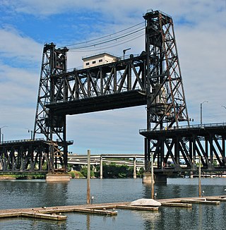
The Steel Bridge is a through truss, double-deck vertical-lift bridge across the Willamette River in Portland, Oregon, United States, opened in 1912. Its lower deck carries railroad and bicycle/pedestrian traffic, while the upper deck carries road traffic, and light rail (MAX), making the bridge one of the most multimodal in the world. It is the only double-deck bridge with independent lifts in the world and the second oldest vertical-lift bridge in North America, after the nearby Hawthorne Bridge. The bridge links the Rose Quarter and Lloyd District in the east to Old Town Chinatown neighborhood in the west.

The Cambie Bridge is a six-lane, precast, box girder bridge spanning False Creek in Vancouver, British Columbia. The current bridge opened in 1985, but is the third bridge at the same location. Often referred to as the Cambie Street Bridge, it connects Cambie Street on the south shore of False Creek to both Nelson and Smithe Streets in the downtown peninsula. It is the easternmost of False Creek's fixed crossings; the Burrard and Granville bridges are a little more than a kilometre to the west, and the new Canada Line SkyTrain tunnel is built just west of the Cambie Bridge.

The Fig Tree Bridge is a road bridge that carries Burns Bay Road across the Lane Cove River, and connects the suburbs of Hunters Hill in the south and Linley Point in the north, located approximately seven kilometres northwest of the central business district of Sydney in New South Wales, Australia. The concrete girder bridge carries motor vehicles, and a grade-separated footpath and cycleway.

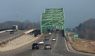
The Daniel Boone Bridge is the name for two bridges carrying Interstate 64, U.S. Route 40, U.S. Route 61 and the Avenue of the Saints across the Missouri River between St. Louis County and St. Charles County, Missouri. The older bridge, which carries westbound traffic, is a continuous truss bridge, while the newer bridge, which carries eastbound traffic, is a deck girder bridge.

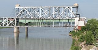
The Armour-Swift-Burlington (ASB) Bridge, also known as the North Kansas City Bridge and the LRC Bridge, is a rail crossing over the Missouri River in Kansas City, Missouri, that formerly also had an upper deck for automobile traffic.

The Fairfax Bridge and Platte Purchase Bridge were a pair of twin truss bridges over the Missouri River that handled traffic on U.S. Route 69 (US 69), connecting Interstate 635 (I-635) in Riverside, Missouri with the Seventh Street Trafficway in Fairfax, Kansas. The southbound span was built by the Kansas City Bridge Company, and was 2,486.5 feet (757.9 m) long and had 13 spans on 15 piers. The northbound spans biggest span was 465.96 feet and it is 2552.19 feet long and had a deck width of 28.31 feet and vertical clearance of 15.02 feet.

The Platte Purchase Bridge was a continuous truss bridge over the Missouri River that handled northbound U.S. Route 69, connecting the Seventh Street Trafficway in Fairfax, Kansas with Interstate 635 (Kansas–Missouri) in Riverside, Missouri. Its biggest span was 465.96 feet and it is 2552.19 feet long and had a deck width of 28.31 feet and vertical clearance of 15.02 feet. The bridge was named for the Platte Purchase.

The South Omaha Veterans Memorial Bridge was a continuous warren through truss bridge over the Missouri River connecting Omaha, Nebraska with Council Bluffs, Iowa via U.S. Highway 275.

The Carl E. Stotz Memorial Little League Bridge, formerly known as the Market Street Bridge, carries approximately 27,700 vehicles a day on U.S. Route 15 over the West Branch Susquehanna River between Williamsport and South Williamsport in Lycoming County, Pennsylvania, in the United States. It is the seventh bridge on the site and was built at a cost of over $60,000,000.
The 23rd Street viaduct, known as the (East) Kansas Avenue Bridge in Kansas, is an automobile crossing of the Kansas River, south of the Rock Island Bridge. Though it is entirely in Kansas City, Kansas, one half leads to Kansas City, Missouri, where Kansas Avenue becomes Avenida César E. Chávez, known as 23rd Street until 1994. The span is 1,395 feet (425 m) long.

The Lewis and Clark Viaduct are two nine span viaducts that cross the Kansas River in the United States. Designed by Waddell and Hedrick, the first viaduct, a four-lane, deck truss bridge, opened to the public on January 29, 1907, the second bridge, also of the deck truss design, opened to the public on November 12, 1962. It rises above the West Bottoms, and several sets of railroad tracks. The 1907 viaduct is notable for being the first roadway bridge to connect Kansas City, Missouri, with Kansas City, Kansas, non-stop all the way across. It is about 1.5 miles (2.4 km) long and carries Interstate 70/U.S. Route 24/U.S. Route 40/U.S. Route 169 (I-70/US 24/US 40/US 169). The I-670 Viaduct serves as a complementary to the viaduct, it was built in 1990 to the south.
The 18th Street Expressway Bridge is a one level deck truss, four lane crossing of the Kansas River in Kansas City, Kansas. It was built in 1959, to replace the Argentine Bridge to the west.
The 12th Street Bridge is an automobile crossing of the Kansas River in Kansas City, Kansas.

The U.S. 40 and 59 Bridges are twin multi-beam girder bridges over the Kansas River at Lawrence, Kansas. The west bridge carries two lanes of southbound traffic, connecting to Vermont Street, while the east bridge carries two lanes of northbound traffic from Massachusetts Street. Both bridges converge on the north end to become North 2nd Street. The east bridge is also the third bridge to be built at this location.
Armourdale community is a district in the lower part of the Kansas River valley in Kansas City, Kansas. It is a main district between the West Bottoms and the Rosedale, Kansas area. The Kansas River makes an oxbow curve around the entire district, which is home to Shawnee Park and Bill Clem Park.

The Highway 78 Bridge at the Red River is an eight-span through truss bridge over the Red River between Oklahoma and Texas on Oklahoma State Highway 78/Texas State Highway 78. It was built as a federal relief project during the Great Depression as part of President Franklin Roosevelt's New Deal. Today the bridge and the area retain the look and feel of the time of its construction. As part of Highway 78 the bridge's average daily traffic was 1,700 cars per day.

Heizer, also called Heizerton, is an unincorporated community in Barton County, Kansas, United States.

The West Sixth Street Bridge is a historic stone arch bridge in downtown Austin, Texas. Built in 1887, the bridge is one of the state's oldest masonry arch bridges. It is located at the site of the first bridge in Austin, carrying Sixth Street across Shoal Creek to link the western and central parts of the old city. The bridge was added to the National Register of Historic Places in 2014.

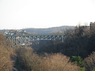
The Charles Anderson Memorial Bridge is a steel deck truss bridge located in Pittsburgh, Pennsylvania, United States. The bridge carries the four-lane roadway of Boulevard of the Allies across a ravine known as Junction Hollow, connecting the neighborhoods of Central Oakland and South Oakland with Schenley Park. The bridge also spans the Junction Hollow Trail and P&W Subdivision railroad tracks which run along the bottom of the valley.


