
108 Mile Ranch is a residential community of 700 homes situated in the South Cariboo region of British Columbia located in a historic area of ranches and lakes.

100 Mile House is a district municipality located in the South Cariboo region of central British Columbia, Canada.

Lillooet is a district municipality in the Squamish-Lillooet region of southwestern British Columbia. The town is on the west shore of the Fraser River immediately north of the Seton River mouth. On BC Highway 99, the locality is by road about 100 kilometres (62 mi) northeast of Pemberton, 64 kilometres (40 mi) northwest of Lytton, and 172 kilometres (107 mi) west of Kamloops.
Highway 97 is a major highway in the Canadian province of British Columbia. It is the longest continuously numbered route in the province, running 2,081 km (1,293 mi) and is the only route that runs the entire north–south length of the British Columbia, connecting the Canada–United States border near Osoyoos in the south to the British Columbia–Yukon boundary in the north at Watson Lake, Yukon.
Highway 24, also known as the Little Fort Highway or the Interlakes Highway, is a 97-kilometre-long (60 mi) east-west connection between the Cariboo Highway, just south of 100 Mile House, and the Southern Yellowhead Highway at Little Fort. It practically provides a "second-chance" route to travellers heading east from Vancouver who missed the route to the northern part of the province or toward Edmonton.

The Cariboo is an intermontane region of British Columbia, Canada, centered on a plateau stretching from Fraser Canyon to the Cariboo Mountains. The name is a reference to the caribou that were once abundant in the region.

Williams Lake is a city in the Central Interior of British Columbia, in the central part of a region known as the Cariboo. Williams Lake is one of the largest cites, by population of metropolitan area, in the Cariboo after neighbouring Quesnel. The city is famous for the Williams Lake Stampede, which was once the second largest professional rodeo in Canada, after only the Calgary Stampede.
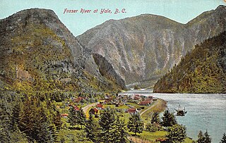
Yale is an unincorporated town in the Canadian province of British Columbia, which grew in importance during the Fraser Canyon Gold Rush.

The Cariboo Regional District spans the Cities and Districts of Quesnel, Williams Lake, 100 Mile House, and Wells in the Central Interior of British Columbia.

The Cariboo Road was a project initiated in 1860 by the Governor of the Colony of British Columbia, James Douglas. It involved a feat of engineering stretching from Fort Yale to Barkerville, B.C. through extremely hazardous canyon territory in the Interior of British Columbia.

The Fraser Canyon is a major landform of the Fraser River where it descends rapidly through narrow rock gorges in the Coast Mountains en route from the Interior Plateau of British Columbia to the Fraser Valley. Colloquially, the term "Fraser Canyon" is often used to include the Thompson Canyon from Lytton to Ashcroft, since they form the same highway route which most people are familiar with, although it is actually reckoned to begin above Williams Lake at Soda Creek Canyon near the town of the same name.

The Douglas Road, a.k.a. the Lillooet Trail, Harrison Trail or Lakes Route, was a goldrush-era transportation route from the British Columbia Coast to the Interior. Over 30,000 men are reckoned to have travelled the route in, although by the end of the 1860s it was virtually abandoned due to the construction of the Cariboo Wagon Road, which bypassed the region.

Clinton is a village in British Columbia, Canada, located approximately 40 km (25 mi) northwest of Cache Creek and 30 km south of 70 Mile House.
150 Mile House is an unincorporated community of 1,172 people in the Cariboo region of British Columbia. It is located 15 km (9 mi) southeast of Williams Lake on Highway 97.
The Old Cariboo Road is a reference to the original wagon road to the Cariboo gold fields in what is now the Canadian province of British Columbia. It should not be confused with the Cariboo Road, which was built slightly later and used a different route.

70 Mile House is a community situated on Highway 97 in the Cariboo region of British Columbia, Canada. Its name is derived from its distance from Lillooet, which was Mile 0 of the Old Cariboo Road. Other examples of towns named by their distance from Lillooet on the Old Cariboo Road are 93 Mile House, 100 Mile House, and 150 Mile House. In its heyday, 70 Mile House was a frequent stop for stagecoaches, such as the ones run by Barnard's Express and for Cataline's mule train.
Lac La Hache is a recreational and retirement community in the Cariboo region of British Columbia, Canada. Located on the shore of Lac La Hache alongside British Columbia Highway 97 near the regional centre of 100 Mile House, the community's origins date to the days of the Cariboo Gold Rush and the Cariboo Wagon Road, for which it provided an important roadhouse. Lac La Hache, or "The Lake of the Axe" as it translates to, was named, during the fur trade era, after the unfortunate incident of a French-Canadian voyageur who lost his axe head while chopping a hole in the ice. It is a town rich in history, as it sits along the Gold Rush Trail.
Australian is an unincorporated community on the east side of the Fraser River in the North Cariboo region of central British Columbia. On BC Highway 97, the locality is by road about 85 kilometres (53 mi) north of Williams Lake and 33 kilometres (21 mi) south of Quesnel.

The Interlakes, also known as the Interlakes District, is a geographic region of the Interior of British Columbia, Canada, located along and around the Interlakes Highway between 100 Mile House on BC Highway 97 and Little Fort on the North Thompson River. The area is a subregion of the Cariboo and includes the communities of Bridge Lake and Lac des Roches.
Parsonville is a ghost town on the east shore of the Fraser River approximately opposite Lillooet. On BC Highway 99, the locality is by road about 100 kilometres (62 mi) northeast of Pemberton, 64 kilometres (40 mi) northwest of Lytton, and 172 kilometres (107 mi) west of Kamloops.
