Hook of Holland is a town in the southwestern corner of Holland, at the mouth of the New Waterway shipping canal into the North Sea. The town is administered by the municipality of Rotterdam as a district of that city. Its district covers an area of 16.7 km2, of which 13.92 km2 is land. On 1 January 1999 it had an estimated population of 9,400.

Overijssel is a province of the Netherlands located in the eastern part of the country. The province's name translates to "across the IJssel", from the perspective of the Episcopal principality of Utrecht by which it was held until 1528. The capital city of Overijssel is Zwolle and the largest city is Enschede. The province had a population of 1,162,215 as of November 2019.
Daarlerveen is a village in the Dutch province of Overijssel. It is located in the municipality of Hellendoorn, about 2 km south of the town of Vroomshoop.

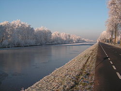
Gramsbergen is a small Dutch city on the Vechte, located in the municipality of Hardenberg and the province of Overijssel. The town is located on corridors of different transportation modes: The N34, the Zwolle - Emmen railway and the Almelo - de Haandrik canal.

Dronryp is a village in the Dutch municipality of Waadhoeke. On 1 January 2017, it had 3,281 inhabitants.

Geerdijk is a village in the Dutch province of Overijssel. It is located in the municipality of Twenterand. It became a village in 2009.

Vroomshoop is a town located at the center of the municipality Twenterand in the Dutch province of Overijssel and was founded around 1859. The earliest inhabitants lived from the peat that was found in the nearby area.

Vriezenveen is a town in the municipality of Twenterand in the Dutch province of Overijssel. The population was 13,800 on January 1, 2020.

Den Ham [dɛn ɦɑm] is a village in the Dutch province of Overijssel. It is located in the municipality of Twenterand, about 15 km northwest of Almelo.

Bergentheim is a village in the municipality of Hardenberg, the Netherlands. Located between the canal Almelo- De Haandrik and the railway Zwolle-Emmen, the town used to have a railway station, but it was closed in 1975. The building was still there until August 1993.

Ens is a village in the Dutch province of Flevoland. It is a part of the municipality of Noordoostpolder, and lies about 10 km southeast of Emmeloord.

Nagele is a village in the Dutch province of Flevoland. It is a part of the municipality of Noordoostpolder, and lies about 10 km south of Emmeloord.

Eext is a village in the Dutch province of Drenthe. It is a part of the municipality of Aa en Hunze, and lies about 12 km east of Assen. There are three hunebedden (dolmen) near the village.

Annerveenschekanaal is a village in the Dutch province of Drenthe. It is a part of the municipality of Aa en Hunze, and lies about 18 km east of Assen.

Valthermond is a village in the Dutch province of Drenthe. It is a part of the municipality of Borger-Odoorn, and lies about 18 km north of Emmen.

Emmer-Compascuum is a village in the Netherlands and is part of the Emmen municipality in Drenthe.

Warns is a village in the northern Netherlands. It is located in the municipality of Súdwest-Fryslân, Friesland. It had a population of around 720 in January 2017.

Berltsum is a village in Waadhoeke municipality in the province of Friesland, the Netherlands. It had a population of around 2,529 in January 2017. Until 2018, the village was part of the Menameradiel municipality.

Ypecolsga is a village in Súdwest-Fryslân in the province of Friesland, the Netherlands. It had a population of around 50 in January 2017.

Musselkanaal is a town in the Dutch province of Groningen. It is located in the municipality of Stadskanaal. It was established by the city of Groningen in the 1840s to exploit the peat. It used to be part of the municipality of Onstwedde, but was merged into Stadskanaal in 1968.