The Rio Grande is one of the principal rivers in the southwestern United States and northern Mexico. The Rio Grande begins in south-central Colorado in the United States and flows to the Gulf of Mexico. After passing through the length of New Mexico along the way, it forms part of the Mexico–United States border. According to the International Boundary and Water Commission, its total length was 1,896 miles (3,051 km) in the late 1980s, though course shifts occasionally result in length changes. Depending on how it is measured, the Rio Grande is either the fourth- or fifth-longest river system in North America.

The Río de la Plata, called River Plate in British English and the Commonwealth and La Plata River in other English-speaking countries, is the estuary formed by the confluence of the Uruguay River and the Paraná River at Punta Gorda. It empties into the Atlantic Ocean and forms a funnel-shaped indentation on the southeastern coastline of South America. Depending on the geographer, the Río de la Plata may be considered a river, an estuary, a gulf, or a marginal sea. It is the widest river in the world, with a maximum width of 220 kilometres (140 mi).
The Uruguay River is a major river in South America. It flows from north to south and forms parts of the boundaries of Brazil, Argentina, and Uruguay, separating some of the Argentine provinces of La Mesopotamia from the other two countries. It passes between the states of Santa Catarina and Rio Grande do Sul in Brazil; forms the eastern border of the provinces of Misiones, Corrientes, and Entre Ríos in Argentina; and makes up the western borders of the departments of Artigas, Salto, Paysandú, Río Negro, Soriano, and Colonia in Uruguay.

Entre Ríos is a central province of Argentina, located in the Mesopotamia region. It borders the provinces of Buenos Aires (south), Corrientes (north) and Santa Fe (west), and Uruguay in the east.

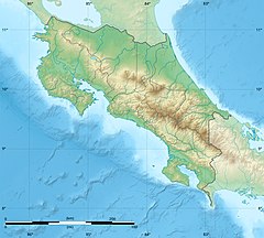
Guanacaste is a province of Costa Rica located in the northwestern region of the country, along the coast of the Pacific Ocean. It is bordered by Nicaragua to the north, Alajuela Province to the east, and Puntarenas Province to the southeast. It is the most sparsely populated of all the provinces of Costa Rica. The province covers an area of 10,141 km2 (3,915 sq mi) and as of 2010, had a population of 354,154, with annual revenue of $2million.

Arenal Tempisque Conservation Area, is an administrative area which is managed by SINAC for the purposes of conservation in the northwest part of Costa Rica, near the Arenal Volcano and covering part of the Cordillera de Tilarán and Cordillera de Guanacaste. It contains a number of National Parks, Wildlife refuges and Protected Zones. The area was previously known as Arenal Tilarán Conservation Area.

The Río de la Plata basin, more often called the River Plate basin in scholarly writings, sometimes called the Platine basin or Platine region, is the 3,170,000-square-kilometre (1,220,000 sq mi) hydrographical area in South America that drains to the Río de la Plata. It includes areas of southeastern Bolivia, southern and central Brazil, the entire country of Paraguay, most of Uruguay, and northern Argentina. Making up about one fourth of the continent's surface, it is the second largest drainage basin in South America and one of the largest in the world.

Abangares is a canton in the Guanacaste province of Costa Rica. The head city is in Las Juntas district.

Esparza is a canton in the Puntarenas province of Costa Rica. The head city is Esparza in Espíritu Santo district.
Sierra, locally known as Las Minas, is a district of the Abangares canton, in the Guanacaste province of Costa Rica. It is well known as a historical mining town of Costa Rica, located in the north west Pacific Region. It goes from an altitude of 210 meters to 1200 meters.
Las Juntas is a district of the Abangares canton, in the Guanacaste province of Costa Rica.
Colorado is a district of the Abangares canton, in the Guanacaste province of Costa Rica.
According to the Territorial Administrative Division the cantons of Costa Rica are subdivided into 488 districts (distritos), each of which has a unique five digit postal code.

Abangares River Basin Protected Zone, is a protected area in Costa Rica, managed under the Arenal Tempisque Conservation Area, it was created in 1995 by decree 24539-MIRENEM.
National Primary Route 18, or just Route 18 is a National Road Route of Costa Rica, located in the Guanacaste province.
National Secondary Route 133, or just Route 133 is a National Road Route of Costa Rica, located in the Guanacaste province.
National Secondary Route 145, or just Route 145 is a National Road Route of Costa Rica, located in the Guanacaste province.
National Tertiary Route 601, or just Route 601 is a National Road Route of Costa Rica, located in the Guanacaste, Puntarenas provinces.