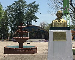
Comitán is the fourth-largest city in the Mexican state of Chiapas. It is the seat of government of the municipality of the same name.

Chilpancingo de los Bravo is the capital and second-largest city of the state of Guerrero, Mexico. In 2010 it had a population of 187,251 people. The municipality has an area of 2,338.4 km2 (902.9 sq mi) in the south-central part of the state, situated in the Sierra Madre del Sur, on the bank of the Huacapa River. The city is on Mexican Federal Highway 95 which connects Acapulco to Mexico City. It is served by Chilpancingo National Airport, which is one of the five airports in the state.

Felipe Carrillo Puerto is the municipal seat and largest city in Felipe Carrillo Puerto Municipality in the Mexican state of Quintana Roo. According to the 2010 census, the city's population was 25,744 persons, mostly of Maya descent.

Abasolo is a city and seat of the municipality of Abasolo in the northern Mexican state of Coahuila. In 2000, the city had 1,130 inhabitants.

Pabellón de Arteaga is a city in the Mexican state of Aguascalientes. It stands at 22°09′N102°16′W in the central part of the state. The city serves as the municipal seat of the municipality of Pabellón de Arteaga. As of 2010, the city had a total population of 28,633, up from 26,797 in 2005. It is the third-largest city in the state behind Aguascalientes and Jesús María.
Tuxpan is both a municipality and city located in the Mexican state of Veracruz. The population of the city was 78,523 and of the municipality was 134,394 inhabitants, according to the INEGI census of 2005, residing in a total area of 1,051.89 km2 (406.14 sq mi). The municipality includes many smaller outlying communities, the largest of which are Alto Lucero and Santiago de la Peña. A local beachside community is also nearby.

Santa Rosalía is a town located in the Mulegé Municipality of northern Baja California Sur, Mexico. It is on the Gulf of California coast of the Baja California Peninsula. As of 2015, the town had a population of 14,160 inhabitants. It was once a company town.

Ramos Arizpe is a city and seat of the surrounding municipality of the same name in the Mexican state of Coahuila. Ramos Arizpe is located 11 km from the state capital of Saltillo. It is part of the Saltillo metropolitan area. The city reported a population of 48,228 in the 2005 census; the municipality had a population of 56,708. Its area is 5,306.6 km².
Rioverde is a city and its surrounding municipality located in the south-central part of the state of San Luis Potosí, Mexico. It is the fifth-most populated city in the state, behind San Luis Potosí, Soledad de Graciano Sánchez, Ciudad Valles, and Matehuala. It is the agricultural, economic, turistic and demographic most important core in the Zona Media, one of the four geographical divisions of the state. The city had a 2005 census population of 49,183, while the municipality, of which it serves as municipal seat, had a population of 85,945 and an area extent of 3,109.71 km². The population of its metropolitan area, which includes the largest municipality of Ciudad Fernández, was 126,997.
Aldama is a municipality of the northeastern Mexican state of Tamaulipas. According to the census of 2010, the municipality had an area of 3,672 square kilometres (1,418 sq mi) and a population of 29,470, including the town of Aldama with a population of 13,661.

Apizaco is a city in Apizaco Municipality located near the geographic center of the Mexican state of Tlaxcala, approximately 25 minutes by car from the state's capital city of Tlaxcala. The city gets its name from the Nahuatl language words "ātl" (water), "pitzāhuac" (thin), and the suffix "co" (place), forming "Āpitzāco", or roughly "thin water place". Those seeking to reach the port of Veracruz by railroad from Mexico City must travel through Apizaco. The city began because of its location on this railroad.
Soto la Marina is a town in Soto la Marina Municipality located in the Mexican state of Tamaulipas. It was directly hit by Hurricane Alex in 2010. It is located on the banks of the Soto la Marina river, just up river from the small ocean port of La Pesca, and downriver from Ciudad Victoria, the capital of the State of Tamaulipas. 180 miles South of Brownsville, Texas, it is accessible from there via a highway in approximately 3 hours driving time.

Tula is a town located in Tula Municipality in the state of Tamaulipas.
Alcozauca de Guerrero is one of the 81 municipalities of Guerrero, in south-western Mexico. The municipal seat lies at Alcozauca de Guerrero. The municipality covers an area of 55,160 hectares.

Acatzingo Municipality is a municipality in Puebla in south-eastern Mexico.

Ahuazotepec Municipality is a municipality in Puebla in south-eastern Mexico.
Quimixtlán Municipality is a municipality in Puebla in south-eastern Mexico.
Zongozotla Municipality is a municipality in Puebla in south-eastern Mexico.

Amaxac de Guerrero is a municipality in Tlaxcala in south-eastern Mexico.
Teolocholco (municipality) is a municipality in Tlaxcala in south-eastern Mexico.